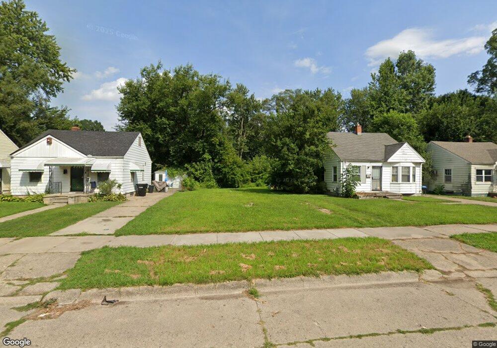
19324 Westbrook St Detroit, MI 48219
Evergreen Lahser NeighborhoodEstimated Value: $69,000 - $94,000
--
Bed
1
Bath
766
Sq Ft
$102/Sq Ft
Est. Value
About This Home
This home is located at 19324 Westbrook St, Detroit, MI 48219 and is currently estimated at $78,333, approximately $102 per square foot. 19324 Westbrook St is a home located in Wayne County with nearby schools including Ralph W. Emerson Elementary-Middle School, Charles L. Spain Elementary-Middle School, and Edward 'Duke' Ellington Conservatory of Music and Art.
Ownership History
Date
Name
Owned For
Owner Type
Purchase Details
Closed on
Jan 12, 2017
Sold by
Sabree Eric R
Bought by
Detroit Land Bank Authority
Current Estimated Value
Purchase Details
Closed on
Dec 30, 2014
Sold by
Handymen Inc
Bought by
Grp3 Llc
Purchase Details
Closed on
Nov 21, 2013
Sold by
Wayne County Treasurer
Bought by
Handymen Inc
Purchase Details
Closed on
Jun 11, 2010
Sold by
Griffin Marion C and Griffin Gail L
Bought by
Metro G & E Properties Llc
Create a Home Valuation Report for This Property
The Home Valuation Report is an in-depth analysis detailing your home's value as well as a comparison with similar homes in the area
Home Values in the Area
Average Home Value in this Area
Purchase History
| Date | Buyer | Sale Price | Title Company |
|---|---|---|---|
| Detroit Land Bank Authority | -- | None Available | |
| Grp3 Llc | -- | None Available | |
| Handymen Inc | $500 | None Available | |
| Metro G & E Properties Llc | -- | None Available |
Source: Public Records
Tax History Compared to Growth
Tax History
| Year | Tax Paid | Tax Assessment Tax Assessment Total Assessment is a certain percentage of the fair market value that is determined by local assessors to be the total taxable value of land and additions on the property. | Land | Improvement |
|---|---|---|---|---|
| 2025 | -- | $1,900 | $0 | $0 |
| 2024 | -- | $0 | $0 | $0 |
| 2023 | $0 | $0 | $0 | $0 |
| 2022 | -- | $0 | $0 | $0 |
| 2021 | $0 | $0 | $0 | $0 |
| 2020 | $1,511 | $0 | $0 | $0 |
| 2019 | $1,511 | $0 | $0 | $0 |
| 2018 | $0 | $8,100 | $0 | $0 |
| 2017 | $150 | $7,900 | $0 | $0 |
| 2016 | $1,103 | $11,400 | $0 | $0 |
| 2015 | $1,140 | $11,400 | $0 | $0 |
| 2013 | $1,421 | $14,208 | $0 | $0 |
| 2010 | -- | $20,830 | $909 | $19,921 |
Source: Public Records
Map
Nearby Homes
- 19357 Blackstone St
- 19345 Westbrook St
- 19161 Westbrook St
- 19411 Chapel St
- 19734 Westbrook St
- 19460 Burgess
- 21400 W Seven Mile Rd
- 20509 W Seven Mile Rd
- 19730 Trinity St
- 19018 Westbrook St
- 19467 Greydale Ave
- 19926 Blackstone St
- 19500 Lahser Rd
- 18985 Trinity St
- 18970 Bentler St
- 19700 Braile St
- 19712 Lahser Rd
- 20834 Pembroke Ave
- 19515 Patton St
- 19199 Lahser Rd
- 19318 Westbrook St
- 19328 Westbrook St
- 19334 Westbrook St
- 19312 Westbrook St
- 19306 Westbrook St
- 19338 Westbrook St
- 19325 Blackstone St
- 19331 Blackstone St
- 19319 Blackstone St
- 19335 Blackstone St
- 19300 Westbrook St
- 19344 Westbrook St
- 19313 Blackstone St
- 19341 Blackstone St
- 19301 Blackstone St
- 19319 Westbrook St
- 19345 Blackstone St
- 19341 Westbrook St
- 19354 Westbrook St
- 19351 Blackstone St