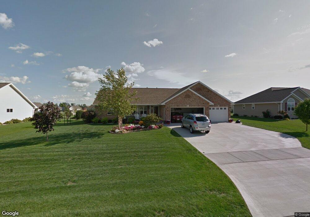
1933 Bonfire Way de Pere, WI 54115
Estimated Value: $392,000 - $435,000
3
Beds
2
Baths
1,601
Sq Ft
$257/Sq Ft
Est. Value
About This Home
This home is located at 1933 Bonfire Way, de Pere, WI 54115 and is currently estimated at $411,573, approximately $257 per square foot. 1933 Bonfire Way is a home located in Brown County with nearby schools including Hemlock Creek Elementary School, West De Pere Middle School, and West De Pere High School.
Ownership History
Date
Name
Owned For
Owner Type
Purchase Details
Closed on
Sep 14, 2005
Sold by
Robert Peters Construction Inc
Bought by
Gilson Wayne J and Gilson Joyce A
Current Estimated Value
Home Financials for this Owner
Home Financials are based on the most recent Mortgage that was taken out on this home.
Original Mortgage
$190,000
Outstanding Balance
$102,161
Interest Rate
5.93%
Mortgage Type
Purchase Money Mortgage
Estimated Equity
$309,412
Purchase Details
Closed on
Jun 6, 2005
Sold by
Lexington Homes Inc
Bought by
Robert Peters Construction Inc
Create a Home Valuation Report for This Property
The Home Valuation Report is an in-depth analysis detailing your home's value as well as a comparison with similar homes in the area
Home Values in the Area
Average Home Value in this Area
Purchase History
| Date | Buyer | Sale Price | Title Company |
|---|---|---|---|
| Gilson Wayne J | $195,500 | Evans Title | |
| Robert Peters Construction Inc | $47,500 | Evans Title |
Source: Public Records
Mortgage History
| Date | Status | Borrower | Loan Amount |
|---|---|---|---|
| Open | Gilson Wayne J | $190,000 |
Source: Public Records
Tax History Compared to Growth
Tax History
| Year | Tax Paid | Tax Assessment Tax Assessment Total Assessment is a certain percentage of the fair market value that is determined by local assessors to be the total taxable value of land and additions on the property. | Land | Improvement |
|---|---|---|---|---|
| 2024 | $4,203 | $289,200 | $54,200 | $235,000 |
| 2023 | $3,863 | $289,200 | $54,200 | $235,000 |
| 2022 | $3,877 | $289,200 | $54,200 | $235,000 |
| 2021 | $3,889 | $289,200 | $54,200 | $235,000 |
| 2020 | $3,838 | $203,900 | $35,700 | $168,200 |
| 2019 | $3,781 | $203,900 | $35,700 | $168,200 |
| 2018 | $3,616 | $203,900 | $35,700 | $168,200 |
| 2017 | $3,678 | $203,900 | $35,700 | $168,200 |
| 2016 | $3,716 | $203,900 | $35,700 | $168,200 |
| 2015 | $3,783 | $203,900 | $35,700 | $168,200 |
| 2014 | $3,946 | $203,900 | $35,700 | $168,200 |
| 2013 | $3,946 | $203,900 | $35,700 | $168,200 |
Source: Public Records
Map
Nearby Homes
- 1595 Talus Cir
- 1108 Hoks Ridge Ln
- 1359 Shelby Ln
- 1454 Navigator Way
- 0 Scheuring Rd
- 1338 Highland Ridge Dr
- 3644 E Hank Ave
- 3578 W Hank Ave
- 3629 W Hank Ave
- 3581 W Hank Ave
- 3608 E Hank Ave
- 3566 W Hank Ave
- 1068 Misty Meadow Cir Unit 2
- 1408 Crossroads Dr
- 1432 Crossroads Dr
- 1396 Crossroads Dr
- 1378 Crossroads Dr
- 1372 Crossroads Dr
- 1414 Crossroads Dr
- 1411 Crossroads Dr
- 1925 Bonfire Way
- 1939 Bonfire Way
- 814 Mystic Ct
- 822 Mystic Ct
- 1936 Bonfire Way
- 1917 Bonfire Way
- 830 Mystic Ct
- 1943 Bonfire Way
- 1560 Morning Mist Way
- 1922 Bonfire Way
- 1950 Bonfire Way
- 1570 Morning Mist Way
- 838 Mystic Ct
- 1909 Bonfire Way
- 1914 Bonfire Way
- 1925 Sandy Springs Rd
- 1931 Sandy Springs Rd
- 1949 Bonfire Way
- 1919 Sandy Springs Rd
- 811 Mystic Ct
