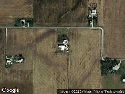
1933 Ellis Rd New Weston, OH 45348
Estimated Value: $190,000 - $253,324
3
Beds
1
Bath
1,973
Sq Ft
$117/Sq Ft
Est. Value
About This Home
This home is located at 1933 Ellis Rd, New Weston, OH 45348 and is currently estimated at $230,831, approximately $116 per square foot. 1933 Ellis Rd is a home with nearby schools including Mississinawa Valley Elementary School and Mississinawa Valley Junior/Senior High School.
Ownership History
Date
Name
Owned For
Owner Type
Purchase Details
Closed on
Dec 9, 2021
Sold by
Bateman Nelson Eddie and Frances Junior Bateman First A
Bought by
Livingston Levi J and Rhoades Sarah J
Current Estimated Value
Home Financials for this Owner
Home Financials are based on the most recent Mortgage that was taken out on this home.
Original Mortgage
$179,350
Outstanding Balance
$166,934
Interest Rate
3.09%
Mortgage Type
Purchase Money Mortgage
Estimated Equity
$76,016
Purchase Details
Closed on
Aug 6, 2021
Sold by
Junior Bateman Francis
Bought by
Francis Junior Bateman First Amended And Rest
Purchase Details
Closed on
Jun 8, 2021
Sold by
Estate Of Frances Junior Bateman
Bought by
Bateman Florence Ellen and Francis Junior Bateman First A
Purchase Details
Closed on
May 26, 2020
Sold by
Bateman Francis Junieor
Bought by
Bateman Florence Ellen
Create a Home Valuation Report for This Property
The Home Valuation Report is an in-depth analysis detailing your home's value as well as a comparison with similar homes in the area
Home Values in the Area
Average Home Value in this Area
Purchase History
| Date | Buyer | Sale Price | Title Company |
|---|---|---|---|
| Livingston Levi J | $211,000 | None Available | |
| Francis Junior Bateman First Amended And Rest | -- | -- | |
| Bateman Florence Ellen | -- | None Available | |
| Bateman Florence Ellen | -- | None Available |
Source: Public Records
Mortgage History
| Date | Status | Borrower | Loan Amount |
|---|---|---|---|
| Open | Livingston Levi J | $179,350 |
Source: Public Records
Tax History Compared to Growth
Tax History
| Year | Tax Paid | Tax Assessment Tax Assessment Total Assessment is a certain percentage of the fair market value that is determined by local assessors to be the total taxable value of land and additions on the property. | Land | Improvement |
|---|---|---|---|---|
| 2024 | $1,717 | $58,500 | $11,810 | $46,690 |
| 2023 | $1,720 | $58,500 | $11,810 | $46,690 |
| 2022 | $2,711 | $69,340 | $10,210 | $59,130 |
| 2021 | $1,077 | $42,690 | $9,650 | $33,040 |
| 2020 | $2,344 | $229,850 | $196,810 | $33,040 |
| 2019 | $2,807 | $209,600 | $183,160 | $26,440 |
| 2018 | $2,758 | $209,600 | $183,160 | $26,440 |
| 2017 | $3,128 | $209,600 | $183,160 | $26,440 |
| 2016 | $3,142 | $192,390 | $169,510 | $22,880 |
| 2015 | $3,142 | $192,390 | $169,510 | $22,880 |
| 2014 | $3,189 | $193,540 | $169,510 | $24,030 |
| 2013 | $1,796 | $165,960 | $141,930 | $24,030 |
Source: Public Records
Map
Nearby Homes
- 13747 State Route 49 N
- 4475 Ohio 705
- 709 Lynwood Ct
- 0 W Deerfield Rd Unit 837795
- 0 W Deerfield Rd
- 723 E Central St
- 1226 N Plum St
- 223 E Caroline St
- 721 N Union St
- 811 N Howard St
- 631 N Columbia St
- 417 E Canal St
- 827 W Elm St
- 635 W Pearl St
- 1103 W Oak St
- 800 W Chestnut St
- 504 Leahey St
- LOT 25 Governor Isaac P Gray Add
- LOT 9 Governor P Isaac Add
- LOT 19 & 20 Governor Isaac P Gray Add
- 1933 Ellis Rd
- 1878 Ellis Rd
- 2051 Ellis Rd
- 2081 Ellis Rd
- 12698 Light Rd
- 1789 Rossburg Lightsville Rd
- 12311 Staudt Rd
- 2254 Rossburg Lightsville Rd
- 12357 Staudt Rd
- 2397 Ellis Rd
- 1419 Ellis Rd
- 12716 State Route 49
- 1932 Brock Cosmos Rd
- 2374 Rossburg Lightsville Rd
- 12734 Ohio 49
- 12742 Ohio 49
- 12700 State Route 49
- 12712 State Route 49
- 12728 State Route 49
- 12742 State Route 49
