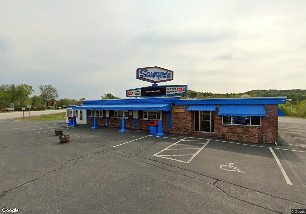
1933 Lake Shore Rd Gilford, NH 03249
Estimated Value: $993,061
--
Bed
--
Bath
--
Sq Ft
1.23
Acres
About This Home
This home is located at 1933 Lake Shore Rd, Gilford, NH 03249 and is currently estimated at $993,061. 1933 Lake Shore Rd is a home located in Belknap County with nearby schools including Gilford Elementary School, Gilford Middle School, and Gilford High School.
Ownership History
Date
Name
Owned For
Owner Type
Purchase Details
Closed on
Aug 24, 2021
Sold by
Litchfield Dairy Hldg Llc
Bought by
Dockham Shore Realty Llc
Current Estimated Value
Purchase Details
Closed on
Jun 14, 2007
Sold by
Sawyers Dairy Bar Inc
Bought by
Kitchfield Dairy Holdi
Create a Home Valuation Report for This Property
The Home Valuation Report is an in-depth analysis detailing your home's value as well as a comparison with similar homes in the area
Home Values in the Area
Average Home Value in this Area
Purchase History
| Date | Buyer | Sale Price | Title Company |
|---|---|---|---|
| Dockham Shore Realty Llc | $700,000 | None Available | |
| Dockham Shore Realty Llc | $700,000 | None Available | |
| Kitchfield Dairy Holdi | $706,700 | -- | |
| Kitchfield Dairy Holdi | $706,700 | -- |
Source: Public Records
Mortgage History
| Date | Status | Borrower | Loan Amount |
|---|---|---|---|
| Previous Owner | Kitchfield Dairy Holdi | $500,000 | |
| Previous Owner | Kitchfield Dairy Holdi | $200,000 |
Source: Public Records
Tax History Compared to Growth
Tax History
| Year | Tax Paid | Tax Assessment Tax Assessment Total Assessment is a certain percentage of the fair market value that is determined by local assessors to be the total taxable value of land and additions on the property. | Land | Improvement |
|---|---|---|---|---|
| 2024 | $8,863 | $787,800 | $271,600 | $516,200 |
| 2023 | $8,114 | $787,800 | $271,600 | $516,200 |
| 2022 | $8,211 | $670,300 | $246,900 | $423,400 |
| 2021 | $8,231 | $670,300 | $246,900 | $423,400 |
| 2020 | $4,113 | $649,900 | $246,900 | $403,000 |
| 2019 | $4,059 | $649,900 | $246,900 | $403,000 |
| 2018 | $10,553 | $619,300 | $246,900 | $372,400 |
| 2017 | $3,665 | $619,300 | $246,900 | $372,400 |
| 2016 | $11,118 | $619,400 | $247,000 | $372,400 |
| 2015 | $11,131 | $619,400 | $247,000 | $372,400 |
| 2011 | $9,284 | $500,500 | $204,800 | $295,700 |
Source: Public Records
Map
Nearby Homes
- 17 Harris Shore Rd Unit 410D
- 12 Wildwood Rd
- 60 Weirs Rd Unit D2
- 1996 Lake Shore Rd
- 73 Weirs Rd
- 73 Weirs Slip I-22
- 73 Weirs
- 16 Varney Point Road Left
- 115 Weirs Rd Unit 109B
- 19 Smith Cove Rd
- 320 Old Lake Shore Rd Unit 3
- 343 Old Lake Shore Rd Unit 32
- 118 Weirs Rd Unit G05
- 110 Heights Rd
- 31 Henderson Rd Unit 17
- 41 Glendale Place Unit 13 A & B
- 47 Varney Point Road Right
- 46 Glendale Place Unit 1
- 24 Dock Rd Unit 22
- 24 Dock Rd Unit 18
- I2 Weirs Rd Unit I2
- C10 Weirs Rd Unit C10
- 506 Weirs Rd Unit 506
- 505 Weirs Rd Unit 505
- 504 Weirs Rd Unit 504
- 507 Weirs Rd Unit 507
- 406 Weirs Rd Unit 406
- 501 Weirs Rd Unit 501
- 408 Weirs Rd Unit 408
- 411 Weirs Rd Unit 411
- 0 Weirs Rd Unit 410 D
- 0 Weirs Rd Unit G 21 4996970
- 0 Weirs Rd Unit 504 A 2728504
- 348 Intervale Rd
- 8 Weirs Rd Unit 8
- 3 Weirs Rd Unit 3
- 17 Harris Shore 504-D Rd Unit 504D
- 17 Harris Shore 508 C Rd Unit 508C
- 17 Harris Shore 410 B Rd Unit 410 B
- 17 Harris Shore 502-B Rd Unit 502-B