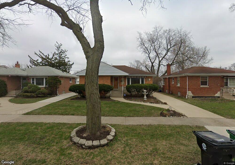
1933 Manchester Ave Westchester, IL 60154
Estimated Value: $323,000 - $339,000
2
Beds
1
Bath
1,054
Sq Ft
$314/Sq Ft
Est. Value
About This Home
This home is located at 1933 Manchester Ave, Westchester, IL 60154 and is currently estimated at $330,696, approximately $313 per square foot. 1933 Manchester Ave is a home located in Cook County with nearby schools including Westchester Primary School, Westchester Intermediate School, and Westchester Middle School.
Ownership History
Date
Name
Owned For
Owner Type
Purchase Details
Closed on
Jun 29, 2004
Sold by
Dalheim Robert W and Dalheim Elayne C
Bought by
Serrano Erecka T
Current Estimated Value
Home Financials for this Owner
Home Financials are based on the most recent Mortgage that was taken out on this home.
Original Mortgage
$170,000
Outstanding Balance
$77,332
Interest Rate
4.87%
Mortgage Type
Unknown
Estimated Equity
$253,364
Create a Home Valuation Report for This Property
The Home Valuation Report is an in-depth analysis detailing your home's value as well as a comparison with similar homes in the area
Home Values in the Area
Average Home Value in this Area
Purchase History
| Date | Buyer | Sale Price | Title Company |
|---|---|---|---|
| Serrano Erecka T | $233,000 | Ticor Title Insurance Compan |
Source: Public Records
Mortgage History
| Date | Status | Borrower | Loan Amount |
|---|---|---|---|
| Open | Serrano Erecka T | $170,000 |
Source: Public Records
Tax History Compared to Growth
Tax History
| Year | Tax Paid | Tax Assessment Tax Assessment Total Assessment is a certain percentage of the fair market value that is determined by local assessors to be the total taxable value of land and additions on the property. | Land | Improvement |
|---|---|---|---|---|
| 2024 | $6,216 | $27,000 | $4,655 | $22,345 |
| 2023 | $5,073 | $27,000 | $4,655 | $22,345 |
| 2022 | $5,073 | $20,050 | $3,990 | $16,060 |
| 2021 | $4,937 | $20,049 | $3,990 | $16,059 |
| 2020 | $4,890 | $20,049 | $3,990 | $16,059 |
| 2019 | $4,639 | $19,850 | $3,657 | $16,193 |
| 2018 | $4,576 | $19,850 | $3,657 | $16,193 |
| 2017 | $4,505 | $19,850 | $3,657 | $16,193 |
| 2016 | $4,128 | $16,650 | $3,325 | $13,325 |
| 2015 | $4,038 | $16,650 | $3,325 | $13,325 |
| 2014 | $3,960 | $16,650 | $3,325 | $13,325 |
| 2013 | $4,110 | $18,981 | $3,325 | $15,656 |
Source: Public Records
Map
Nearby Homes
- 1900 Manchester Ave
- 1840 Gardner Rd
- 1907 Suffolk Ave
- 1623 Manchester Ave
- 1601 Bristol Ave
- 1932 Newcastle Ave
- 1500 Bristol Ave
- 2128 Hull Ave
- 1433 Bristol Ave
- 1542 Homestead Rd
- 2320 S 22nd Ave
- 10072 Drury Ln
- 2237 S 22nd Ave
- 2510 S 17th Ave
- 1119 Newcastle Ave
- 1427 Homestead Rd Unit H
- 2330 S 17th Ave
- 1245 S Mannheim Rd Unit 2
- 1247 S Mannheim Rd Unit 3
- 1518 Cleveland Ave
- 1939 Manchester Ave
- 1927 Manchester Ave
- 1943 Manchester Ave
- 1923 Manchester Ave
- 1940 Bristol Ave
- 1928 Bristol Ave
- 1951 Manchester Ave
- 1919 Manchester Ave
- 1946 Bristol Ave
- 1924 Bristol Ave
- 1934 Manchester Ave
- 1952 Bristol Ave
- 1915 Manchester Ave
- 1957 Manchester Ave
- 1920 Bristol Ave
- 1928 Manchester Ave
- 1940 Manchester Ave
- 1924 Manchester Ave
- 1946 Manchester Ave