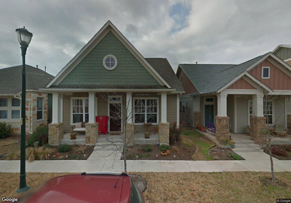
1933 Mccloskey St Austin, TX 78723
Mueller NeighborhoodEstimated Value: $794,575 - $878,000
Studio
3
Baths
1,842
Sq Ft
$454/Sq Ft
Est. Value
About This Home
This home is located at 1933 Mccloskey St, Austin, TX 78723 and is currently estimated at $836,144, approximately $453 per square foot. 1933 Mccloskey St is a home located in Travis County with nearby schools including Maplewood Elementary School, Kealing Middle School, and McCallum High School.
Ownership History
Date
Name
Owned For
Owner Type
Purchase Details
Closed on
Mar 17, 2008
Sold by
Weekley Homes Lp
Bought by
Stengele Leslie Dean and Pollack Philip Francis
Current Estimated Value
Home Financials for this Owner
Home Financials are based on the most recent Mortgage that was taken out on this home.
Original Mortgage
$245,200
Outstanding Balance
$149,363
Interest Rate
5.67%
Mortgage Type
Purchase Money Mortgage
Estimated Equity
$686,781
Create a Home Valuation Report for This Property
The Home Valuation Report is an in-depth analysis detailing your home's value as well as a comparison with similar homes in the area
Home Values in the Area
Average Home Value in this Area
Purchase History
| Date | Buyer | Sale Price | Title Company |
|---|---|---|---|
| Stengele Leslie Dean | -- | None Available |
Source: Public Records
Mortgage History
| Date | Status | Borrower | Loan Amount |
|---|---|---|---|
| Open | Stengele Leslie Dean | $245,200 |
Source: Public Records
Tax History
| Year | Tax Paid | Tax Assessment Tax Assessment Total Assessment is a certain percentage of the fair market value that is determined by local assessors to be the total taxable value of land and additions on the property. | Land | Improvement |
|---|---|---|---|---|
| 2025 | $12,616 | $760,066 | $442,560 | $317,506 |
| 2023 | $11,408 | $753,317 | $0 | $0 |
| 2022 | $13,525 | $684,834 | $0 | $0 |
| 2021 | $13,551 | $622,576 | $200,000 | $426,700 |
| 2020 | $12,139 | $565,978 | $200,000 | $365,978 |
| 2018 | $12,362 | $558,375 | $200,000 | $358,375 |
| 2017 | $11,847 | $531,201 | $200,000 | $331,201 |
| 2016 | $10,840 | $486,073 | $125,000 | $361,073 |
| 2015 | $8,654 | $452,337 | $80,000 | $376,274 |
| 2014 | $8,654 | $411,215 | $80,000 | $331,215 |
Source: Public Records
Map
Nearby Homes
- 1912 Antone St
- 4108 Camacho St
- 4004 Pinckney St
- 1931 E 38th 1 2 St Unit 33
- 1931 E 38 1 2 St Unit 43
- 1813 E 38th 1 2 St Unit 2
- 2237 Zach Scott St
- 2624 Tom Miller St
- 3709 Tower View Ct
- 2133 Emma Long St
- 3824 Hermalinda St
- 3705 Tower View Ct
- 3706 Basford Rd
- 4116 Berkman Dr
- 3900 Threadgill St Unit 2
- 2805 Mccurdy St Unit Building 19
- 2805 Mccurdy St Unit 10
- 2805 Mccurdy St Unit 4
- 2805 Mccurdy St Unit 9
- 2805 Mccurdy St Unit 1
- 1937 Mccloskey St
- 1929 Mccloskey St
- 1925 Mccloskey St
- 1932 Emma Long St
- 1921 Mccloskey St
- 1936 Emma Long St
- 1928 Emma Long St
- 4032 Camacho St
- 4036 Camacho St
- 4028 Camacho St
- 1932 Mccloskey St
- 1936 Mccloskey St
- 1928 Mccloskey St
- 1917 Mccloskey St
- 1917 Mccloskey St Unit B
- 1917 Mccloskey St Unit E
- 1917 Mccloskey St Unit D
- 1917 Mccloskey St Unit A
- 1924 Mccloskey St
- 1920 Emma Long St
Your Personal Tour Guide
Ask me questions while you tour the home.