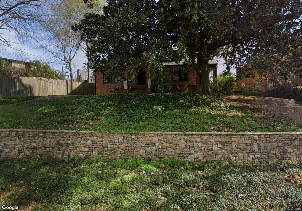
1934 Dimon St Columbus, GA 31906
Peacock Woods-Dimon Circle NeighborhoodEstimated Value: $329,570 - $393,000
3
Beds
3
Baths
2,112
Sq Ft
$176/Sq Ft
Est. Value
About This Home
This home is located at 1934 Dimon St, Columbus, GA 31906 and is currently estimated at $372,143, approximately $176 per square foot. 1934 Dimon St is a home located in Muscogee County with nearby schools including Richards Middle School, Hardaway High School, and Wynnton Elementary School.
Ownership History
Date
Name
Owned For
Owner Type
Purchase Details
Closed on
Jun 18, 2020
Sold by
Golden Row Development Llc
Bought by
Flournoy Emily and Flournoy Sloan
Current Estimated Value
Home Financials for this Owner
Home Financials are based on the most recent Mortgage that was taken out on this home.
Original Mortgage
$232,750
Outstanding Balance
$206,315
Interest Rate
3.2%
Mortgage Type
New Conventional
Estimated Equity
$165,828
Purchase Details
Closed on
Mar 27, 2015
Sold by
Register Charles David
Bought by
Golden Row Developent Llc
Create a Home Valuation Report for This Property
The Home Valuation Report is an in-depth analysis detailing your home's value as well as a comparison with similar homes in the area
Home Values in the Area
Average Home Value in this Area
Purchase History
| Date | Buyer | Sale Price | Title Company |
|---|---|---|---|
| Flournoy Emily | $245,000 | -- | |
| Golden Row Developent Llc | $48,000 | -- |
Source: Public Records
Mortgage History
| Date | Status | Borrower | Loan Amount |
|---|---|---|---|
| Open | Flournoy Emily | $232,750 |
Source: Public Records
Tax History Compared to Growth
Tax History
| Year | Tax Paid | Tax Assessment Tax Assessment Total Assessment is a certain percentage of the fair market value that is determined by local assessors to be the total taxable value of land and additions on the property. | Land | Improvement |
|---|---|---|---|---|
| 2025 | $3,247 | $117,572 | $17,404 | $100,168 |
| 2024 | $3,246 | $117,572 | $17,404 | $100,168 |
| 2023 | $2,572 | $117,572 | $17,404 | $100,168 |
| 2022 | $3,385 | $93,492 | $17,404 | $76,088 |
| 2021 | $3,379 | $96,136 | $17,404 | $78,732 |
| 2020 | $2,292 | $56,128 | $17,404 | $38,724 |
| 2019 | $2,300 | $56,128 | $17,404 | $38,724 |
| 2018 | $2,252 | $54,956 | $17,404 | $37,552 |
| 2017 | $2,527 | $54,956 | $17,404 | $37,552 |
| 2016 | $792 | $19,200 | $3,189 | $16,011 |
| 2015 | $484 | $29,284 | $4,656 | $24,628 |
| 2014 | $484 | $29,284 | $4,656 | $24,628 |
| 2013 | -- | $29,284 | $4,656 | $24,628 |
Source: Public Records
Map
Nearby Homes
- 1400 Eberhart Ave
- 1917 Dimon St
- 2016 Poplar Dr
- 2133 13th St
- 2125 13th St Unit 12
- 1557 18th Ave
- 2227 15th St
- 1242 18th Ave
- 1227 Forest Ave Unit 4
- 1226 18th Ave Unit A/B
- 1641 16th Ave
- 2551 Wynnton Rd
- 1809 Carter Ave
- 2312 Marion St
- 1319 Hilton Ave
- 1622 14th Ave
- 1717 Stark Ave
- 1033 Britt Ave
- 1700 Stark Ave
- 1706 Stark Ave
- 1341 Eberhart Ave
- 1347 Eberhart Ave
- 1337 Eberhart Ave
- 1330 Munro Ave
- 1333 Eberhart Ave
- 1937 Dimon St
- 1933 Dimon St
- 1941 Dimon St
- 1925 Dimon St
- 1320 Munro Ave
- 2002 Dimon St
- 1323 Eberhart Ave
- 1411 Eberhart Ave
- 1342 Eberhart Ave
- 1338 Eberhart Ave
- 1334 Eberhart Ave
- 1314 Munro Ave
- 1330 Eberhart Ave
- 2008 Dimon St
- 2001 Dimon St