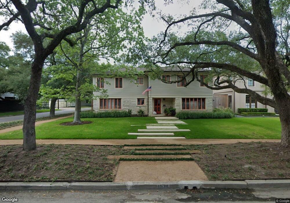
1934 Dunstan Rd Houston, TX 77005
University Place NeighborhoodEstimated Value: $1,969,000 - $2,149,000
4
Beds
3
Baths
3,726
Sq Ft
$548/Sq Ft
Est. Value
About This Home
This home is located at 1934 Dunstan Rd, Houston, TX 77005 and is currently estimated at $2,042,963, approximately $548 per square foot. 1934 Dunstan Rd is a home located in Harris County with nearby schools including Poe Elementary School, Lanier Middle School, and Lamar High School.
Ownership History
Date
Name
Owned For
Owner Type
Purchase Details
Closed on
Jul 2, 2001
Sold by
Villarreal Levy Gerardo and Villarreal Levy Christine
Bought by
Eyberg Douglas K and Eyberg Lynn M
Current Estimated Value
Home Financials for this Owner
Home Financials are based on the most recent Mortgage that was taken out on this home.
Original Mortgage
$275,000
Interest Rate
7.16%
Purchase Details
Closed on
Jun 1, 1999
Sold by
Rylander James Benton and Rylander Deborah D
Bought by
Villarreal Levy Gerardo and Villarreal Levy Christine
Home Financials for this Owner
Home Financials are based on the most recent Mortgage that was taken out on this home.
Original Mortgage
$520,000
Interest Rate
6.91%
Create a Home Valuation Report for This Property
The Home Valuation Report is an in-depth analysis detailing your home's value as well as a comparison with similar homes in the area
Home Values in the Area
Average Home Value in this Area
Purchase History
| Date | Buyer | Sale Price | Title Company |
|---|---|---|---|
| Eyberg Douglas K | -- | Charter Title Company | |
| Villarreal Levy Gerardo | -- | Stewart Title |
Source: Public Records
Mortgage History
| Date | Status | Borrower | Loan Amount |
|---|---|---|---|
| Closed | Eyberg Douglas K | $275,000 | |
| Previous Owner | Villarreal Levy Gerardo | $520,000 | |
| Closed | Villarreal Levy Gerardo | $65,000 |
Source: Public Records
Tax History Compared to Growth
Tax History
| Year | Tax Paid | Tax Assessment Tax Assessment Total Assessment is a certain percentage of the fair market value that is determined by local assessors to be the total taxable value of land and additions on the property. | Land | Improvement |
|---|---|---|---|---|
| 2025 | $17,865 | $1,703,277 | $1,176,450 | $526,827 |
| 2024 | $17,865 | $1,656,043 | $1,176,450 | $479,593 |
| 2023 | $17,865 | $1,631,278 | $1,176,450 | $454,828 |
| 2022 | $33,637 | $1,527,640 | $1,140,800 | $386,840 |
| 2021 | $32,981 | $1,415,099 | $1,033,850 | $381,249 |
| 2020 | $36,101 | $1,490,789 | $998,200 | $492,589 |
| 2019 | $37,249 | $1,472,028 | $998,200 | $473,828 |
| 2018 | $22,446 | $1,410,486 | $962,550 | $447,936 |
| 2017 | $35,665 | $1,410,486 | $962,550 | $447,936 |
| 2016 | $34,335 | $1,404,219 | $926,900 | $477,319 |
| 2015 | $20,401 | $1,404,219 | $926,900 | $477,319 |
| 2014 | $20,401 | $1,122,232 | $755,780 | $366,452 |
Source: Public Records
Map
Nearby Homes
- 1928 Dunstan Rd
- 1804 Bolsover St
- 1801 Sunset Blvd
- 1832 Albans Rd
- 2121 Quenby St
- 1723 Sunset Blvd
- 2129 Quenby St
- 2135 Quenby St
- 1723 Albans Rd
- 2019 Bissonnet St
- 5228 Hazard St
- 1700 Sunset Blvd Unit E
- 2114 Wroxton Rd
- 2216 Tangley St
- 2215 Dunstan Rd
- 2042 Bissonnet St
- 2039 South Blvd
- 5309 Cherokee St
- 2130 South Blvd
- 5319 Mandell St
- 1930 Dunstan Rd
- 2002 Dunstan Rd
- 2001 Quenby St
- 1918 Dunstan Rd
- 1933 Dunstan Rd
- 2006 Dunstan Rd
- 1929 Dunstan Rd
- 2007 Quenby St
- 1923 Dunstan Rd
- 2003 Dunstan Rd
- 1914 Dunstan Rd
- 1931 Sunset Blvd
- 2010 Dunstan Rd
- 1919 Dunstan Rd
- 2011 Quenby St
- 2002 Quenby St
- 2007 Dunstan Rd
- 1917 Dunstan Rd
- 2006 Quenby St
- 2015 Quenby St