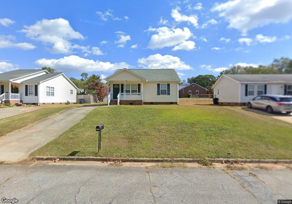
1934 Inman Dr Unit A Anderson, SC 29625
Estimated Value: $130,000 - $164,808
--
Bed
--
Bath
979
Sq Ft
$152/Sq Ft
Est. Value
About This Home
This home is located at 1934 Inman Dr Unit A, Anderson, SC 29625 and is currently estimated at $148,702, approximately $151 per square foot. 1934 Inman Dr Unit A is a home located in Anderson County with nearby schools including Whitehall Elementary School, Westside High School, and Anderson Institute of Technology.
Ownership History
Date
Name
Owned For
Owner Type
Purchase Details
Closed on
Jul 10, 2019
Sold by
Affordable Housing For Aging America Llc
Bought by
Geer Michael Anthony
Current Estimated Value
Home Financials for this Owner
Home Financials are based on the most recent Mortgage that was taken out on this home.
Original Mortgage
$78,429
Outstanding Balance
$68,823
Interest Rate
3.9%
Mortgage Type
New Conventional
Estimated Equity
$79,879
Purchase Details
Closed on
May 5, 2008
Sold by
Alder Michael and Alder Melanie
Bought by
Affordable Housing For Aging America Llc
Purchase Details
Closed on
Dec 10, 2005
Sold by
Affordable Housing For Aging America Llc
Bought by
Alder Michael and Alder Melanie
Create a Home Valuation Report for This Property
The Home Valuation Report is an in-depth analysis detailing your home's value as well as a comparison with similar homes in the area
Home Values in the Area
Average Home Value in this Area
Purchase History
| Date | Buyer | Sale Price | Title Company |
|---|---|---|---|
| Geer Michael Anthony | $80,855 | None Available | |
| Affordable Housing For Aging America Llc | -- | -- | |
| Alder Michael | -- | None Available |
Source: Public Records
Mortgage History
| Date | Status | Borrower | Loan Amount |
|---|---|---|---|
| Open | Geer Michael Anthony | $78,429 |
Source: Public Records
Tax History Compared to Growth
Tax History
| Year | Tax Paid | Tax Assessment Tax Assessment Total Assessment is a certain percentage of the fair market value that is determined by local assessors to be the total taxable value of land and additions on the property. | Land | Improvement |
|---|---|---|---|---|
| 2024 | $881 | $3,760 | $290 | $3,470 |
| 2023 | $882 | $3,760 | $290 | $3,470 |
| 2022 | $856 | $3,760 | $290 | $3,470 |
| 2021 | $785 | $3,230 | $260 | $2,970 |
| 2020 | $782 | $3,230 | $260 | $2,970 |
| 2019 | $494 | $1,930 | $260 | $1,670 |
| 2018 | $1,290 | $2,880 | $380 | $2,500 |
| 2017 | -- | $2,880 | $380 | $2,500 |
| 2016 | $1,366 | $3,090 | $330 | $2,760 |
| 2015 | $1,373 | $3,090 | $330 | $2,760 |
| 2014 | $1,354 | $3,090 | $330 | $2,760 |
Source: Public Records
Map
Nearby Homes
- 213 Oneal Dr
- 2005 Northview Ave
- 119 Mcclure Dr
- 1721 Martin Ave
- 216 Celebration Ave
- 1710 Martin Ave
- 1808 Edgewood Ave
- 209 Celebration Ave
- 113 Traditions Blvd
- 2223 Ridgewood Ave
- 211 Westwind Rd
- 157 Bleckley Trail
- 207 Mayfield Dr
- 130 Bleckley Trail
- 114 Henry Ave
- 2600 E North Ave
- 600 Rogers St
- 2 P St
- 122 Laurel Oak Dr
- 167 Laurel Oak Dr
- 1934 Inman Dr
- 1936 Inman Dr
- 1920B Inman Dr
- 1920 Inman Dr
- 1919 Dobbins Ave
- 1921 Dobbins Ave
- 1927 Dobbins Ave
- 1918 Inman Dr
- 1931 Dobbins Ave
- 1935 Inman Dr
- 1931 Inman Dr
- 1937 Inman Dr
- 1917 Dobbins Ave
- 1939 Inman Dr
- 1935 Dobbins Ave
- 1916 Inman Dr
- 1921 Inman Dr
- 1934 Dobbins Ave
- 2121 Woodside Ave
- 2125 Woodside Ave