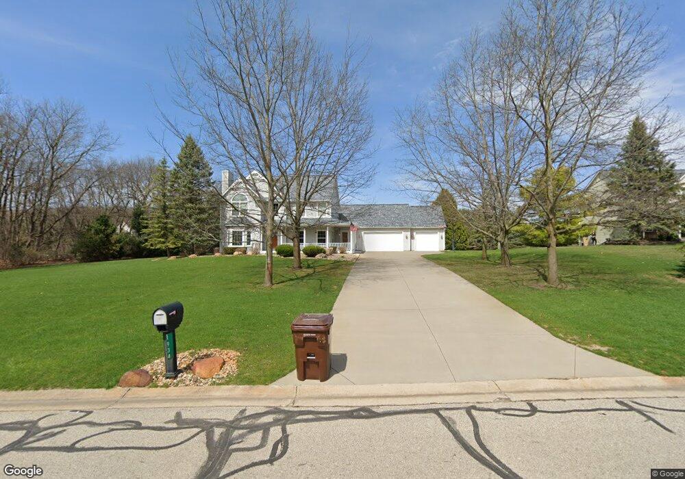
1934 Sundance Ridge Unit Bldg-Unit Howell, MI 48843
Estimated Value: $529,753 - $562,000
4
Beds
3
Baths
2,604
Sq Ft
$210/Sq Ft
Est. Value
About This Home
This home is located at 1934 Sundance Ridge Unit Bldg-Unit, Howell, MI 48843 and is currently estimated at $547,188, approximately $210 per square foot. 1934 Sundance Ridge Unit Bldg-Unit is a home located in Livingston County with nearby schools including Parker Middle School and Howell High School.
Ownership History
Date
Name
Owned For
Owner Type
Purchase Details
Closed on
May 2, 2022
Sold by
Flis Michael A and Flis Elizabeth M
Bought by
Flis Michael A and Flis Michael A
Current Estimated Value
Purchase Details
Closed on
Jul 1, 2019
Sold by
Smith Andrew and Smith Jennifer
Bought by
Flis Michael A
Purchase Details
Closed on
Mar 7, 2018
Sold by
Fender Tony and Fender Lindsey
Bought by
Smith Andrew and Smith Jennifer
Purchase Details
Closed on
Mar 29, 2017
Sold by
Martel Mark Joseph and Martel Patricia Anne
Bought by
Fender Tony and Fender Lindsey
Home Financials for this Owner
Home Financials are based on the most recent Mortgage that was taken out on this home.
Original Mortgage
$294,500
Interest Rate
4.1%
Mortgage Type
New Conventional
Purchase Details
Closed on
Sep 2, 2016
Sold by
Martel Mark Joseph and Martel Patricia Anne
Bought by
Martel Mark Joseph and Martel Patricia Anne
Purchase Details
Closed on
Apr 29, 2003
Sold by
Martel Mark J and Martel Patricia A
Bought by
The Patricia Anne Martel Revocable Trust
Home Financials for this Owner
Home Financials are based on the most recent Mortgage that was taken out on this home.
Original Mortgage
$195,000
Interest Rate
5.95%
Mortgage Type
Purchase Money Mortgage
Purchase Details
Closed on
Apr 28, 2003
Sold by
The Patricia Anne Martel Revocable Trust
Bought by
Martel Mark J and Martel Patricia A
Home Financials for this Owner
Home Financials are based on the most recent Mortgage that was taken out on this home.
Original Mortgage
$195,000
Interest Rate
5.95%
Mortgage Type
Purchase Money Mortgage
Purchase Details
Closed on
Feb 9, 1999
Sold by
Martel Patricia Anne
Bought by
Patricia Anne Martel Revocable Trust
Create a Home Valuation Report for This Property
The Home Valuation Report is an in-depth analysis detailing your home's value as well as a comparison with similar homes in the area
Home Values in the Area
Average Home Value in this Area
Purchase History
| Date | Buyer | Sale Price | Title Company |
|---|---|---|---|
| Flis Michael A | -- | Matecun Thomas & Olson Plc | |
| Flis Michael A | $350,000 | -- | |
| Smith Andrew | $342,000 | -- | |
| Fender Tony | $310,000 | None Available | |
| Martel Mark Joseph | -- | None Available | |
| Martel Mark Joseph | -- | None Available | |
| The Patricia Anne Martel Revocable Trust | -- | Select Title Company | |
| Martel Mark J | -- | Select Title | |
| Patricia Anne Martel Revocable Trust | -- | -- | |
| Martel Patricia Anne | -- | -- |
Source: Public Records
Mortgage History
| Date | Status | Borrower | Loan Amount |
|---|---|---|---|
| Previous Owner | Fender Tony | $294,500 | |
| Previous Owner | Martel Mark J | $195,000 |
Source: Public Records
Tax History Compared to Growth
Tax History
| Year | Tax Paid | Tax Assessment Tax Assessment Total Assessment is a certain percentage of the fair market value that is determined by local assessors to be the total taxable value of land and additions on the property. | Land | Improvement |
|---|---|---|---|---|
| 2025 | $3,212 | $257,700 | $0 | $0 |
| 2024 | $3,121 | $250,900 | $0 | $0 |
| 2023 | $2,981 | $210,400 | $0 | $0 |
| 2022 | $4,054 | $182,800 | $0 | $0 |
| 2021 | $3,952 | $182,800 | $0 | $0 |
| 2020 | $4,027 | $177,000 | $0 | $0 |
| 2019 | $3,480 | $152,300 | $0 | $0 |
| 2018 | $3,365 | $145,600 | $0 | $0 |
| 2017 | $2,499 | $123,100 | $0 | $0 |
| 2016 | $2,485 | $114,800 | $0 | $0 |
| 2014 | $2,270 | $115,100 | $0 | $0 |
| 2012 | $2,270 | $100,300 | $0 | $0 |
Source: Public Records
Map
Nearby Homes
- 4428 Sundance Cir
- 2214 White Hawk Trail
- 1 Brighton Rd
- 0000 Brighton Rd
- 2568 W Coon Lake Rd
- 2763 Clivedon Rd
- 150 Brighton Rd
- 2878 Clivedon Rd
- 2705 Black Eagle Ridge Unit 49
- 3031 Cedar Point Rd
- 1286 Gray Fox Ct
- 4681 Roya Trail
- 04 Prince Edward Dr
- 05 Prince Edward Dr
- 2686 Magnolia Garden Dr Unit 31
- 2105 Webster Park Dr
- 2146 Webster Park Dr
- 4789 Lakeshire Dr
- 3760 Southwick Dr
- 3456 Beattie Rd
- 1934 Sundance Ridge
- 1922 Sundance Ridge
- 4421 Sundance Cir Unit Bldg-Unit
- 4421 Sundance Cir
- 4399 Sundance Cir
- 4361 Sundance Cir
- 1910 Sundance Ridge
- 4349 Sundance Cir
- 1939 Sundance Ridge
- 1927 Sundance Ridge
- 1951 Sundance Ridge
- 4337 Sundance Cir
- 1898 Sundance Ridge
- 4581 Sierra Dr
- 1963 Sundance Ridge
- 1975 Sundance Ridge
- 4600 Sierra Dr
- 1897 Sundance Ridge
- 4416 Sundance Cir
- 1886 Sundance Ridge