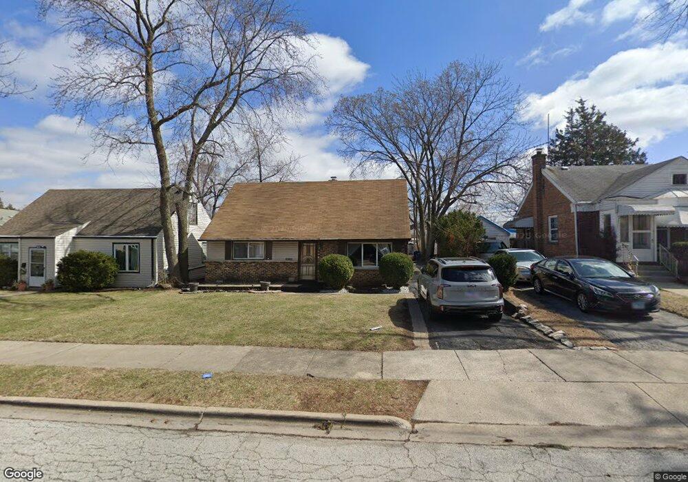
1935 Herbert Ave Berkeley, IL 60163
Estimated Value: $290,000 - $357,000
4
Beds
3
Baths
1,993
Sq Ft
$169/Sq Ft
Est. Value
About This Home
This home is located at 1935 Herbert Ave, Berkeley, IL 60163 and is currently estimated at $336,470, approximately $168 per square foot. 1935 Herbert Ave is a home located in Cook County with nearby schools including Macarthur Intermediate School, Sunnyside Elementary School, and Proviso West High School.
Ownership History
Date
Name
Owned For
Owner Type
Purchase Details
Closed on
Feb 7, 2003
Sold by
Dawson Richard
Bought by
Molden Maurice and Molden Whyketha
Current Estimated Value
Home Financials for this Owner
Home Financials are based on the most recent Mortgage that was taken out on this home.
Original Mortgage
$145,500
Outstanding Balance
$61,168
Interest Rate
6.07%
Estimated Equity
$275,302
Purchase Details
Closed on
Jul 20, 1999
Sold by
Connors Kevin W and Mckelvey Nancy
Bought by
Dawson Richard
Create a Home Valuation Report for This Property
The Home Valuation Report is an in-depth analysis detailing your home's value as well as a comparison with similar homes in the area
Home Values in the Area
Average Home Value in this Area
Purchase History
| Date | Buyer | Sale Price | Title Company |
|---|---|---|---|
| Molden Maurice | $150,000 | Cti | |
| Dawson Richard | $125,000 | -- |
Source: Public Records
Mortgage History
| Date | Status | Borrower | Loan Amount |
|---|---|---|---|
| Open | Molden Maurice | $145,500 |
Source: Public Records
Tax History
| Year | Tax Paid | Tax Assessment Tax Assessment Total Assessment is a certain percentage of the fair market value that is determined by local assessors to be the total taxable value of land and additions on the property. | Land | Improvement |
|---|---|---|---|---|
| 2025 | $8,034 | $25,001 | $3,988 | $21,013 |
| 2024 | $8,034 | $25,001 | $3,988 | $21,013 |
| 2023 | $8,355 | $25,001 | $3,988 | $21,013 |
| 2022 | $8,355 | $22,438 | $2,719 | $19,719 |
| 2021 | $8,368 | $22,437 | $2,718 | $19,719 |
| 2020 | $7,985 | $22,437 | $2,718 | $19,719 |
| 2019 | $8,110 | $22,564 | $2,537 | $20,027 |
| 2018 | $7,949 | $22,564 | $2,537 | $20,027 |
| 2017 | $7,622 | $22,564 | $2,537 | $20,027 |
| 2016 | $6,512 | $18,584 | $2,356 | $16,228 |
| 2015 | $6,442 | $18,584 | $2,356 | $16,228 |
| 2014 | $6,347 | $18,584 | $2,356 | $16,228 |
| 2013 | $5,332 | $17,192 | $2,356 | $14,836 |
Source: Public Records
Map
Nearby Homes
- 2050 Atwood Ave
- 504 N Irving Ave
- 250 N Irving Ave
- 5949 School St
- 522 E Park Manor Ct
- 226 N Lind Ave
- 593 S Edgewood Ave
- 520 N Wolf Rd Unit 203
- 4938 W Randolph St
- 605 N Wolf Rd Unit B9
- 956 S Cadwell Ave
- 70 N Laverne Ave
- 341 Iroquois Rd
- 928 S Hillcrest Ave
- 4904 W Hawthorne Ave
- 1529 N Hillside Ave
- 1447 N Ashbel Ave
- 515 S Parkview Ave
- 1428 1/2 N Ashbel Ave
- 426 E Harrison St
- 1939 Herbert Ave
- 1931 Herbert Ave
- 1941 Herbert Ave
- 1936 N Taft Ave
- 1940 N Taft Ave
- 1932 N Taft Ave
- 1943 Herbert Ave
- 1923 Herbert Ave
- 1948 N Taft Ave
- 1928 N Taft Ave
- 1950 N Taft Ave
- 1924 N Taft Ave
- 1936 Herbert Ave
- 1940 Herbert Ave
- 1932 Herbert Ave
- 1919 Herbert Ave
- 1952 N Taft Ave
- 1928 Herbert Ave
- 1944 Herbert Ave
- 1920 N Taft Ave
Your Personal Tour Guide
Ask me questions while you tour the home.