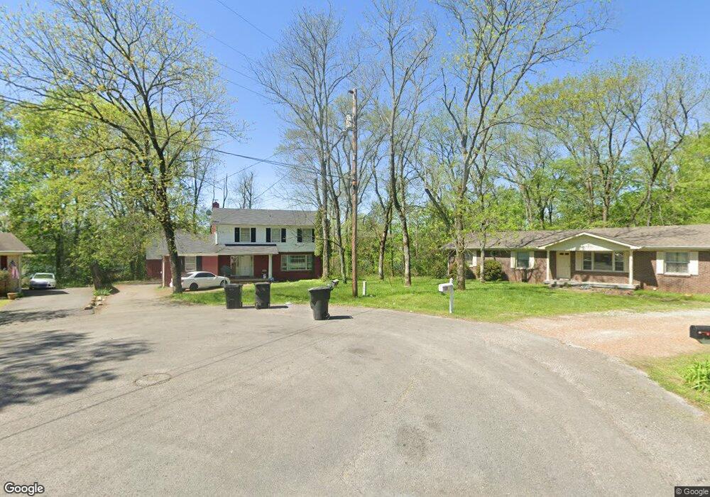
1935 Larry Ct Murfreesboro, TN 37130
Estimated Value: $305,637 - $416,000
Studio
2
Baths
1,904
Sq Ft
$179/Sq Ft
Est. Value
About This Home
This home is located at 1935 Larry Ct, Murfreesboro, TN 37130 and is currently estimated at $341,159, approximately $179 per square foot. 1935 Larry Ct is a home located in Rutherford County with nearby schools including Black Fox Elementary School, Whitworth-Buchanan Middle School, and Riverdale High School.
Ownership History
Date
Name
Owned For
Owner Type
Purchase Details
Closed on
Mar 22, 2024
Sold by
Zhu Winnie and Chao Yang Chao
Bought by
Dong Weiqiang
Current Estimated Value
Purchase Details
Closed on
Jun 14, 2018
Sold by
Daily Buffett And Grill Murfreesboro Inc
Bought by
Yang Zhao G
Purchase Details
Closed on
Mar 1, 2017
Sold by
Yang Fe and Lin Tong
Bought by
Daily Buffett & Lgrill Murfreesboro Inc
Purchase Details
Closed on
Aug 18, 2003
Sold by
Nunley Sherry L
Bought by
Tong Lin
Home Financials for this Owner
Home Financials are based on the most recent Mortgage that was taken out on this home.
Original Mortgage
$78,800
Interest Rate
5.24%
Create a Home Valuation Report for This Property
The Home Valuation Report is an in-depth analysis detailing your home's value as well as a comparison with similar homes in the area
Home Values in the Area
Average Home Value in this Area
Purchase History
| Date | Buyer | Sale Price | Title Company |
|---|---|---|---|
| Dong Weiqiang | $230,000 | None Listed On Document | |
| Yang Zhao G | -- | None Available | |
| Daily Buffett & Lgrill Murfreesboro Inc | -- | None Available | |
| Tong Lin | $108,000 | -- |
Source: Public Records
Mortgage History
| Date | Status | Borrower | Loan Amount |
|---|---|---|---|
| Previous Owner | Tong Lin | $78,800 |
Source: Public Records
Tax History
| Year | Tax Paid | Tax Assessment Tax Assessment Total Assessment is a certain percentage of the fair market value that is determined by local assessors to be the total taxable value of land and additions on the property. | Land | Improvement |
|---|---|---|---|---|
| 2025 | $1,895 | $67,000 | $13,750 | $53,250 |
| 2024 | -- | $67,000 | $13,750 | $53,250 |
| 2023 | $1,241 | $66,150 | $13,750 | $52,400 |
| 2022 | $1,069 | $66,150 | $13,750 | $52,400 |
| 2021 | $899 | $40,525 | $9,375 | $31,150 |
| 2020 | $899 | $40,525 | $9,375 | $31,150 |
| 2019 | $899 | $40,525 | $9,375 | $31,150 |
| 2018 | $1,236 | $40,525 | $0 | $0 |
| 2017 | $1,251 | $31,925 | $0 | $0 |
| 2016 | $1,241 | $31,925 | $0 | $0 |
| 2015 | $1,241 | $31,925 | $0 | $0 |
| 2014 | $794 | $31,925 | $0 | $0 |
| 2013 | -- | $27,600 | $0 | $0 |
Source: Public Records
Map
Nearby Homes
- 1607 Kensington Dr
- 1534 Kensington Dr
- 1806 Fern Dr
- 1811 Cascade Ct
- 2010 Bartway Dr Unit 2012
- 2223 Viking Ct
- 1610 Bartway Dr
- 1710 Clydeway Dr
- 1507 Bartway Dr
- 2260 Viking Ct
- 2422 Turtle Trace
- 2131 S Rutherford Blvd
- 1806 Greerson Dr
- 1919 Bradyville Pike
- 1709 Thomas Ct
- 1214 Rutherford St
- 2015 Olympia Place
- 1510 Foxdale Dr
- 1110 Olympia Place
- 2103 Halligen Ct
- 1939 Larry Ct
- 1931 Larry Ct
- 1927 Larry Ct
- 1943 Larry Ct
- 1947 Ransom Dr
- 1923 Ransom Dr
- 1951 Ransom Dr
- 1919 Ransom Dr
- 1955 Ransom Dr
- 1922 Ransom Dr
- 1926 Ransom Dr
- 1915 Ransom Dr
- 1918 Ransom Dr
- 1930 Ransom Dr
- 1959 Ransom Dr
- 1934 Ransom Dr
- 1914 Ransom Dr
- 1911 Ransom Dr
- 1623 Kensington Dr
- 1627 Kensington Dr
Your Personal Tour Guide
Ask me questions while you tour the home.