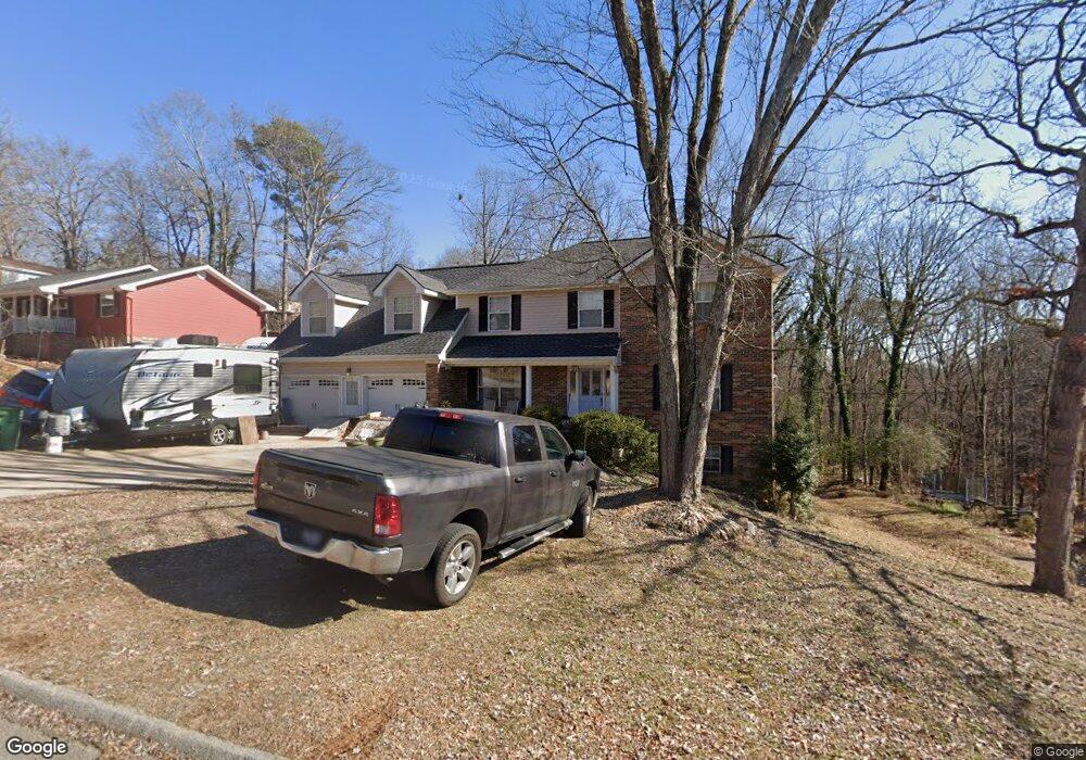
1935 Rock Bluff Rd Unit 4 Hixson, TN 37343
Estimated Value: $387,986 - $483,000
4
Beds
4
Baths
3,200
Sq Ft
$139/Sq Ft
Est. Value
About This Home
This home is located at 1935 Rock Bluff Rd Unit 4, Hixson, TN 37343 and is currently estimated at $443,747, approximately $138 per square foot. 1935 Rock Bluff Rd Unit 4 is a home located in Hamilton County with nearby schools including McConnell Elementary School, Loftis Middle School, and Hixson High School.
Ownership History
Date
Name
Owned For
Owner Type
Purchase Details
Closed on
Dec 20, 1996
Sold by
Carignan Joseph Edgar and Carignan Elizabeth A
Bought by
Cross Richard L and Lavook Cross Lynn R
Current Estimated Value
Home Financials for this Owner
Home Financials are based on the most recent Mortgage that was taken out on this home.
Original Mortgage
$106,875
Outstanding Balance
$10,542
Interest Rate
7.37%
Estimated Equity
$433,205
Create a Home Valuation Report for This Property
The Home Valuation Report is an in-depth analysis detailing your home's value as well as a comparison with similar homes in the area
Home Values in the Area
Average Home Value in this Area
Purchase History
| Date | Buyer | Sale Price | Title Company |
|---|---|---|---|
| Cross Richard L | $112,500 | Pioneer Title Agency Inc |
Source: Public Records
Mortgage History
| Date | Status | Borrower | Loan Amount |
|---|---|---|---|
| Open | Cross Richard L | $106,875 |
Source: Public Records
Tax History Compared to Growth
Tax History
| Year | Tax Paid | Tax Assessment Tax Assessment Total Assessment is a certain percentage of the fair market value that is determined by local assessors to be the total taxable value of land and additions on the property. | Land | Improvement |
|---|---|---|---|---|
| 2024 | $1,446 | $64,625 | $0 | $0 |
| 2023 | $1,455 | $64,625 | $0 | $0 |
| 2022 | $1,455 | $64,625 | $0 | $0 |
| 2021 | $1,455 | $64,625 | $0 | $0 |
| 2020 | $1,489 | $53,525 | $0 | $0 |
| 2019 | $1,489 | $53,525 | $0 | $0 |
| 2018 | $1,489 | $53,525 | $0 | $0 |
| 2017 | $1,489 | $53,525 | $0 | $0 |
| 2016 | $1,387 | $0 | $0 | $0 |
| 2015 | $1,387 | $49,825 | $0 | $0 |
| 2014 | $1,387 | $0 | $0 | $0 |
Source: Public Records
Map
Nearby Homes
- 1820 Rock Bluff Rd
- 1705 Sea Gull Ln
- 1800 Mountain Bay Dr
- 1706 Mountain Bay Dr
- 6517 Shelter Cove Dr
- 1924 Bay Pointe Dr
- 6577 Fairview Rd
- 6512 Fairview Rd
- 2227 Bay Pointe Dr
- 2027 Paige Meadows Ct
- 2039 Paige Meadows Ct
- 0 Ridge Lake Rd Unit RTC2805180
- 0 Ridge Lake Rd Unit 1509241
- 000 Hixson Pike
- 7551 Foster Hixson Cemetery Rd
- 6400 Ridge Lake Rd Unit 3
- Hamilton Plan at The Farmstead - Courtyard Homes
- Delaney Plan at The Farmstead - Courtyard Homes
- Lincoln Plan at The Farmstead - Courtyard Homes
- Cumberland Plan at The Farmstead - Courtyard Homes
- 1933 Rock Bluff Rd
- 1939 Rock Bluff Rd
- 1941 Rock Bluff Rd
- 6604 Schooner Bay Ln Unit 6
- 1929 Rock Bluff Rd
- 1929 Rock Bluff Rd Unit 432
- 1934 Rock Bluff Rd
- 6622 Schooner Bay Ln
- 6606 Schooner Bay Ln
- 6606 Schooner Bay Ln Unit 631
- 1938 Rock Bluff Rd
- 1938 Rock Bluff Rd Unit 4
- 1938 Rock Bluff Rd Unit 226
- 1932 Rock Bluff Rd
- 1940 Rock Bluff Rd
- 1940 Rock Bluff Rd Unit 432
- 2001 Rock Bluff Rd
- 1930 Rock Bluff Rd
- 6608 Schooner Bay Ln
- 1926 Rock Bluff Rd