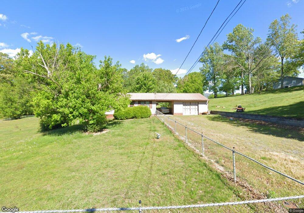
1935 Sail Rd Newport, TN 37821
Estimated Value: $135,000 - $322,000
--
Bed
1
Bath
1,040
Sq Ft
$194/Sq Ft
Est. Value
About This Home
This home is located at 1935 Sail Rd, Newport, TN 37821 and is currently estimated at $201,889, approximately $194 per square foot. 1935 Sail Rd is a home located in Cocke County with nearby schools including Cosby Elementary School and Cosby High School.
Ownership History
Date
Name
Owned For
Owner Type
Purchase Details
Closed on
Jan 2, 2024
Sold by
Allen William K
Bought by
Hannah Heath A and Hannah Ksenia
Current Estimated Value
Home Financials for this Owner
Home Financials are based on the most recent Mortgage that was taken out on this home.
Original Mortgage
$125,860
Outstanding Balance
$123,795
Interest Rate
7.29%
Mortgage Type
New Conventional
Estimated Equity
$78,094
Purchase Details
Closed on
Oct 23, 2023
Sold by
Smelcer Janice Kay
Bought by
Allen William K
Create a Home Valuation Report for This Property
The Home Valuation Report is an in-depth analysis detailing your home's value as well as a comparison with similar homes in the area
Home Values in the Area
Average Home Value in this Area
Purchase History
| Date | Buyer | Sale Price | Title Company |
|---|---|---|---|
| Hannah Heath A | $140,000 | None Listed On Document | |
| Allen William K | $80,000 | None Listed On Document |
Source: Public Records
Mortgage History
| Date | Status | Borrower | Loan Amount |
|---|---|---|---|
| Open | Hannah Heath A | $125,860 |
Source: Public Records
Tax History Compared to Growth
Tax History
| Year | Tax Paid | Tax Assessment Tax Assessment Total Assessment is a certain percentage of the fair market value that is determined by local assessors to be the total taxable value of land and additions on the property. | Land | Improvement |
|---|---|---|---|---|
| 2024 | $454 | $17,750 | $2,550 | $15,200 |
| 2023 | $0 | $17,750 | $2,550 | $15,200 |
| 2022 | $455 | $17,750 | $2,550 | $15,200 |
| 2021 | $455 | $17,750 | $2,550 | $15,200 |
| 2020 | $455 | $17,750 | $2,550 | $15,200 |
| 2019 | $456 | $16,100 | $2,550 | $13,550 |
| 2018 | $456 | $16,100 | $2,550 | $13,550 |
| 2017 | $467 | $16,100 | $2,550 | $13,550 |
| 2016 | $417 | $16,100 | $2,550 | $13,550 |
| 2015 | $384 | $16,100 | $2,550 | $13,550 |
| 2014 | $384 | $16,100 | $2,550 | $13,550 |
| 2013 | $384 | $16,000 | $2,375 | $13,625 |
Source: Public Records
Map
Nearby Homes
- 301 Friendship Rd
- Lots 17-18 English Mountain Rd
- 0 English Mountain Rd
- 16a Moody Moon Ridge Way
- Lots 17-18 English Mtn Rd
- 125 Shiner Run Dr
- 7035 Armory Rd
- Lot 36 English Fields Dr
- 0 English Fields Dr Unit 1295842
- 0 English Fields Dr Unit 305748
- 0 English Fields Dr Unit 707048
- 0 Robert e Lee Dr Unit 302634
- 211 Circle Rd
- 116 Circle Rd
- 1058 Clearview Dr
- 1607 Tranquility Ridge Way
- 2481 Elk Way
- 145 Oakwood Way
- 910 English Mountain Rd
- 0 Siesta Dr
- 1929 Sail Rd
- 1941 Sail Rd
- 271 Friendship Rd
- 290 Friendship Rd
- 302 Friendship Rd
- 1924 Sail Rd
- 1926 Sail Rd
- 1906 Sail Rd
- 310 Friendship Rd
- 1920 Sail Rd
- 1910 Sail Rd
- 1910 Sail Rd
- 1914 Sail Rd
- 320 Friendship Rd
- 1815 Shale Rd
- 1910 Brooks Cemetery Rd
- 271 Sea Rd
- 322 Friendship Rd
- 255 Sea Rd
- 1903 Brooks Cemetery Rd