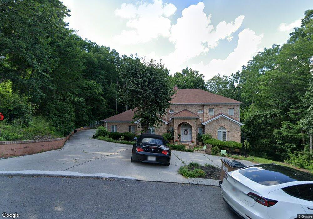
1935 Wren Way Dalton, GA 30720
Estimated Value: $662,000 - $740,000
4
Beds
5
Baths
4,440
Sq Ft
$156/Sq Ft
Est. Value
About This Home
This home is located at 1935 Wren Way, Dalton, GA 30720 and is currently estimated at $692,749, approximately $156 per square foot. 1935 Wren Way is a home located in Whitfield County with nearby schools including Dug Gap Elementary School, Valley Point Middle School, and Southeast Whitfield County High School.
Ownership History
Date
Name
Owned For
Owner Type
Purchase Details
Closed on
Jan 25, 2023
Sold by
Paramo-Contreras Yulian
Bought by
Dalton Neza Farm Llc
Current Estimated Value
Purchase Details
Closed on
Aug 7, 2014
Sold by
Us Bank National Associati
Bought by
Truman Acm Golden State Re
Purchase Details
Closed on
Apr 1, 2014
Sold by
Nelson Karen F
Bought by
Us Bank National Association T and Truman Acm Grantor
Purchase Details
Closed on
May 31, 2007
Sold by
Pleasant Tony A
Bought by
Nelson Karen F
Home Financials for this Owner
Home Financials are based on the most recent Mortgage that was taken out on this home.
Original Mortgage
$341,100
Interest Rate
10.88%
Mortgage Type
New Conventional
Purchase Details
Closed on
Sep 27, 2002
Sold by
Leary Michael and Leary Rebecca
Bought by
Pleasant Tony A and Pleasant Shyronda Y
Purchase Details
Closed on
Feb 1, 1997
Bought by
Leary Rebecca G
Create a Home Valuation Report for This Property
The Home Valuation Report is an in-depth analysis detailing your home's value as well as a comparison with similar homes in the area
Home Values in the Area
Average Home Value in this Area
Purchase History
| Date | Buyer | Sale Price | Title Company |
|---|---|---|---|
| Dalton Neza Farm Llc | -- | -- | |
| Truman Acm Golden State Re | -- | -- | |
| Us Bank National Association T | -- | -- | |
| Nelson Karen F | $379,000 | -- | |
| Pleasant Tony A | $332,200 | -- | |
| Leary Rebecca G | -- | -- |
Source: Public Records
Mortgage History
| Date | Status | Borrower | Loan Amount |
|---|---|---|---|
| Previous Owner | Nelson Karen F | $341,100 |
Source: Public Records
Tax History Compared to Growth
Tax History
| Year | Tax Paid | Tax Assessment Tax Assessment Total Assessment is a certain percentage of the fair market value that is determined by local assessors to be the total taxable value of land and additions on the property. | Land | Improvement |
|---|---|---|---|---|
| 2024 | $6,064 | $309,109 | $15,000 | $294,109 |
| 2023 | $6,064 | $202,144 | $12,000 | $190,144 |
| 2022 | $5,028 | $179,043 | $12,000 | $167,043 |
| 2021 | $5,030 | $179,043 | $12,000 | $167,043 |
| 2020 | $4,138 | $144,568 | $12,000 | $132,568 |
| 2019 | $4,200 | $144,568 | $12,000 | $132,568 |
| 2018 | $4,262 | $144,568 | $12,000 | $132,568 |
| 2017 | $4,264 | $144,568 | $12,000 | $132,568 |
| 2016 | $3,357 | $134,306 | $13,734 | $120,572 |
| 2014 | $3,416 | $134,306 | $13,734 | $120,572 |
| 2013 | -- | $134,306 | $13,734 | $120,572 |
Source: Public Records
Map
Nearby Homes
- 1909 Sourwood Dr
- 2001 Eagle Point Dr
- 104 Buckingham Dr
- 1908 Valley Brook Dr
- 608 Brookview Ln
- 702 Courtland Dr
- 604 Foster Rd
- 2512 Dug Gap Rd
- 0 Shannon Dr Unit 131263
- 428 Lower Dug Gap Rd SW
- 0 Fawn Dr Unit 130141
- 0 Fawn Dr Unit 130140
- 1922 W Brookhaven Cir
- 0 Taylor Dr Unit 130142
- 0 Taylor Dr Unit 130143
- 1922 W Brookhaven Cir
- 1915 W Brookhaven Cir
- 0 Vinewood Dr
- 1913 Tara Place
- 3016 E Brookhaven Cir
- 1931 Wren Way
- 1930 Wren Way
- 1936 Wren Way
- 1927 Wren Way
- 1920 Wren Way
- 1936 SW Wren Way
- 1928 Sourwood Dr
- 809 Katlau Dr
- 1930 Sourwood Dr
- 1923 Wren Way
- 1926 Sourwood Dr
- 1914 Wren Way
- 1946 Sourwood Dr
- 1924 Sourwood Dr
- 0 Wren Way Unit RTC2729217
- 0 Wren Way Unit RTC2728186
- 0 Wren Way Unit RTC2726829
- 00 Wren Way
- 0 Wren Way Unit 88006
- 0 Wren Way Unit 1292829