Estimated Value: $472,000 - $572,000
4
Beds
2
Baths
2,112
Sq Ft
$253/Sq Ft
Est. Value
About This Home
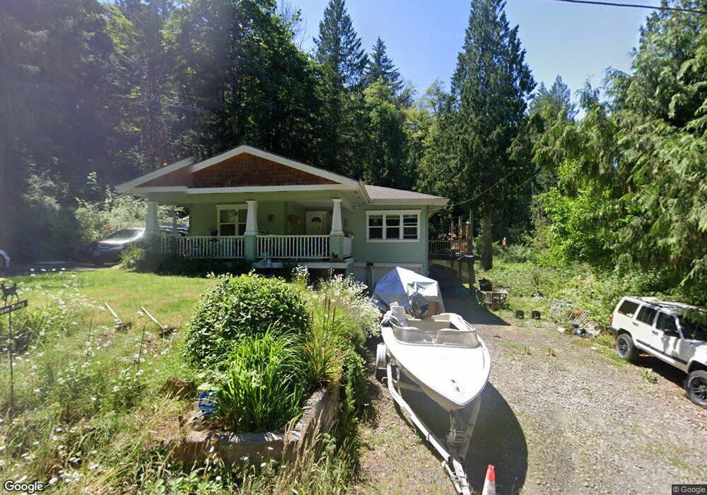
This home is located at 19353 SE Langensand Rd, Sandy, OR 97055 and is currently estimated at $533,440, approximately $252 per square foot. 19353 SE Langensand Rd is a home located in Clackamas County with nearby schools including Firwood Elementary School, Cedar Ridge Middle School, and Sandy High School.
Ownership History
Date
Name
Owned For
Owner Type
Purchase Details
Closed on
Mar 19, 2024
Sold by
Brown Betty C and Brown Edwin B
Bought by
Brown Family Trust and Brown
Current Estimated Value
Purchase Details
Closed on
Oct 7, 1998
Sold by
Comstock Robert A and Comstock Marcy S
Bought by
Brown Edwin C and Brown Betty C
Home Financials for this Owner
Home Financials are based on the most recent Mortgage that was taken out on this home.
Original Mortgage
$189,150
Interest Rate
6.88%
Create a Home Valuation Report for This Property
The Home Valuation Report is an in-depth analysis detailing your home's value as well as a comparison with similar homes in the area
Purchase History
| Date | Buyer | Sale Price | Title Company |
|---|---|---|---|
| Brown Family Trust | -- | None Listed On Document | |
| Brown Edwin C | $195,000 | First American Title Ins Co |
Source: Public Records
Mortgage History
| Date | Status | Borrower | Loan Amount |
|---|---|---|---|
| Previous Owner | Brown Edwin C | $189,150 |
Source: Public Records
Tax History Compared to Growth
Tax History
| Year | Tax Paid | Tax Assessment Tax Assessment Total Assessment is a certain percentage of the fair market value that is determined by local assessors to be the total taxable value of land and additions on the property. | Land | Improvement |
|---|---|---|---|---|
| 2025 | $3,982 | $286,756 | -- | -- |
| 2024 | $3,792 | $278,404 | -- | -- |
| 2023 | $3,792 | $270,296 | $0 | $0 |
| 2022 | $3,600 | $262,424 | $0 | $0 |
| 2021 | $3,474 | $254,781 | $0 | $0 |
| 2020 | $3,383 | $247,361 | $0 | $0 |
| 2019 | $3,369 | $240,157 | $0 | $0 |
| 2018 | $3,277 | $233,162 | $0 | $0 |
| 2017 | $3,204 | $226,371 | $0 | $0 |
| 2016 | $3,092 | $219,778 | $0 | $0 |
Source: Public Records
Map
Nearby Homes
- 0 SE Jacoby Rd Unit 800
- 39302 Stratford Place
- 18712 Cloud Cap Ave
- 40192 Laurel St
- 18653 Van Fleet Ave
- 18462 SE Langensand Rd
- 39784 Syblon Ln
- 38875 Cascadia Village Dr
- 38802 Cascadia Village Dr
- 18050 SE Langensand Rd
- 38581 Limerick St
- 17745 Davis Dr
- The 2676 Plan at Timber Grove
- The 2260 Plan at Timber Grove
- The 2414 Plan at Timber Grove
- 18635 Warm Springs St Unit 4
- 41057 SE Vista Loop Dr
- 41081 SE Vista Loop Dr
- 41540 Metolius Ave Unit 19
- 41570 Metolius Ave Unit 22
- 19303 SE Langensand Rd
- 19270 SE Jacoby Rd
- 19363 SE Langensand Rd
- 0 SE Langensand Rd
- 19264 SE Jacoby Rd Unit 801
- 19111 SE Langensand Rd
- 19475 SE Langensand Rd
- 19260 SE Jacoby Rd
- 19031 SE Langensand Rd
- 19525 SE Langensand Rd
- 19605 SE Langensand Rd
- 19538 SE Langensand Rd
- 18975 SE Langensand (Wow) Rd
- 18975 SE Langensand Rd
- 19641 SE Langensand Rd
- 18990 SE Langensand Rd
- 19720 SE Jacoby Rd
- 19364 SE Jacoby Rd
- 19656 SE Langensand Rd
- 18995 SE Langensand Rd