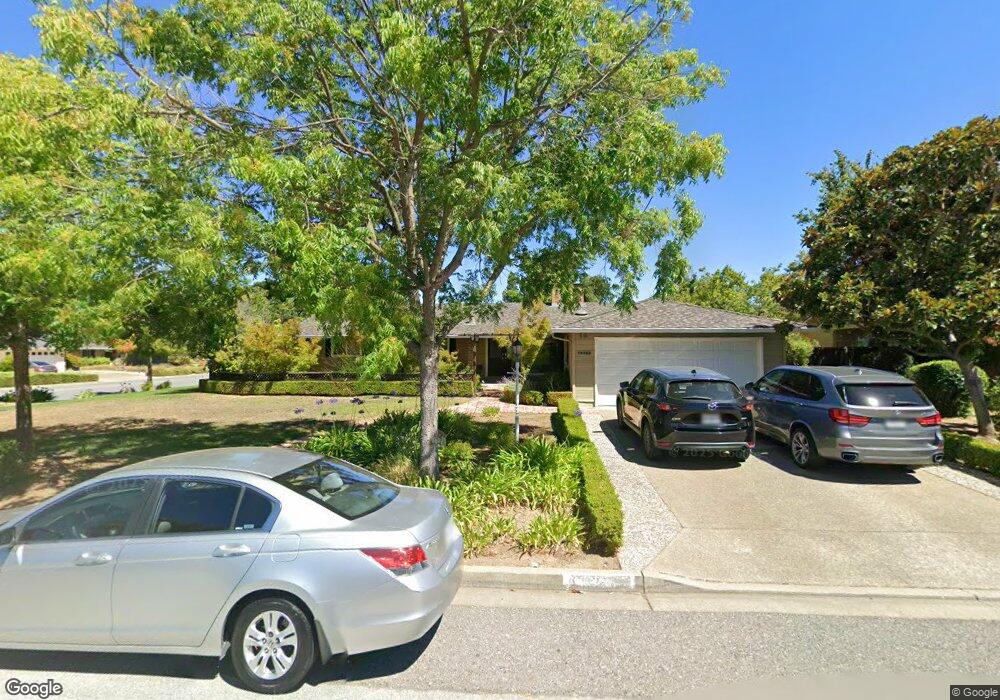
19355 Brookview Dr Saratoga, CA 95070
West San Jose NeighborhoodEstimated Value: $3,476,918 - $4,073,000
4
Beds
3
Baths
1,999
Sq Ft
$1,866/Sq Ft
Est. Value
About This Home
This home is located at 19355 Brookview Dr, Saratoga, CA 95070 and is currently estimated at $3,729,980, approximately $1,865 per square foot. 19355 Brookview Dr is a home located in Santa Clara County with nearby schools including Blue Hills Elementary School, Joaquin Miller Middle, and Lynbrook High School.
Ownership History
Date
Name
Owned For
Owner Type
Purchase Details
Closed on
Mar 2, 2021
Sold by
Oneal Dan and Oneal Margaret Lager
Bought by
Oneal
Current Estimated Value
Purchase Details
Closed on
Feb 1, 2021
Sold by
Dan & Mimi Oneal Living Trust and Friedrich Jane
Bought by
Larry Friedrich And Jane A Friedrich Living T and Friedrich
Purchase Details
Closed on
Jan 24, 2008
Sold by
Oneal Dan and Oneal Margaret L
Bought by
Oneal Dan and Oneal Margaret L
Purchase Details
Closed on
Mar 13, 1995
Sold by
Oneal Margaret L
Bought by
Oneal Dan and Oneal Margaret L
Create a Home Valuation Report for This Property
The Home Valuation Report is an in-depth analysis detailing your home's value as well as a comparison with similar homes in the area
Home Values in the Area
Average Home Value in this Area
Purchase History
| Date | Buyer | Sale Price | Title Company |
|---|---|---|---|
| Oneal | -- | -- | |
| Larry Friedrich And Jane A Friedrich Living T | -- | None Listed On Document | |
| Oneal Dan | -- | None Available | |
| Oneal Dan | -- | -- |
Source: Public Records
Tax History Compared to Growth
Tax History
| Year | Tax Paid | Tax Assessment Tax Assessment Total Assessment is a certain percentage of the fair market value that is determined by local assessors to be the total taxable value of land and additions on the property. | Land | Improvement |
|---|---|---|---|---|
| 2025 | $2,641 | $137,172 | $41,554 | $95,618 |
| 2024 | $2,641 | $134,484 | $40,740 | $93,744 |
| 2023 | $2,601 | $131,848 | $39,942 | $91,906 |
| 2022 | $2,819 | $129,263 | $39,159 | $90,104 |
| 2021 | $2,761 | $126,730 | $38,392 | $88,338 |
| 2020 | $2,701 | $125,432 | $37,999 | $87,433 |
| 2019 | $2,630 | $122,973 | $37,254 | $85,719 |
| 2018 | $2,551 | $120,563 | $36,524 | $84,039 |
| 2017 | $2,429 | $118,200 | $35,808 | $82,392 |
| 2016 | $2,069 | $115,883 | $35,106 | $80,777 |
| 2015 | $2,255 | $114,143 | $34,579 | $79,564 |
| 2014 | $2,176 | $111,908 | $33,902 | $78,006 |
Source: Public Records
Map
Nearby Homes
- 12140 Woodside Dr
- 1681 Danromas Way
- 1587 Miller Ave
- 19920 Viewridge Dr
- 13010 Glen Brae Dr
- 19437 Via Real Dr
- 19423 Vineyard Ln
- 5635 W Walbrook Dr
- 12790 Glen Arbor Ct
- 19113 Vineyard Ln
- 1577 Maurice Ln
- 19662 Via Grande Dr
- 11010 Maple Place Unit 25-06 Plan 4
- 10750 Elm Cir Unit 88-17 Plan 2
- 10730 Elm Cir Unit 86-17 Plan 2
- 11315 Cottonwood Place Unit 39-09 Plan 3
- 12584 Paseo Flores
- Plan 2 at The Elms
- Plan 3 at The Elms
- Plan 4 at The Elms
- 19333 Brookview Dr
- 12288 Miller Ave
- 19332 Melinda Cir
- 12299 Miller Ave
- 19321 Brookview Dr
- 19354 Brookview Dr
- 12281 Miller Ave
- 12313 Miller Ave
- 19320 Melinda Cir
- 19332 Brookview Dr
- 12325 Miller Ave
- 19309 Brookview Dr
- 19353 Melinda Cir
- 19320 Brookview Dr
- 12278 Mabel Ct
- 12290 Mabel Ct
- 19365 Melinda Cir
- 19331 Melinda Cir
- 12256 Mabel Ct
- 12414 Miller Ave