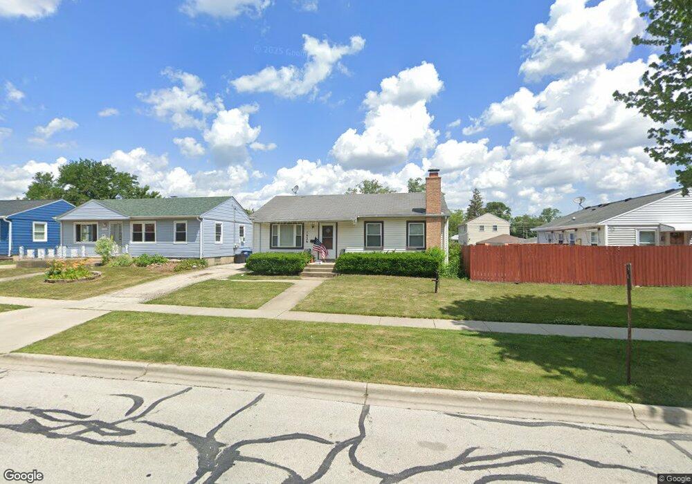
1936 Fargo Ave Des Plaines, IL 60018
Estimated Value: $295,000 - $364,000
3
Beds
1
Bath
864
Sq Ft
$372/Sq Ft
Est. Value
About This Home
This home is located at 1936 Fargo Ave, Des Plaines, IL 60018 and is currently estimated at $321,145, approximately $371 per square foot. 1936 Fargo Ave is a home located in Cook County with nearby schools including South Elementary School, Algonquin Middle School, and Maine West High School.
Ownership History
Date
Name
Owned For
Owner Type
Purchase Details
Closed on
Jun 18, 2003
Sold by
Cronin Sharon K and Thompson Sharon K
Bought by
Thompson Thomas L and Thompson Sharon K
Current Estimated Value
Home Financials for this Owner
Home Financials are based on the most recent Mortgage that was taken out on this home.
Original Mortgage
$104,000
Interest Rate
5.36%
Mortgage Type
Unknown
Create a Home Valuation Report for This Property
The Home Valuation Report is an in-depth analysis detailing your home's value as well as a comparison with similar homes in the area
Home Values in the Area
Average Home Value in this Area
Purchase History
| Date | Buyer | Sale Price | Title Company |
|---|---|---|---|
| Thompson Thomas L | -- | Chicago Title Insurance Comp |
Source: Public Records
Mortgage History
| Date | Status | Borrower | Loan Amount |
|---|---|---|---|
| Closed | Thompson Thomas L | $104,000 |
Source: Public Records
Tax History Compared to Growth
Tax History
| Year | Tax Paid | Tax Assessment Tax Assessment Total Assessment is a certain percentage of the fair market value that is determined by local assessors to be the total taxable value of land and additions on the property. | Land | Improvement |
|---|---|---|---|---|
| 2024 | $6,855 | $26,001 | $4,688 | $21,313 |
| 2023 | $6,690 | $26,001 | $4,688 | $21,313 |
| 2022 | $6,690 | $26,001 | $4,688 | $21,313 |
| 2021 | $5,174 | $16,831 | $3,906 | $12,925 |
| 2020 | $5,086 | $16,831 | $3,906 | $12,925 |
| 2019 | $5,090 | $18,912 | $3,906 | $15,006 |
| 2018 | $7,037 | $23,529 | $3,437 | $20,092 |
| 2017 | $6,912 | $23,529 | $3,437 | $20,092 |
| 2016 | $6,538 | $23,529 | $3,437 | $20,092 |
| 2015 | $5,950 | $19,682 | $2,968 | $16,714 |
| 2014 | $5,825 | $19,682 | $2,968 | $16,714 |
| 2013 | $5,680 | $19,682 | $2,968 | $16,714 |
Source: Public Records
Map
Nearby Homes
- 38 E Touhy Ave
- 1706 Buckingham Dr
- 2500 Maple St
- 1966 Laura Ln
- 2600 S Scott St
- 1641 E Touhy Ave
- 1629 E Touhy Ave
- 2609 Eisenhower Dr
- 1928 Kennicott Ct
- 2126 David Dr
- 2646 Maple St
- 1721 Linden St
- 1640 S River Rd
- 1757 Farwell Ave
- 2017 Pine St Unit B
- 22 Park Ln Unit 203
- 44 Park Ln Unit 435
- 1724 Illinois St
- 1689 S Elm St
- 300 Boardwalk Place Unit T300
- 1922 Fargo Ave
- 1944 Fargo Ave
- 1914 Fargo Ave
- 1935 Welwyn Ave
- 1921 Welwyn Ave
- 1941 Welwyn Ave
- 1906 Fargo Ave
- 1915 Welwyn Ave
- 1958 Fargo Ave
- 1905 Welwyn Ave
- 1900 Fargo Ave
- 1913 Fargo St
- 1935 Fargo Ave
- 1945 Fargo Ave
- 1921 Fargo Ave
- 1959 Welwyn Ave
- 1913 Fargo Ave
- 1964 Fargo Ave
- 1896 Fargo Ave
- 1907 Fargo Ave