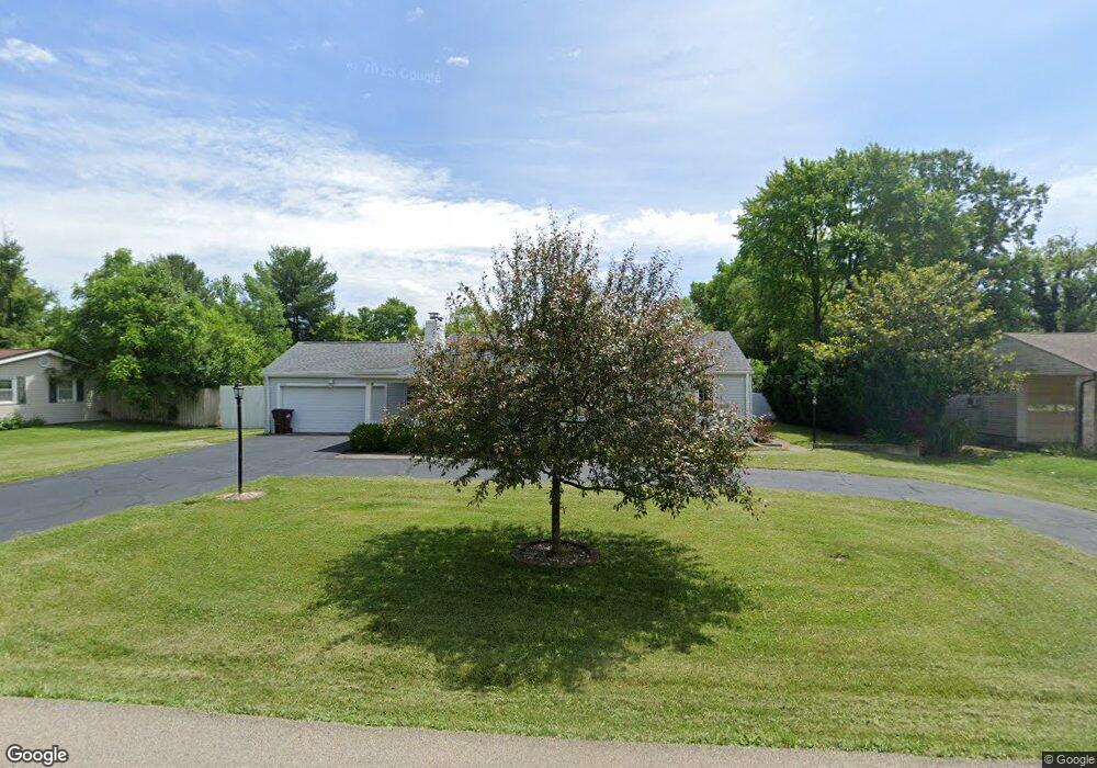
1936 N Central Dr Beavercreek, OH 45432
Estimated Value: $271,000 - $287,636
3
Beds
2
Baths
1,976
Sq Ft
$141/Sq Ft
Est. Value
About This Home
This home is located at 1936 N Central Dr, Beavercreek, OH 45432 and is currently estimated at $279,159, approximately $141 per square foot. 1936 N Central Dr is a home located in Greene County with nearby schools including Parkwood Elementary School, Herman K Ankeney Middle School, and Beavercreek High School.
Ownership History
Date
Name
Owned For
Owner Type
Purchase Details
Closed on
Apr 2, 2007
Sold by
Va
Bought by
Reed Marion and Reed Gina
Current Estimated Value
Home Financials for this Owner
Home Financials are based on the most recent Mortgage that was taken out on this home.
Original Mortgage
$196,100
Outstanding Balance
$120,833
Interest Rate
6.5%
Mortgage Type
Adjustable Rate Mortgage/ARM
Estimated Equity
$158,326
Purchase Details
Closed on
Aug 31, 2006
Sold by
Emory Gary L
Bought by
Va
Purchase Details
Closed on
Jun 30, 2000
Sold by
Mary Wells
Bought by
Emory Gary L
Home Financials for this Owner
Home Financials are based on the most recent Mortgage that was taken out on this home.
Original Mortgage
$119,900
Interest Rate
8.64%
Mortgage Type
VA
Purchase Details
Closed on
Mar 12, 1996
Sold by
Curry Russell
Bought by
Wells Mary
Create a Home Valuation Report for This Property
The Home Valuation Report is an in-depth analysis detailing your home's value as well as a comparison with similar homes in the area
Home Values in the Area
Average Home Value in this Area
Purchase History
| Date | Buyer | Sale Price | Title Company |
|---|---|---|---|
| Reed Marion | -- | None Available | |
| Va | $109,722 | None Available | |
| Emory Gary L | $119,900 | -- | |
| Wells Mary | $67,000 | -- |
Source: Public Records
Mortgage History
| Date | Status | Borrower | Loan Amount |
|---|---|---|---|
| Open | Reed Marion | $196,100 | |
| Previous Owner | Emory Gary L | $119,900 |
Source: Public Records
Tax History Compared to Growth
Tax History
| Year | Tax Paid | Tax Assessment Tax Assessment Total Assessment is a certain percentage of the fair market value that is determined by local assessors to be the total taxable value of land and additions on the property. | Land | Improvement |
|---|---|---|---|---|
| 2024 | $4,929 | $75,470 | $12,820 | $62,650 |
| 2023 | $4,929 | $75,470 | $12,820 | $62,650 |
| 2022 | $4,181 | $56,510 | $9,160 | $47,350 |
| 2021 | $4,096 | $56,510 | $9,160 | $47,350 |
| 2020 | $4,210 | $56,510 | $9,160 | $47,350 |
| 2019 | $3,336 | $40,880 | $9,560 | $31,320 |
| 2018 | $2,953 | $40,880 | $9,560 | $31,320 |
| 2017 | $2,903 | $40,880 | $9,560 | $31,320 |
| 2016 | $3,045 | $40,830 | $9,560 | $31,270 |
| 2015 | $3,027 | $40,830 | $9,560 | $31,270 |
| 2014 | $2,984 | $40,830 | $9,560 | $31,270 |
Source: Public Records
Map
Nearby Homes
- 1946 N Longview St
- 3653 Knollwood Dr
- 1778 N Longview St
- 1737 N Central Dr
- 2146 Oxmoor Dr
- 2110 Grange Hall Rd
- 1873 Turnbull Rd
- 1668 N Central Dr
- 1746 Grange Hall Rd
- 2212 Tulane Dr
- 1617 N Central Dr
- 1641 Woods Dr
- 3880 Southview Ave
- 4071 Lyndell Dr
- 4143 Aley Dr
- 1890 Stedman Ln
- 2402 Spicer Dr
- 4220 Grace Cir
- 3331 Home Acres Ave
- 3951 La Bonne Rd
- 1924 N Central Dr
- 1946 N Central Dr
- 1937 Shady Ln
- 1947 Shady Ln
- 1927 Shady Ln
- 1937 N Central Dr
- 1916 N Central Dr
- 1958 N Central Dr
- 1927 N Central Dr
- 1947 N Central Dr
- 1959 Shady Ln
- 1917 Shady Ln
- 1917 N Central Dr
- 1959 N Central Dr
- 3795 Skyline Dr
- 1906 N Central Dr
- 1936 N Longview St
- 1936 Shady Ln
- 1969 Shady Ln
- 1924 N Longview St