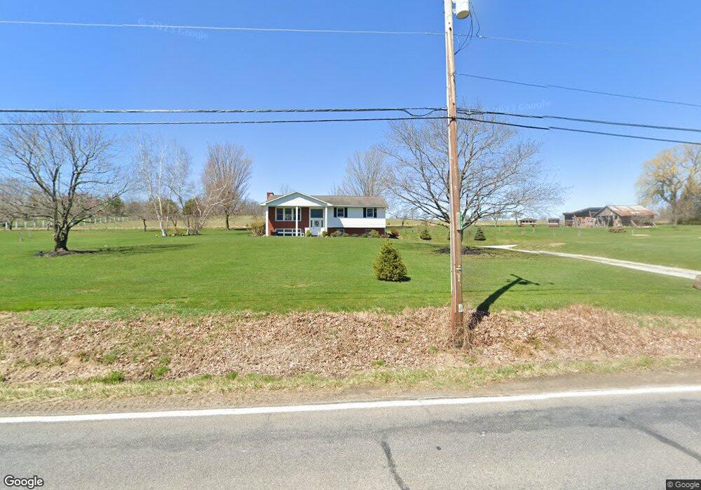
1936 Newton Ransom Blvd Clarks Summit, PA 18411
Estimated Value: $348,000 - $394,000
--
Bed
--
Bath
--
Sq Ft
2.18
Acres
About This Home
This home is located at 1936 Newton Ransom Blvd, Clarks Summit, PA 18411 and is currently estimated at $365,202. 1936 Newton Ransom Blvd is a home located in Lackawanna County with nearby schools including Abington Heights High School.
Ownership History
Date
Name
Owned For
Owner Type
Purchase Details
Closed on
Oct 11, 2019
Sold by
Kristyniak Mary and Shirtz Mary
Bought by
Kristyniak Mary and Shirtz Edward
Current Estimated Value
Purchase Details
Closed on
Aug 6, 2019
Sold by
Bartholme Neil John
Bought by
Kristyniak Mary Lynn
Home Financials for this Owner
Home Financials are based on the most recent Mortgage that was taken out on this home.
Original Mortgage
$225,735
Outstanding Balance
$198,107
Interest Rate
3.8%
Mortgage Type
FHA
Estimated Equity
$167,095
Purchase Details
Closed on
Aug 31, 1973
Bought by
Bartholme Neil and Carol Ann
Create a Home Valuation Report for This Property
The Home Valuation Report is an in-depth analysis detailing your home's value as well as a comparison with similar homes in the area
Home Values in the Area
Average Home Value in this Area
Purchase History
| Date | Buyer | Sale Price | Title Company |
|---|---|---|---|
| Kristyniak Mary | -- | None Available | |
| Kristyniak Mary Lynn | $229,900 | None Available | |
| Bartholme Neil | $200 | -- |
Source: Public Records
Mortgage History
| Date | Status | Borrower | Loan Amount |
|---|---|---|---|
| Open | Kristyniak Mary Lynn | $225,735 |
Source: Public Records
Tax History Compared to Growth
Tax History
| Year | Tax Paid | Tax Assessment Tax Assessment Total Assessment is a certain percentage of the fair market value that is determined by local assessors to be the total taxable value of land and additions on the property. | Land | Improvement |
|---|---|---|---|---|
| 2025 | $4,382 | $18,000 | $2,500 | $15,500 |
| 2024 | $3,618 | $18,000 | $2,500 | $15,500 |
| 2023 | $3,618 | $18,000 | $2,500 | $15,500 |
| 2022 | $3,543 | $18,000 | $2,500 | $15,500 |
| 2021 | $3,543 | $18,000 | $2,500 | $15,500 |
| 2020 | $3,543 | $18,000 | $2,500 | $15,500 |
| 2019 | $3,426 | $18,000 | $2,500 | $15,500 |
| 2018 | $3,394 | $18,000 | $2,500 | $15,500 |
| 2017 | $3,376 | $18,000 | $2,500 | $15,500 |
| 2016 | $2,038 | $18,000 | $2,500 | $15,500 |
| 2015 | -- | $18,000 | $2,500 | $15,500 |
| 2014 | -- | $18,000 | $2,500 | $15,500 |
Source: Public Records
Map
Nearby Homes
- 1932 Newton Ransom Blvd
- 2441 Milwaukee Rd
- 0 Milwaukee Rd Unit GSBSC254290
- 2225 Cherry Hill Rd
- 10 Bald Mt Rd
- 1736 Falls Rd
- 0 Blvd
- 2694 Ransom Rd
- 2500 Falls Rd
- 2352 Newton Ransom Blvd
- 2356 Newton Ransom Blvd
- 1502 Forest Acres Dr
- 3018 Main St
- 162 Highland Rd
- 9119 Valley View Dr
- 3061 Main St
- 0 Spring & Red Oak Dr Unit GSBSC1753
- 314 Terrace Ave
- 52 Ivywood Dr Unit L 6
- 9109 Valley View Dr
- 1936 Newton Ransom Blvd
- 2472 Newton Ransom Blvd
- 1941 Newton Ransom Blvd
- 1928 Newton Ransom Blvd
- 1950 Newton Ransom Blvd
- 1926 Newton Ransom Blvd
- 1952 Newton Ransom Blvd
- 1952 Newton Ransom Blvd
- 1949 Newton Ransom Blvd
- 1949 Newton Ransom Blvd
- 1949 Newton Ransom Blvd
- 1949 Newton Ransom Blvd
- 1949 Newton Ransom Blvd
- 1959 Newton Ransom Blvd
- 1966 Newton Ransom Blvd
- 1922 Newton Ransom Blvd
- 1951 Newton Ransom Blvd
- 1972 Newton Ransom Blvd
- 1915 Newton Ransom Blvd
- 14001 Church Hill Rd