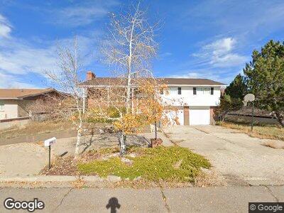
1936 W Uinta St Evanston, WY 82930
Estimated Value: $330,000 - $467,000
4
Beds
3
Baths
3,217
Sq Ft
$120/Sq Ft
Est. Value
About This Home
This home is located at 1936 W Uinta St, Evanston, WY 82930 and is currently estimated at $386,206, approximately $120 per square foot. 1936 W Uinta St is a home located in Uinta County with nearby schools including Evanston High School and Evanston Child Development Center.
Ownership History
Date
Name
Owned For
Owner Type
Purchase Details
Closed on
Jul 14, 2022
Sold by
Lesh William R
Bought by
Cheney Jordan and Cheney Lakota Dawn
Current Estimated Value
Home Financials for this Owner
Home Financials are based on the most recent Mortgage that was taken out on this home.
Original Mortgage
$313,500
Outstanding Balance
$300,408
Interest Rate
5.09%
Mortgage Type
New Conventional
Estimated Equity
$85,798
Create a Home Valuation Report for This Property
The Home Valuation Report is an in-depth analysis detailing your home's value as well as a comparison with similar homes in the area
Home Values in the Area
Average Home Value in this Area
Purchase History
| Date | Buyer | Sale Price | Title Company |
|---|---|---|---|
| Cheney Jordan | -- | First American Title |
Source: Public Records
Mortgage History
| Date | Status | Borrower | Loan Amount |
|---|---|---|---|
| Open | Cheney Jordan | $313,500 | |
| Previous Owner | Lesh William R | $115,500 | |
| Previous Owner | Lesh William R | $119,780 | |
| Previous Owner | Lesh William R | $121,390 | |
| Previous Owner | Lesh William R | $127,384 |
Source: Public Records
Tax History Compared to Growth
Tax History
| Year | Tax Paid | Tax Assessment Tax Assessment Total Assessment is a certain percentage of the fair market value that is determined by local assessors to be the total taxable value of land and additions on the property. | Land | Improvement |
|---|---|---|---|---|
| 2024 | $1,958 | $28,816 | $4,705 | $24,111 |
| 2023 | $1,910 | $28,231 | $4,705 | $23,526 |
| 2022 | $1,156 | $16,982 | $2,892 | $14,090 |
| 2021 | $920 | $13,502 | $2,892 | $10,610 |
| 2020 | $921 | $13,518 | $2,853 | $10,665 |
| 2019 | $942 | $13,850 | $2,853 | $10,997 |
| 2018 | $0 | $13,975 | $3,002 | $10,973 |
| 2017 | $972 | $14,310 | $3,002 | $11,308 |
| 2016 | $976 | $14,356 | $2,738 | $11,618 |
| 2015 | -- | $14,841 | $2,738 | $12,103 |
| 2014 | -- | $16,049 | $0 | $0 |
Source: Public Records
Map
Nearby Homes
- 725 12th St
- 432 15th St
- 1617 W Center St
- 1348 Center St
- 814 Lombard St
- 924 Sage St
- 148 Benjamin Franklin St
- 318 8th St
- 26 Providence Way
- Lot 73 High Point Ranch
- 0 Prospector Dr
- 100 Colonial Ave
- 154 2nd Ave
- 237 4th St
- 108 Cherokee Ct
- 341 Main St
- 325 Main St
- 203 Cheyenne Dr
- 509 County Rd
- 222 Roosevelt Ave
- 1936 W Uinta St
- 1948 W Uinta St
- 1924 W Uinta St
- 1925 W Uinta St
- 625 Country Club Dr
- 638 19th St
- 1917 W Morse Lee St
- 700 19th St
- 1945 W Morse Lee St
- 618 19th St
- 720 19th St
- 624 Country Club Dr
- 736 19th St
- 637 19th St
- 1953 W Uinta St
- 1849 W Uinta St
- 601 19th St
- 1916 W Morse Lee St
- 526 19th St
- 620 Country Club Dr