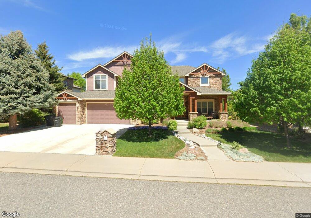
1936 Wasach Dr Longmont, CO 80504
East Side NeighborhoodEstimated Value: $954,557 - $1,256,000
4
Beds
4
Baths
3,215
Sq Ft
$336/Sq Ft
Est. Value
About This Home
This home is located at 1936 Wasach Dr, Longmont, CO 80504 and is currently estimated at $1,079,389, approximately $335 per square foot. 1936 Wasach Dr is a home located in Boulder County with nearby schools including Fall River Elementary School, Trail Ridge Middle School, and Skyline High School.
Ownership History
Date
Name
Owned For
Owner Type
Purchase Details
Closed on
Jul 11, 2003
Sold by
Becker Communities Llc
Bought by
Higgins Stephen J
Current Estimated Value
Home Financials for this Owner
Home Financials are based on the most recent Mortgage that was taken out on this home.
Original Mortgage
$300,000
Outstanding Balance
$126,872
Interest Rate
5.19%
Mortgage Type
Purchase Money Mortgage
Estimated Equity
$952,517
Purchase Details
Closed on
Aug 20, 2002
Sold by
Bosch Land Group Llc
Bought by
Becker Communities Llc
Home Financials for this Owner
Home Financials are based on the most recent Mortgage that was taken out on this home.
Original Mortgage
$4,000,000
Interest Rate
6.48%
Mortgage Type
Credit Line Revolving
Create a Home Valuation Report for This Property
The Home Valuation Report is an in-depth analysis detailing your home's value as well as a comparison with similar homes in the area
Home Values in the Area
Average Home Value in this Area
Purchase History
| Date | Buyer | Sale Price | Title Company |
|---|---|---|---|
| Higgins Stephen J | $575,000 | -- | |
| Becker Communities Llc | $114,000 | -- |
Source: Public Records
Mortgage History
| Date | Status | Borrower | Loan Amount |
|---|---|---|---|
| Open | Higgins Stephen J | $300,000 | |
| Previous Owner | Becker Communities Llc | $4,000,000 |
Source: Public Records
Tax History Compared to Growth
Tax History
| Year | Tax Paid | Tax Assessment Tax Assessment Total Assessment is a certain percentage of the fair market value that is determined by local assessors to be the total taxable value of land and additions on the property. | Land | Improvement |
|---|---|---|---|---|
| 2025 | $6,032 | $64,444 | $9,181 | $55,263 |
| 2024 | $6,032 | $64,444 | $9,181 | $55,263 |
| 2023 | $5,950 | $63,060 | $10,157 | $56,588 |
| 2022 | $5,508 | $55,663 | $7,715 | $47,948 |
| 2021 | $5,580 | $57,265 | $7,937 | $49,328 |
| 2020 | $4,513 | $46,454 | $7,293 | $39,161 |
| 2019 | $4,441 | $46,454 | $7,293 | $39,161 |
| 2018 | $4,638 | $48,823 | $7,344 | $41,479 |
| 2017 | $4,575 | $53,977 | $8,119 | $45,858 |
| 2016 | $4,370 | $43,151 | $9,552 | $33,599 |
| 2015 | $3,931 | $37,038 | $7,721 | $29,317 |
| 2014 | $3,447 | $37,038 | $7,721 | $29,317 |
Source: Public Records
Map
Nearby Homes
- 1939 Sundance Dr
- 1951 Sundance Dr
- 1766 Montgomery Cir
- 1720 Twilight Ct
- 1914 Rannoch Dr
- 1927 Rannoch Dr
- 1931 Rannoch Dr
- 1824 Ute Creek Dr
- 1711 Wildlife Place
- 1618 Otis Dr
- 1426 Galilee Ln
- 1404 Whitehall Dr Unit C
- 1624 Golden Bear Dr
- 2426 Spotswood St
- 1458 Ajax Way
- 2432 Tyrrhenian Dr
- Congaree Plan at Spring Valley
- Biscayne Plan at Spring Valley
- Denali Plan at Spring Valley
- Acadia Plan at Spring Valley
- 1930 Wasach Dr
- 1942 Wasach Dr
- 1945 Sundance Dr
- 1933 Sundance Dr
- 1924 Wasach Dr
- 1948 Wasach Dr
- 1937 Wasach Dr
- 1931 Wasach Dr
- 1943 Wasach Dr
- 1927 Sundance Dr
- 1925 Wasach Dr
- 1918 Wasach Dr
- 1919 Wasach Dr
- 1921 Sundance Dr
- 1769 Montgomery Cir
- 1932 Sundance Dr
- 1912 Wasach Dr
- 1952 Sundance Dr
- 1913 Wasach Dr
- 1915 Sundance Dr