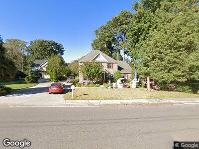
1936 Wolfsnare Rd Virginia Beach, VA 23454
Great Neck NeighborhoodEstimated Value: $634,988 - $708,000
4
Beds
3
Baths
3,418
Sq Ft
$193/Sq Ft
Est. Value
About This Home
This home is located at 1936 Wolfsnare Rd, Virginia Beach, VA 23454 and is currently estimated at $660,997, approximately $193 per square foot. 1936 Wolfsnare Rd is a home located in Virginia Beach City with nearby schools including Alanton Elementary School, Lynnhaven Middle School, and Frank W. Cox High School.
Ownership History
Date
Name
Owned For
Owner Type
Purchase Details
Closed on
Apr 14, 2003
Sold by
Ocean Bay Homes
Bought by
Belak Brain
Current Estimated Value
Home Financials for this Owner
Home Financials are based on the most recent Mortgage that was taken out on this home.
Original Mortgage
$301,163
Outstanding Balance
$138,260
Interest Rate
5.86%
Mortgage Type
New Conventional
Estimated Equity
$518,744
Create a Home Valuation Report for This Property
The Home Valuation Report is an in-depth analysis detailing your home's value as well as a comparison with similar homes in the area
Home Values in the Area
Average Home Value in this Area
Purchase History
| Date | Buyer | Sale Price | Title Company |
|---|---|---|---|
| Belak Brain | $319,000 | -- | |
| Broene Brian | $351,163 | -- |
Source: Public Records
Mortgage History
| Date | Status | Borrower | Loan Amount |
|---|---|---|---|
| Open | Broene Brian | $301,163 | |
| Closed | Belak Brain | $255,200 |
Source: Public Records
Tax History Compared to Growth
Tax History
| Year | Tax Paid | Tax Assessment Tax Assessment Total Assessment is a certain percentage of the fair market value that is determined by local assessors to be the total taxable value of land and additions on the property. | Land | Improvement |
|---|---|---|---|---|
| 2024 | $4,655 | $479,900 | $156,800 | $323,100 |
| 2023 | $4,816 | $486,500 | $152,000 | $334,500 |
| 2022 | $4,816 | $486,500 | $152,000 | $334,500 |
| 2021 | $4,892 | $494,100 | $152,000 | $342,100 |
| 2020 | $5,027 | $494,100 | $152,000 | $342,100 |
| 2019 | $4,809 | $472,600 | $152,000 | $320,600 |
| 2018 | $4,738 | $472,600 | $152,000 | $320,600 |
| 2017 | $4,738 | $472,600 | $152,000 | $320,600 |
| 2016 | $4,688 | $473,500 | $152,000 | $321,500 |
| 2015 | $4,731 | $477,900 | $156,400 | $321,500 |
| 2014 | $3,407 | $403,400 | $186,300 | $217,100 |
Source: Public Records
Map
Nearby Homes
- 813 Hilltop Rd
- 1852 Wolfsnare Rd
- 900 Commodore Dr
- 930 Wildwood Square Ct
- 944 Baillio Dr
- 805 Gloria Place
- 1831 Durham W
- 1857 Karen Ln
- MM Leigh @ Prosperity
- MM Dimitri @ Prosperity
- 719 Tilden Place
- 1761 Wolfsnare Rd
- 689 Biltmore Dr
- 2004 Starboard Ct
- 1822 Sheringham W
- 977 Commodore Dr
- 812 Duke of Suffolk Dr
- 1806 Carlton E
- 1049 Hanson Way
- 1836 Calash Way
- 1936 Wolfsnare Rd
- 905 Mountain Laurel Trail
- 1940 Wolfsnare Rd
- 1944 Wolfsnare Rd
- 909 Mountain Laurel Trail
- 1924 Wolfsnare Rd
- 904 Mountain Laurel Trail
- 1905 Countryside Ln
- 900 Mountain Laurel Trail
- 1937 Wolfsnare Rd
- 1909 Countryside Ln
- 1941 Wolfsnare Rd
- 908 Mountain Laurel Trail
- 829 Regency Dr
- 1948 Wolfsnare Rd
- 1945 Wolfsnare Rd
- 1884 Wolfsnare Rd
- 1884 Long Bridge Ln
- 1913 Countryside Ln
- 912 Mountain Laurel Trail