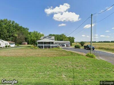
19360 State Route 2 Wauseon, OH 43567
Estimated Value: $191,000 - $276,000
3
Beds
2
Baths
2,323
Sq Ft
$104/Sq Ft
Est. Value
About This Home
This home is located at 19360 State Route 2, Wauseon, OH 43567 and is currently estimated at $241,110, approximately $103 per square foot. 19360 State Route 2 is a home located in Fulton County with nearby schools including Pettisville Elementary School, Pettisville High School, and New Horizons Academy at Sara's Garden.
Ownership History
Date
Name
Owned For
Owner Type
Purchase Details
Closed on
Apr 5, 2024
Sold by
Bacon Kent S and Torbet Linnette L
Bought by
Bacon Family Trust and Torbet Family Trust
Current Estimated Value
Purchase Details
Closed on
Mar 16, 2016
Sold by
Bacon Kent S
Bought by
Bacon Kent S and Torbet Linnette L
Purchase Details
Closed on
Sep 13, 2010
Sold by
Fannie Mae
Bought by
Bacon Kent S
Purchase Details
Closed on
Aug 27, 2010
Sold by
Printke David L and Printke Rosa L
Bought by
Federal National Mortgage Association
Purchase Details
Closed on
Jun 30, 2003
Sold by
Avina Virginia
Bought by
Printke David L and Printke Rosa L
Home Financials for this Owner
Home Financials are based on the most recent Mortgage that was taken out on this home.
Original Mortgage
$153,000
Interest Rate
5.51%
Mortgage Type
Purchase Money Mortgage
Purchase Details
Closed on
Jan 1, 1990
Bought by
Avina Arnold and Avina Virginia
Create a Home Valuation Report for This Property
The Home Valuation Report is an in-depth analysis detailing your home's value as well as a comparison with similar homes in the area
Home Values in the Area
Average Home Value in this Area
Purchase History
| Date | Buyer | Sale Price | Title Company |
|---|---|---|---|
| Bacon Family Trust | -- | None Listed On Document | |
| Bacon Kent S | -- | Attorney | |
| Bacon Kent S | $76,000 | None Available | |
| Federal National Mortgage Association | $56,667 | None Available | |
| Printke David L | $76,500 | -- | |
| Printke David L | $76,500 | -- | |
| Avina Arnold | -- | -- |
Source: Public Records
Mortgage History
| Date | Status | Borrower | Loan Amount |
|---|---|---|---|
| Previous Owner | Printke David L | $20,100 | |
| Previous Owner | Printke David L | $18,000 | |
| Previous Owner | Printke David L | $153,000 |
Source: Public Records
Tax History Compared to Growth
Tax History
| Year | Tax Paid | Tax Assessment Tax Assessment Total Assessment is a certain percentage of the fair market value that is determined by local assessors to be the total taxable value of land and additions on the property. | Land | Improvement |
|---|---|---|---|---|
| 2024 | $2,157 | $53,420 | $14,880 | $38,540 |
| 2023 | $2,157 | $53,420 | $14,880 | $38,540 |
| 2022 | $2,016 | $42,040 | $12,390 | $29,650 |
| 2021 | $2,031 | $42,040 | $12,390 | $29,650 |
| 2020 | $1,933 | $42,040 | $12,390 | $29,650 |
| 2019 | $1,776 | $38,650 | $11,310 | $27,340 |
| 2018 | $872 | $38,650 | $11,310 | $27,340 |
| 2017 | $1,762 | $38,650 | $11,310 | $27,340 |
| 2016 | $1,708 | $39,870 | $15,120 | $24,750 |
| 2015 | $1,654 | $39,870 | $15,120 | $24,750 |
| 2014 | $1,659 | $39,870 | $15,120 | $24,750 |
| 2013 | $1,849 | $39,310 | $12,180 | $27,130 |
Source: Public Records
Map
Nearby Homes
- 4467 County Road 19
- 21265 State Route 2
- 17020 State Route 2
- 216 E Holland St
- 703 N Defiance St
- 400 West St
- 433 Primrose Ln
- 105 N Pointe Dr Unit 105
- 301 S Defiance St
- 316 Stryker St
- 749 Parkside Dr
- 800 W Holland St
- 588 Douglas Dr
- 321 Main St
- 000 County Road B
- 124 Miller Ave
- 0 Lafayette St
- 217 Willow Way
- 310 W Oak St
- 0 Westfield Dr
- 19360 State Route 2
- 19360 State Route 2
- 19390 State Route 2
- 19447 State Route 2
- 19005 Millstone Dr
- 19445 Millstone Dr
- 19435 Millstone Dr
- 19010 Millstone Dr
- 19425 Millstone Dr
- 19415 Millstone Dr
- 5037 County Road 19
- 4987 County Road 19
- 5069 County Road 19
- 19450 Millstone Dr
- 4925 County Road 19
- 5103 County Road 19
- 4915 County Road 19
- 19430 Millstone Dr
- 4895 Co Rd 19
- 4895 County Road 19