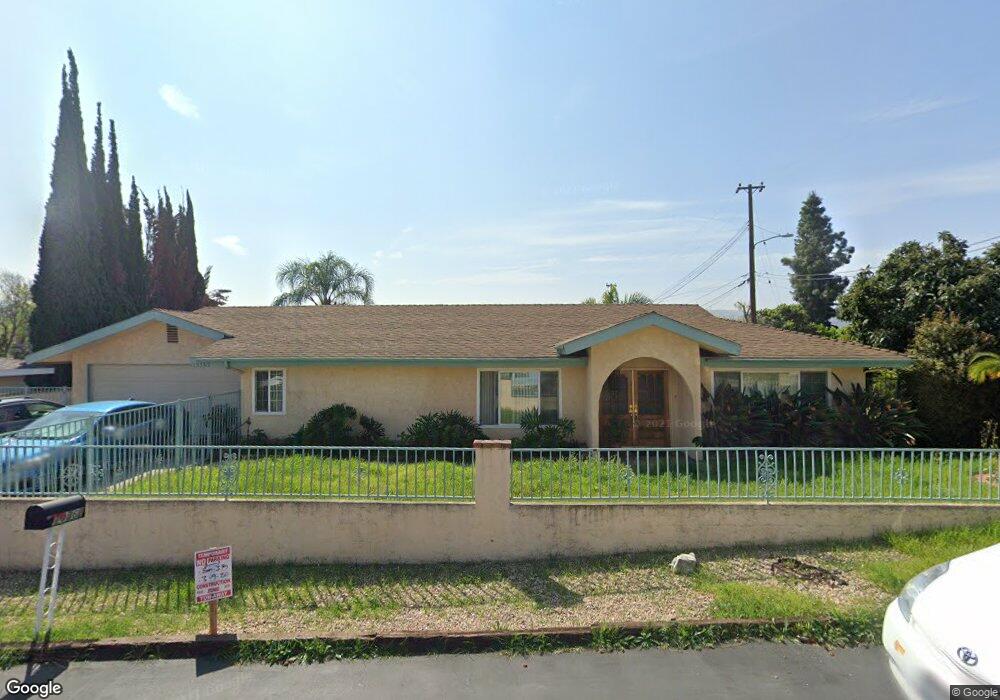
19362 Springport Dr Rowland Heights, CA 91748
Estimated Value: $835,418 - $905,000
2
Beds
2
Baths
1,296
Sq Ft
$682/Sq Ft
Est. Value
About This Home
This home is located at 19362 Springport Dr, Rowland Heights, CA 91748 and is currently estimated at $883,355, approximately $681 per square foot. 19362 Springport Dr is a home located in Los Angeles County with nearby schools including Shelyn Elementary School, Alvarado Intermediate School, and John A. Rowland High School.
Ownership History
Date
Name
Owned For
Owner Type
Purchase Details
Closed on
Feb 18, 2022
Sold by
Lim Connie
Bought by
Connie Lim Family Trust
Current Estimated Value
Purchase Details
Closed on
Jan 23, 2001
Sold by
Anderson Mark W and Anderson Susan R
Bought by
Ung Denys and Lim Connie
Home Financials for this Owner
Home Financials are based on the most recent Mortgage that was taken out on this home.
Original Mortgage
$191,800
Interest Rate
7.12%
Purchase Details
Closed on
Dec 22, 1995
Sold by
Anderson Susan R
Bought by
Anderson Mark W and Anderson Susan R
Home Financials for this Owner
Home Financials are based on the most recent Mortgage that was taken out on this home.
Original Mortgage
$185,600
Interest Rate
7.37%
Create a Home Valuation Report for This Property
The Home Valuation Report is an in-depth analysis detailing your home's value as well as a comparison with similar homes in the area
Home Values in the Area
Average Home Value in this Area
Purchase History
| Date | Buyer | Sale Price | Title Company |
|---|---|---|---|
| Connie Lim Family Trust | -- | -- | |
| Ung Denys | $240,000 | Orange Coast Title | |
| Anderson Mark W | -- | Chicago Title Co |
Source: Public Records
Mortgage History
| Date | Status | Borrower | Loan Amount |
|---|---|---|---|
| Previous Owner | Ung Denys | $191,800 | |
| Previous Owner | Anderson Mark W | $185,600 |
Source: Public Records
Tax History Compared to Growth
Tax History
| Year | Tax Paid | Tax Assessment Tax Assessment Total Assessment is a certain percentage of the fair market value that is determined by local assessors to be the total taxable value of land and additions on the property. | Land | Improvement |
|---|---|---|---|---|
| 2025 | $4,756 | $361,317 | $221,343 | $139,974 |
| 2024 | $4,756 | $354,233 | $217,003 | $137,230 |
| 2023 | $4,602 | $347,289 | $212,749 | $134,540 |
| 2022 | $4,499 | $340,480 | $208,578 | $131,902 |
| 2021 | $4,422 | $333,805 | $204,489 | $129,316 |
| 2019 | $4,290 | $323,907 | $198,425 | $125,482 |
| 2018 | $4,061 | $317,557 | $194,535 | $123,022 |
| 2016 | $3,902 | $305,228 | $186,982 | $118,246 |
| 2015 | $3,838 | $300,644 | $184,174 | $116,470 |
| 2014 | $3,833 | $294,756 | $180,567 | $114,189 |
Source: Public Records
Map
Nearby Homes
- 1953 Camwood Ave
- 1703 Hollandale Ave
- 1560 S Otterbein Ave Unit 44
- 1560 S Otterbein Ave Unit 153
- 1560 S Otterbein Ave Unit 113
- 1560 S Otterbein Ave Unit 170
- 1560 Otterbein Ave Unit 8
- 1560 Otterbein Ave Unit 12
- 19527 Cronin Dr
- 18985 Radby St
- 1816 Nowell Ave
- 1337 Brea Canyon Cutoff Rd
- 1842 Bolanos Ave
- 2033 Bolanos Ave
- 2039 Bolanos Ave
- 19519 Greenwillow Ln
- 1943 Paso Real Ave
- 2270 Paso Real Ave
- 1919 Brea Canyon Cut-Off Rd
- 2366 Pepperdale Dr
- 19365 Springport Dr
- 1910 Valemont Ave
- 19372 Springport Dr
- 19355 Springport Dr
- 19350 Springport Dr
- 19369 Springport Dr
- 19349 Springport Dr
- 19373 Springport Dr
- 1920 Valemont Ave
- 19352 Pilario St
- 19343 Springport Dr
- 19358 Pilario St
- 19340 Springport Dr
- 19346 Pilario St
- 19362 Pilario St
- 19380 Springport Dr
- 19342 Pilario St
- 19381 Springport Dr
- 19368 Pilario St
- 19335 Springport Dr