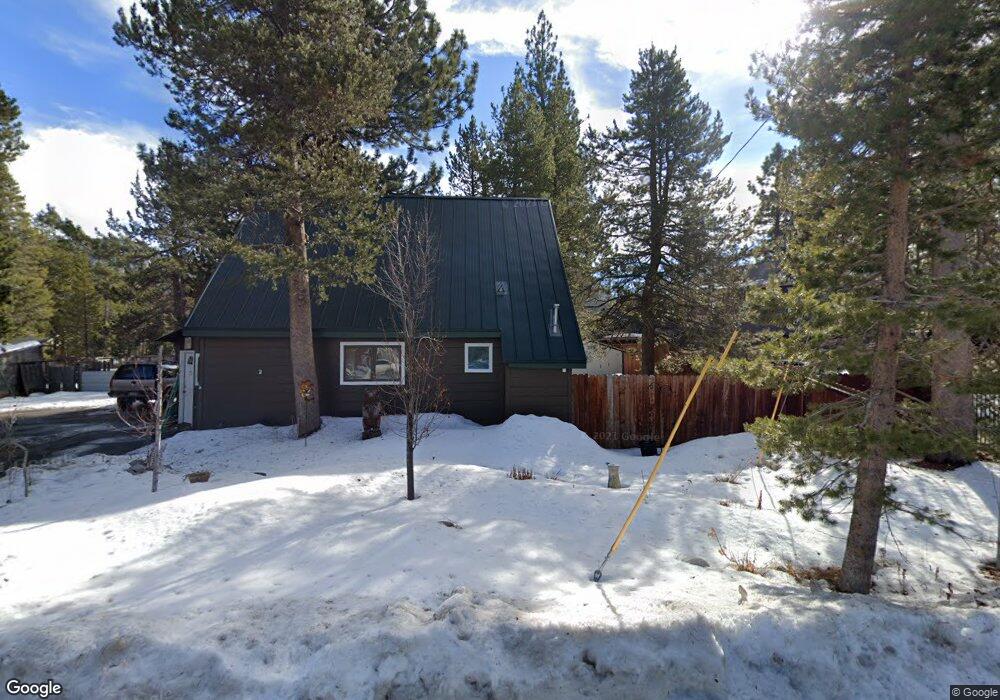
1937 Arrowhead Ave South Lake Tahoe, CA 96150
Estimated Value: $484,000 - $612,000
3
Beds
1
Bath
1,260
Sq Ft
$422/Sq Ft
Est. Value
About This Home
This home is located at 1937 Arrowhead Ave, South Lake Tahoe, CA 96150 and is currently estimated at $531,133, approximately $421 per square foot. 1937 Arrowhead Ave is a home located in El Dorado County with nearby schools including Tahoe Valley Elementary School, South Tahoe Middle School, and South Tahoe High School.
Ownership History
Date
Name
Owned For
Owner Type
Purchase Details
Closed on
Feb 5, 2021
Sold by
Murphy Paul Roger
Bought by
Murphy Michelle B
Current Estimated Value
Home Financials for this Owner
Home Financials are based on the most recent Mortgage that was taken out on this home.
Original Mortgage
$200,500
Outstanding Balance
$179,170
Interest Rate
2.65%
Mortgage Type
New Conventional
Estimated Equity
$351,963
Create a Home Valuation Report for This Property
The Home Valuation Report is an in-depth analysis detailing your home's value as well as a comparison with similar homes in the area
Home Values in the Area
Average Home Value in this Area
Purchase History
| Date | Buyer | Sale Price | Title Company |
|---|---|---|---|
| Murphy Michelle B | -- | Old Republic Title Company |
Source: Public Records
Mortgage History
| Date | Status | Borrower | Loan Amount |
|---|---|---|---|
| Open | Murphy Michelle B | $200,500 |
Source: Public Records
Tax History Compared to Growth
Tax History
| Year | Tax Paid | Tax Assessment Tax Assessment Total Assessment is a certain percentage of the fair market value that is determined by local assessors to be the total taxable value of land and additions on the property. | Land | Improvement |
|---|---|---|---|---|
| 2025 | $1,973 | $185,458 | $34,653 | $150,805 |
| 2024 | $1,973 | $181,823 | $33,974 | $147,849 |
| 2023 | $1,938 | $178,258 | $33,308 | $144,950 |
| 2022 | $1,918 | $174,763 | $32,655 | $142,108 |
| 2021 | $1,885 | $171,337 | $32,015 | $139,322 |
| 2020 | $1,860 | $169,581 | $31,687 | $137,894 |
| 2019 | $1,850 | $166,257 | $31,066 | $135,191 |
| 2018 | $1,809 | $162,998 | $30,457 | $132,541 |
| 2017 | $1,780 | $159,803 | $29,860 | $129,943 |
| 2016 | $1,744 | $156,671 | $29,275 | $127,396 |
| 2015 | $1,655 | $154,320 | $28,836 | $125,484 |
| 2014 | $1,655 | $151,299 | $28,272 | $123,027 |
Source: Public Records
Map
Nearby Homes
- 1982 Cherokee St
- 1140 Sioux St
- 0 Tomahawk Ln
- 1085 Mulberry Dr
- 1935 Apache Ave
- 1940 Apache Ave
- 2182 Lindenwood Dr
- 2877 Us Highway 50
- 2181 Pinewood Dr
- 2189 Cornelian Dr
- 1444 Apache Ave
- 1502 Seminole Dr
- 1666 Arapahoe St
- 2255 Blitzen Rd
- 2263 Blitzen Rd
- 1801 Meadow Vale Dr
- 2113 Oaxaco St
- 1344 Ottawa Dr
- 1675 Arapahoe St
- 1795 Narragansett Cir
- 1941 Arrowhead Ave
- 1947 Arrowhead Ave
- 1927 Arrowhead Ave
- 1149 Modoc Way
- 1942 Arrowhead Ave
- 1923 Arrowhead Ave
- 1951 Arrowhead Ave
- 1145 Modoc Way
- 1142 Modoc Dr
- 1142 Modoc Way
- 1921 Arrowhead Ave
- 1139 Modoc Way
- 1138 Modoc Way
- 2051 Hopi Ave
- 1960 Arrowhead Ave
- 1135 Modoc Way
- 2045 Hopi Ave
- 1134 Modoc Way
- 1214 Apache Ave
- 1192 Apache Ave