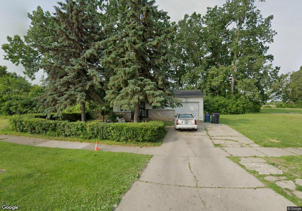
1937 Basil Ln Flint, MI 48504
Bel-Aire Woods NeighborhoodEstimated Value: $48,087 - $63,000
4
Beds
2
Baths
996
Sq Ft
$56/Sq Ft
Est. Value
About This Home
This home is located at 1937 Basil Ln, Flint, MI 48504 and is currently estimated at $56,272, approximately $56 per square foot. 1937 Basil Ln is a home located in Genesee County with nearby schools including Brownell STEM Academy, The New Standard Academy, and Eagle's Nest Academy.
Ownership History
Date
Name
Owned For
Owner Type
Purchase Details
Closed on
Oct 31, 2024
Sold by
Smlt Holdings Llc
Bought by
Sigmo Holdings Llc
Current Estimated Value
Purchase Details
Closed on
Feb 15, 2019
Sold by
Brown Donna and Estate Of Betty Wise
Bought by
Brown Donna
Purchase Details
Closed on
Mar 1, 2018
Sold by
Wise Dooserwelt and Wise Roosevelt
Bought by
Brown Donna and Wise Roosevolt
Purchase Details
Closed on
Jan 26, 2018
Sold by
Bcown Michigan Donna
Bought by
Wise Roesevelt
Purchase Details
Closed on
Feb 9, 2016
Sold by
Wise Roosevelt
Bought by
Brown Donna
Purchase Details
Closed on
Jun 26, 2013
Sold by
Flint Bonding Service
Bought by
Wise Roosevelt and Wise Betty
Create a Home Valuation Report for This Property
The Home Valuation Report is an in-depth analysis detailing your home's value as well as a comparison with similar homes in the area
Home Values in the Area
Average Home Value in this Area
Purchase History
| Date | Buyer | Sale Price | Title Company |
|---|---|---|---|
| Sigmo Holdings Llc | $27,500 | Dream Title & Escrow | |
| Smlt Holdings Llc | $20,606 | Dream Title & Escrow | |
| Brown Donna | -- | None Available | |
| Brown Donna | -- | None Available | |
| Wise Roesevelt | -- | None Available | |
| Brown Donna | -- | None Available | |
| Wise Roosevelt | -- | None Available |
Source: Public Records
Tax History
| Year | Tax Paid | Tax Assessment Tax Assessment Total Assessment is a certain percentage of the fair market value that is determined by local assessors to be the total taxable value of land and additions on the property. | Land | Improvement |
|---|---|---|---|---|
| 2025 | $1,287 | $15,500 | $0 | $0 |
| 2024 | $1,189 | $14,300 | $0 | $0 |
| 2023 | $581 | $11,900 | $0 | $0 |
| 2022 | $0 | $8,600 | $0 | $0 |
| 2021 | $596 | $8,700 | $0 | $0 |
| 2020 | $550 | $8,700 | $0 | $0 |
| 2019 | $815 | $6,900 | $0 | $0 |
| 2018 | $1,335 | $7,200 | $0 | $0 |
| 2017 | $505 | $0 | $0 | $0 |
| 2016 | $480 | $0 | $0 | $0 |
| 2015 | -- | $0 | $0 | $0 |
| 2014 | -- | $0 | $0 | $0 |
| 2012 | -- | $6,900 | $0 | $0 |
Source: Public Records
Map
Nearby Homes
- 5106 Cloverlawn Dr
- 1720 Marlowe Dr
- 5620 Marlowe Dr
- 5413 Fleming Rd
- 5905 Cloverlawn Dr
- 1909 Cherrylawn Dr
- 1518 Randy Ct
- 1709 W Home Ave
- 2013 Canniff St
- 1511 W Home Ave
- 2210 Canniff St
- 4539 Trumbull Dr
- 5502 Susan St
- 6414 Valorie Ln
- 5518 Winthrop Blvd
- 2106 Janice Dr
- 1816 Russet Place
- 5610 Baldwin Blvd
- 4816 Glenn Ave
- 4310 Berger Dr
Your Personal Tour Guide
Ask me questions while you tour the home.