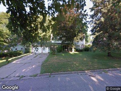
1937 Byrnes Rd Lansing, MI 48906
Northwestside NeighborhoodEstimated Value: $270,955 - $312,000
--
Bed
1
Bath
2,299
Sq Ft
$126/Sq Ft
Est. Value
About This Home
This home is located at 1937 Byrnes Rd, Lansing, MI 48906 and is currently estimated at $290,489, approximately $126 per square foot. 1937 Byrnes Rd is a home located in Ingham County with nearby schools including Cumberland Elementary School, Pattengill Academy, and J.W. Sexton High School.
Ownership History
Date
Name
Owned For
Owner Type
Purchase Details
Closed on
Jun 27, 2019
Sold by
Wahl Laurence J and Wahl James M
Bought by
Wahl Steven
Current Estimated Value
Home Financials for this Owner
Home Financials are based on the most recent Mortgage that was taken out on this home.
Original Mortgage
$171,000
Interest Rate
3.82%
Mortgage Type
New Conventional
Purchase Details
Closed on
Oct 25, 2018
Sold by
The Estate Of Leonhard H Kluge
Bought by
Wahl Laurence J and Wahl James M
Create a Home Valuation Report for This Property
The Home Valuation Report is an in-depth analysis detailing your home's value as well as a comparison with similar homes in the area
Home Values in the Area
Average Home Value in this Area
Purchase History
| Date | Buyer | Sale Price | Title Company |
|---|---|---|---|
| Wahl Steven | $180,000 | Ata National Title Group Llc | |
| Wahl Laurence J | $80,000 | Ata National Title Group Llc |
Source: Public Records
Mortgage History
| Date | Status | Borrower | Loan Amount |
|---|---|---|---|
| Open | Wahl Steven | $173,365 | |
| Closed | Wahl Steven | $173,700 | |
| Closed | Wahl Steven | $171,000 | |
| Previous Owner | Kluge Leonard | $100,000 |
Source: Public Records
Tax History Compared to Growth
Tax History
| Year | Tax Paid | Tax Assessment Tax Assessment Total Assessment is a certain percentage of the fair market value that is determined by local assessors to be the total taxable value of land and additions on the property. | Land | Improvement |
|---|---|---|---|---|
| 2024 | $56 | $125,600 | $18,900 | $106,700 |
| 2023 | $6,459 | $117,100 | $18,900 | $98,200 |
| 2022 | $5,811 | $111,000 | $11,100 | $99,900 |
| 2021 | $5,690 | $102,200 | $8,200 | $94,000 |
| 2020 | $5,657 | $96,000 | $8,200 | $87,800 |
| 2019 | $6,837 | $91,000 | $8,200 | $82,800 |
| 2018 | $3,801 | $83,000 | $8,200 | $74,800 |
| 2017 | $3,640 | $83,000 | $8,200 | $74,800 |
| 2016 | $3,481 | $69,000 | $8,200 | $60,800 |
| 2015 | $3,481 | $65,400 | $16,424 | $48,976 |
| 2014 | $3,481 | $62,900 | $20,529 | $42,371 |
Source: Public Records
Map
Nearby Homes
- 3341 Tecumseh River Rd
- 2100 Northwest Ave
- 2020 Northwest Ave
- 2024 Cogswell Dr
- 1528 Briarwood Dr
- 3508 Springbrook Ln
- 3629 Cambrey Dr
- 1416 Briarwood Dr
- 3500 Colchester Rd
- 3130 Delta River Dr
- 3316 Pickwick Place
- 2107 Westbury Rd
- 3326 W Willow St
- 3733 Colchester Rd
- 2531 Dillingham Ave
- 2713 Earl Ln
- 1121 Boynton Dr
- 1121 Morris Ave
- 2509 Delta River Dr
- 3014 Timber Dr
- 1937 Byrnes Rd
- 1943 Byrnes Rd
- 1912 Kuerbitz Dr
- 1924 Kuerbitz Dr
- 1919 Byrnes Rd
- 1940 Byrnes Rd
- 1930 Byrnes Rd
- 3236 Tecumseh River Rd
- 1932 Kuerbitz Dr
- 1920 Byrnes Rd
- 2007 Byrnes Rd
- 3121 Ridgefield Rd
- 1931 Beacon Hill Dr
- 1906 Byrnes Rd
- 3316 Tecumseh River Rd
- 2015 Byrnes Rd
- 1921 Beacon Hill Dr
- 1927 Kuerbitz Dr