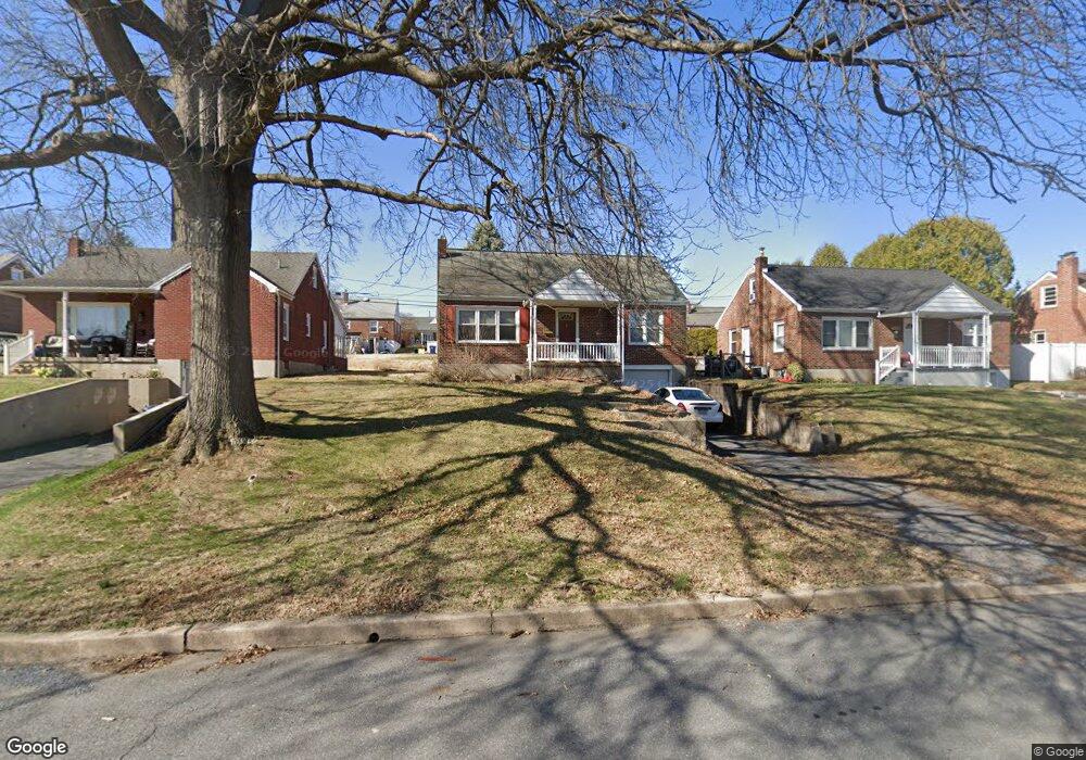
1937 Garfield Ave Reading, PA 19609
West Wyomissing NeighborhoodEstimated Value: $265,323 - $293,000
3
Beds
1
Bath
1,155
Sq Ft
$242/Sq Ft
Est. Value
About This Home
This home is located at 1937 Garfield Ave, Reading, PA 19609 and is currently estimated at $279,081, approximately $241 per square foot. 1937 Garfield Ave is a home located in Berks County with nearby schools including Spring Ridge Elementary School, Wilson Southern Middle School, and Wilson High School.
Ownership History
Date
Name
Owned For
Owner Type
Purchase Details
Closed on
Nov 6, 2006
Sold by
Nye Barry J and Nye Linda L
Bought by
Bender Jeremy L
Current Estimated Value
Home Financials for this Owner
Home Financials are based on the most recent Mortgage that was taken out on this home.
Original Mortgage
$175,000
Outstanding Balance
$104,558
Interest Rate
6.39%
Mortgage Type
New Conventional
Estimated Equity
$174,523
Purchase Details
Closed on
Sep 6, 2005
Sold by
Nye Linda L and Seaman Linda L
Bought by
Nye Barry J and Nye Linda L
Create a Home Valuation Report for This Property
The Home Valuation Report is an in-depth analysis detailing your home's value as well as a comparison with similar homes in the area
Home Values in the Area
Average Home Value in this Area
Purchase History
| Date | Buyer | Sale Price | Title Company |
|---|---|---|---|
| Bender Jeremy L | $175,000 | None Available | |
| Nye Barry J | -- | -- |
Source: Public Records
Mortgage History
| Date | Status | Borrower | Loan Amount |
|---|---|---|---|
| Open | Bender Jeremy L | $175,000 |
Source: Public Records
Tax History Compared to Growth
Tax History
| Year | Tax Paid | Tax Assessment Tax Assessment Total Assessment is a certain percentage of the fair market value that is determined by local assessors to be the total taxable value of land and additions on the property. | Land | Improvement |
|---|---|---|---|---|
| 2025 | $1,600 | $79,500 | $32,000 | $47,500 |
| 2024 | $3,401 | $79,500 | $32,000 | $47,500 |
| 2023 | $3,241 | $79,500 | $32,000 | $47,500 |
| 2022 | $3,161 | $79,500 | $32,000 | $47,500 |
| 2021 | $3,050 | $79,500 | $32,000 | $47,500 |
| 2020 | $3,050 | $79,500 | $32,000 | $47,500 |
| 2019 | $2,964 | $79,500 | $32,000 | $47,500 |
| 2018 | $2,938 | $79,500 | $32,000 | $47,500 |
| 2017 | $2,888 | $79,500 | $32,000 | $47,500 |
| 2016 | $977 | $79,500 | $32,000 | $47,500 |
| 2015 | $977 | $79,500 | $32,000 | $47,500 |
| 2014 | $977 | $79,500 | $32,000 | $47,500 |
Source: Public Records
Map
Nearby Homes
- 1812 Portland Ave
- 1 Wyomissing Hills Blvd
- 2152 Cleveland Ave
- 1809 Squire Ct
- 2021 Noble St
- 1801 Reading Blvd
- 2126 Lincoln Ave
- 105 Clayton Ave
- 609 Lawn
- 61 Grandview Blvd
- 26 Margaret Dr
- 2214 Mckinley Ave
- 2018 Meadow Glen
- 1913 Meadow Ln
- 608 W Wyomissing Blvd
- 719 W Wyomissing Blvd
- 1536 Dauphin Ave
- 1907 Meadow Ln
- 1964 Meadow Ln
- 2408 Noble St
- 1933 Garfield Ave
- 1941 Garfield Ave
- 1929 Garfield Ave
- 1940 Cleveland Ave
- 1938 Cleveland Ave
- 1945 Garfield Ave
- 1942 Cleveland Ave
- 1936 Cleveland Ave
- 1925 Garfield Ave
- 1948 Garfield Ave
- 1944 Garfield Ave
- 1944 Cleveland Ave
- 1952 Garfield Ave
- 1934 Cleveland Ave
- 301 Logan Ave
- 1940 Garfield Ave
- 1932 Cleveland Ave
- 1921 Garfield Ave
- 1936 Garfield Ave
- 307 Logan Ave