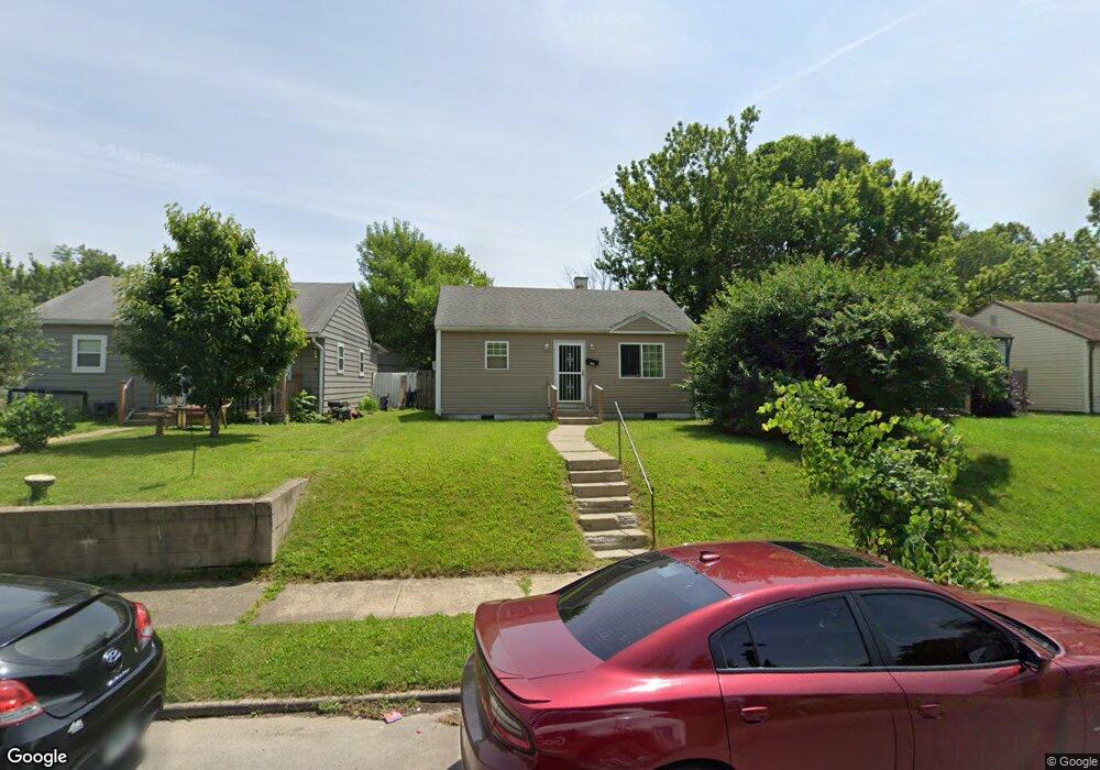
1937 N Euclid Ave Indianapolis, IN 46218
Near Eastside NeighborhoodEstimated Value: $59,000 - $117,000
2
Beds
1
Bath
696
Sq Ft
$140/Sq Ft
Est. Value
About This Home
This home is located at 1937 N Euclid Ave, Indianapolis, IN 46218 and is currently estimated at $97,752, approximately $140 per square foot. 1937 N Euclid Ave is a home located in Marion County with nearby schools including Thomas D. Gregg School No. 15, Washington Irving School 14, and Brookside School 54.
Ownership History
Date
Name
Owned For
Owner Type
Purchase Details
Closed on
Aug 12, 2020
Sold by
Coastal Family Limited Partnership and Coastal Famiily Limited Partnership Llc
Bought by
Revel Inc
Current Estimated Value
Purchase Details
Closed on
Aug 11, 2020
Sold by
Coastal Family Limited Partnership Llc
Bought by
Revel Llc
Purchase Details
Closed on
Feb 7, 2017
Purchase Details
Closed on
Feb 6, 2017
Sold by
Ocg Indianapolis Llc
Bought by
Oceanpointe Investments Limited
Purchase Details
Closed on
Jul 15, 2016
Sold by
Lovell Randy
Bought by
Ocg Indianapolis Llc
Purchase Details
Closed on
Dec 9, 2011
Sold by
Bornstein Bonita Lynn and Lynn Bonita
Bought by
Lovell Randy
Create a Home Valuation Report for This Property
The Home Valuation Report is an in-depth analysis detailing your home's value as well as a comparison with similar homes in the area
Home Values in the Area
Average Home Value in this Area
Purchase History
| Date | Buyer | Sale Price | Title Company |
|---|---|---|---|
| Revel Inc | -- | None Listed On Document | |
| Revel Llc | $35,500 | Monument Title | |
| -- | $26,000 | -- | |
| Coastal Family Limited Partnership | $26,000 | Paramount Title Agency Llc | |
| Oceanpointe Investments Limited | -- | None Available | |
| Ocg Indianapolis Llc | -- | Mtc | |
| Lovell Randy | -- | None Available |
Source: Public Records
Tax History Compared to Growth
Tax History
| Year | Tax Paid | Tax Assessment Tax Assessment Total Assessment is a certain percentage of the fair market value that is determined by local assessors to be the total taxable value of land and additions on the property. | Land | Improvement |
|---|---|---|---|---|
| 2024 | $1,172 | $49,800 | $7,100 | $42,700 |
| 2023 | $1,172 | $46,500 | $7,100 | $39,400 |
| 2022 | $1,142 | $46,500 | $7,100 | $39,400 |
| 2021 | $1,229 | $50,400 | $7,100 | $43,300 |
| 2020 | $1,115 | $45,300 | $2,700 | $42,600 |
| 2019 | $1,032 | $41,000 | $2,700 | $38,300 |
| 2018 | $1,311 | $33,700 | $2,700 | $31,000 |
| 2017 | $737 | $31,800 | $2,700 | $29,100 |
| 2016 | $347 | $31,800 | $2,700 | $29,100 |
| 2014 | $372 | $36,200 | $2,700 | $33,500 |
| 2013 | $457 | $36,200 | $2,700 | $33,500 |
Source: Public Records
Map
Nearby Homes
- 1946 N Euclid Ave
- 2048 N Euclid Ave
- 2016 Glenridge Dr
- 1906 N Linwood Ave
- 1916 N Colorado Ave
- 4512 E 21st St
- 1943 N Drexel Ave
- 2047 N Bosart Ave
- 1905 N Bosart Ave
- 4706 E 21st St
- 1709 N Euclid Ave
- 1720 N Gladstone Ave
- 1731 N Bosart Ave
- 1616 N Euclid Ave
- 1905 N Dequincy St
- 2225 N Drexel Ave
- 1953 Kildare Ave
- 1617 N Bosart Ave
- 4614 E 16th St
- 1843 Kildare Ave
- 1933 N Euclid Ave
- 1941 N Euclid Ave
- 1929 N Euclid Ave
- 1947 N Euclid Ave
- 1949 N Euclid Ave
- 1925 N Euclid Ave
- 1938 N Linwood Ave
- 1942 N Linwood Ave
- 1934 N Linwood Ave
- 1921 N Euclid Ave
- 1985 N Euclid Ave
- 1946 N Linwood Ave
- 1930 N Linwood Ave
- 1938 N Euclid Ave
- 1942 N Euclid Ave
- 1934 N Euclid Ave
- 1926 N Linwood Ave
- 1950 N Linwood Ave
- 1917 N Euclid Ave
- 1930 N Euclid Ave