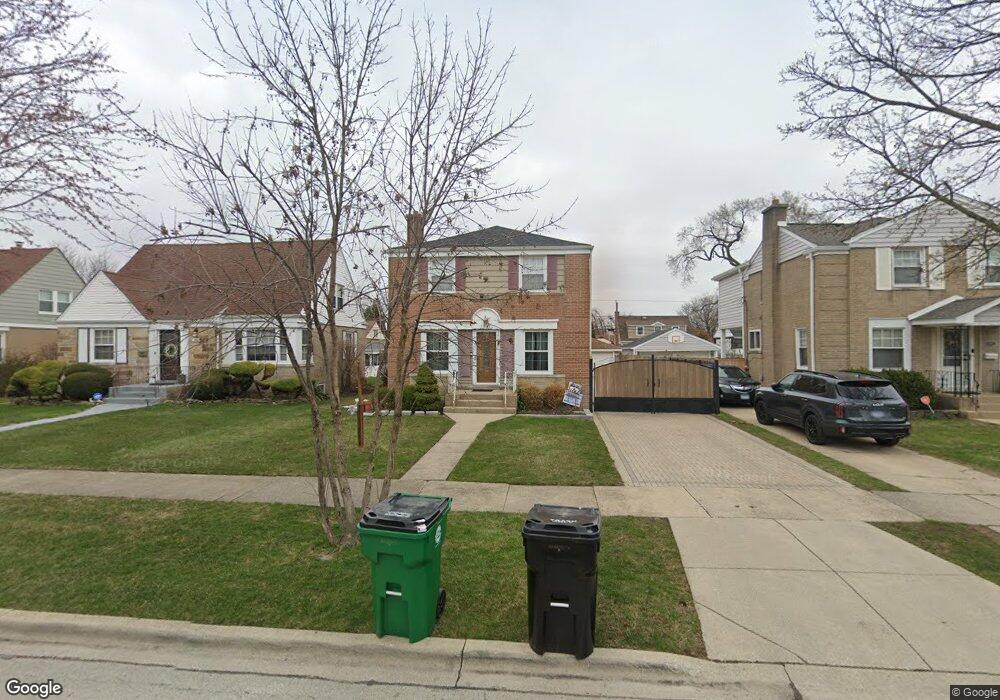
1937 Portsmouth Ave Westchester, IL 60154
Estimated Value: $304,000 - $361,000
3
Beds
2
Baths
1,299
Sq Ft
$266/Sq Ft
Est. Value
About This Home
This home is located at 1937 Portsmouth Ave, Westchester, IL 60154 and is currently estimated at $345,443, approximately $265 per square foot. 1937 Portsmouth Ave is a home located in Cook County with nearby schools including Westchester Primary School, Westchester Intermediate School, and Westchester Middle School.
Ownership History
Date
Name
Owned For
Owner Type
Purchase Details
Closed on
Jun 1, 2005
Sold by
Geiling Brian
Bought by
Dunne Thomas D and Dunne Esmeralda M
Current Estimated Value
Home Financials for this Owner
Home Financials are based on the most recent Mortgage that was taken out on this home.
Original Mortgage
$173,000
Outstanding Balance
$91,187
Interest Rate
5.91%
Mortgage Type
Fannie Mae Freddie Mac
Estimated Equity
$254,256
Purchase Details
Closed on
Mar 8, 2005
Sold by
Campbell Georgette and Zace Gregory
Bought by
Geiling Brian
Create a Home Valuation Report for This Property
The Home Valuation Report is an in-depth analysis detailing your home's value as well as a comparison with similar homes in the area
Home Values in the Area
Average Home Value in this Area
Purchase History
| Date | Buyer | Sale Price | Title Company |
|---|---|---|---|
| Dunne Thomas D | -- | Git | |
| Geiling Brian | $215,000 | Atgf Inc |
Source: Public Records
Mortgage History
| Date | Status | Borrower | Loan Amount |
|---|---|---|---|
| Open | Dunne Thomas D | $173,000 |
Source: Public Records
Tax History Compared to Growth
Tax History
| Year | Tax Paid | Tax Assessment Tax Assessment Total Assessment is a certain percentage of the fair market value that is determined by local assessors to be the total taxable value of land and additions on the property. | Land | Improvement |
|---|---|---|---|---|
| 2024 | $5,649 | $24,841 | $4,655 | $20,186 |
| 2023 | $5,310 | $24,841 | $4,655 | $20,186 |
| 2022 | $5,310 | $20,825 | $3,990 | $16,835 |
| 2021 | $5,166 | $20,825 | $3,990 | $16,835 |
| 2020 | $5,113 | $20,825 | $3,990 | $16,835 |
| 2019 | $4,750 | $20,245 | $3,657 | $16,588 |
| 2018 | $4,687 | $20,245 | $3,657 | $16,588 |
| 2017 | $4,613 | $20,245 | $3,657 | $16,588 |
| 2016 | $4,270 | $17,137 | $3,325 | $13,812 |
| 2015 | $4,179 | $17,137 | $3,325 | $13,812 |
| 2014 | $4,097 | $17,137 | $3,325 | $13,812 |
| 2013 | $3,953 | $18,354 | $3,325 | $15,029 |
Source: Public Records
Map
Nearby Homes
- 1907 Suffolk Ave
- 1932 Newcastle Ave
- 1900 Manchester Ave
- 2128 Hull Ave
- 1840 Gardner Rd
- 1623 Manchester Ave
- 1601 Bristol Ave
- 1500 Bristol Ave
- 1433 Bristol Ave
- 1542 Homestead Rd
- 10567 Waterford Dr
- 10630 W Cermak Rd Unit 2E
- 1860 Buckingham Ave
- 10072 Drury Ln
- 10531 Camelot St
- 1811 Downing Ave
- 10551 Essex St
- 10524 Camelot St
- 10511 Preston St
- 1245 S Mannheim Rd Unit 2
- 1933 Portsmouth Ave
- 1943 Portsmouth Ave
- 1927 Portsmouth Ave
- 1947 Portsmouth Ave
- 1936 Suffolk Ave
- 1932 Suffolk Ave
- 1942 Suffolk Ave
- 1951 Portsmouth Ave
- 1923 Portsmouth Ave
- 1926 Suffolk Ave
- 1946 Suffolk Ave
- 1936 Portsmouth Ave
- 1917 Portsmouth Ave
- 1922 Suffolk Ave
- 1952 Suffolk Ave
- 1957 Portsmouth Ave
- 1932 Portsmouth Ave
- 1942 Portsmouth Ave
- 1926 Portsmouth Ave
- 1946 Portsmouth Ave