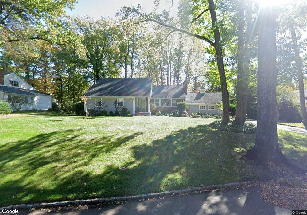
1937 Wood Rd Scotch Plains, NJ 07076
Estimated Value: $699,257 - $1,228,000
--
Bed
--
Bath
1,901
Sq Ft
$510/Sq Ft
Est. Value
About This Home
This home is located at 1937 Wood Rd, Scotch Plains, NJ 07076 and is currently estimated at $968,814, approximately $509 per square foot. 1937 Wood Rd is a home located in Union County with nearby schools including William J. McGinn Elementary School, Terrill Middle School, and Scotch Plains-Fanwood High School.
Ownership History
Date
Name
Owned For
Owner Type
Purchase Details
Closed on
Jul 19, 2006
Sold by
Boyle James F
Bought by
Jayinski Jose D and Jayinski Aimee
Current Estimated Value
Home Financials for this Owner
Home Financials are based on the most recent Mortgage that was taken out on this home.
Original Mortgage
$417,000
Outstanding Balance
$247,836
Interest Rate
6.67%
Estimated Equity
$720,978
Purchase Details
Closed on
Oct 5, 1994
Sold by
Griffin Gifford and Griffin Jeanne D
Bought by
Boyle James F
Create a Home Valuation Report for This Property
The Home Valuation Report is an in-depth analysis detailing your home's value as well as a comparison with similar homes in the area
Home Values in the Area
Average Home Value in this Area
Purchase History
| Date | Buyer | Sale Price | Title Company |
|---|---|---|---|
| Jayinski Jose D | $630,000 | -- | |
| Boyle James F | $295,000 | -- |
Source: Public Records
Mortgage History
| Date | Status | Borrower | Loan Amount |
|---|---|---|---|
| Open | Jayinski Jose D | $417,000 |
Source: Public Records
Tax History Compared to Growth
Tax History
| Year | Tax Paid | Tax Assessment Tax Assessment Total Assessment is a certain percentage of the fair market value that is determined by local assessors to be the total taxable value of land and additions on the property. | Land | Improvement |
|---|---|---|---|---|
| 2025 | $18,276 | $155,300 | $51,200 | $104,100 |
| 2024 | $17,737 | $155,300 | $51,200 | $104,100 |
| 2023 | $17,737 | $155,300 | $51,200 | $104,100 |
| 2022 | $17,526 | $155,300 | $51,200 | $104,100 |
| 2021 | $17,496 | $155,300 | $51,200 | $104,100 |
| 2020 | $17,412 | $155,300 | $51,200 | $104,100 |
| 2019 | $17,283 | $155,300 | $51,200 | $104,100 |
| 2018 | $16,993 | $155,300 | $51,200 | $104,100 |
| 2017 | $16,616 | $155,300 | $51,200 | $104,100 |
| 2016 | $15,792 | $150,500 | $51,200 | $99,300 |
| 2015 | $15,533 | $150,500 | $51,200 | $99,300 |
| 2014 | $15,021 | $150,500 | $51,200 | $99,300 |
Source: Public Records
Map
Nearby Homes
- 1466 Lamberts Mill Rd
- 314 Highgate Ave
- 2 Brookside Ct
- 2154 W Broad St
- 119 Lamberts Mill Rd
- 2 Dutch Ln
- 1972 W Broad St
- 1933 Mary Ellen Ln
- 525 Edgar Rd
- 676 Vermont St
- 2116 Newark Ave
- 2 Unami Ln
- 608 Hort St
- 1840 Raritan Rd
- 538 Westfield Ave
- 1701 Raritan Rd
- 724 South Ave W Unit 724A
- 834 Tice Place
- 1148 Tanglewood Ln
- 187 King St