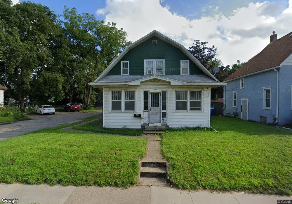
1938 Franklin St Waterloo, IA 50703
Neighbors for Life NeighborhoodEstimated Value: $91,000 - $174,000
5
Beds
2
Baths
3,858
Sq Ft
$30/Sq Ft
Est. Value
About This Home
This home is located at 1938 Franklin St, Waterloo, IA 50703 and is currently estimated at $116,888, approximately $30 per square foot. 1938 Franklin St is a home located in Black Hawk County with nearby schools including Highland Elementary School, George Washington Carver Academy, and East High School.
Ownership History
Date
Name
Owned For
Owner Type
Purchase Details
Closed on
Jan 25, 2006
Sold by
Jls Management Llc
Bought by
Priebe Grace M and Priebe Valerie K
Current Estimated Value
Home Financials for this Owner
Home Financials are based on the most recent Mortgage that was taken out on this home.
Original Mortgage
$67,516
Outstanding Balance
$38,375
Interest Rate
6.46%
Mortgage Type
New Conventional
Estimated Equity
$78,514
Create a Home Valuation Report for This Property
The Home Valuation Report is an in-depth analysis detailing your home's value as well as a comparison with similar homes in the area
Home Values in the Area
Average Home Value in this Area
Purchase History
| Date | Buyer | Sale Price | Title Company |
|---|---|---|---|
| Priebe Grace M | $71,500 | Title Services Corporation |
Source: Public Records
Mortgage History
| Date | Status | Borrower | Loan Amount |
|---|---|---|---|
| Open | Priebe Grace M | $67,516 |
Source: Public Records
Tax History Compared to Growth
Tax History
| Year | Tax Paid | Tax Assessment Tax Assessment Total Assessment is a certain percentage of the fair market value that is determined by local assessors to be the total taxable value of land and additions on the property. | Land | Improvement |
|---|---|---|---|---|
| 2025 | $1,122 | $70,300 | $7,730 | $62,570 |
| 2024 | $1,122 | $61,940 | $7,730 | $54,210 |
| 2023 | $968 | $61,940 | $7,730 | $54,210 |
| 2022 | $940 | $52,950 | $7,730 | $45,220 |
| 2021 | $944 | $52,950 | $7,730 | $45,220 |
| 2020 | $938 | $50,870 | $5,040 | $45,830 |
| 2019 | $938 | $50,870 | $5,040 | $45,830 |
| 2018 | $940 | $50,870 | $5,040 | $45,830 |
| 2017 | $972 | $50,870 | $5,040 | $45,830 |
| 2016 | $956 | $50,870 | $5,040 | $45,830 |
| 2015 | $956 | $50,870 | $5,040 | $45,830 |
| 2014 | $886 | $47,050 | $5,040 | $42,010 |
Source: Public Records
Map
Nearby Homes
- 2024 Mulberry St
- 528 Linden Ave
- 1927 Lafayette St
- 818 Steely St
- 1612 Franklin St
- 137 French St
- 211 Madison St
- 1127 Independence Ave
- 823 Glenwood St
- 1912 Sycamore St
- 400 Elm St
- 0 Madison Monroe Unit NBR20253026
- 1235 Independence Ave
- 401 Dearborn Ave
- 408-410 E 8th St
- 507 California St
- 1765 Independence Ave
- 911 Lafayette St Unit 913
- 0 Bates St
- 1002 Mobile St
- 1930 Franklin St
- 1944 Franklin St
- 1926 Franklin St
- 1935 Mulberry St
- 1920 Franklin St
- 1929 Mulberry St
- 1945 Mulberry St
- 1927 Mulberry St
- 1949 Mulberry St
- 1921 Mulberry St
- 1929 Franklin St
- 1931 Franklin St
- 1927 Franklin St
- 1951 Mulberry St
- 1933 Franklin St
- 1919 Mulberry St
- 1912 Franklin St
- 1925 Franklin St
- 1917 Mulberry St
- 2009 Mulberry St