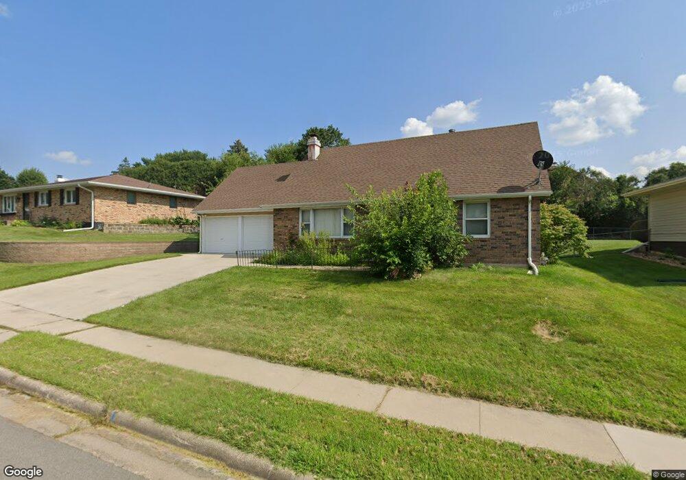
1938 Judson Dr Dubuque, IA 52001
Estimated Value: $253,000 - $285,000
4
Beds
3
Baths
2,528
Sq Ft
$105/Sq Ft
Est. Value
About This Home
This home is located at 1938 Judson Dr, Dubuque, IA 52001 and is currently estimated at $264,895, approximately $104 per square foot. 1938 Judson Dr is a home located in Dubuque County with nearby schools including Hoover Elementary School, Eleanor Roosevelt Middle School, and Dubuque Senior High School.
Ownership History
Date
Name
Owned For
Owner Type
Purchase Details
Closed on
Oct 1, 2009
Sold by
Anthony Scott M and Anthony Amy N
Bought by
Mcdermott Nicolette C
Current Estimated Value
Home Financials for this Owner
Home Financials are based on the most recent Mortgage that was taken out on this home.
Original Mortgage
$100,000
Outstanding Balance
$65,267
Interest Rate
5.15%
Mortgage Type
New Conventional
Estimated Equity
$199,628
Create a Home Valuation Report for This Property
The Home Valuation Report is an in-depth analysis detailing your home's value as well as a comparison with similar homes in the area
Home Values in the Area
Average Home Value in this Area
Purchase History
| Date | Buyer | Sale Price | Title Company |
|---|---|---|---|
| Mcdermott Nicolette C | $125,000 | None Available |
Source: Public Records
Mortgage History
| Date | Status | Borrower | Loan Amount |
|---|---|---|---|
| Open | Mcdermott Nicolette C | $100,000 |
Source: Public Records
Tax History Compared to Growth
Tax History
| Year | Tax Paid | Tax Assessment Tax Assessment Total Assessment is a certain percentage of the fair market value that is determined by local assessors to be the total taxable value of land and additions on the property. | Land | Improvement |
|---|---|---|---|---|
| 2025 | $2,768 | $237,100 | $43,700 | $193,400 |
| 2024 | $2,768 | $202,700 | $39,500 | $163,200 |
| 2023 | $2,684 | $202,700 | $39,500 | $163,200 |
| 2022 | $2,692 | $171,730 | $37,420 | $134,310 |
| 2021 | $2,820 | $171,730 | $37,420 | $134,310 |
| 2020 | $2,614 | $155,780 | $35,340 | $120,440 |
| 2019 | $2,630 | $155,780 | $35,340 | $120,440 |
| 2018 | $2,586 | $150,020 | $33,260 | $116,760 |
| 2017 | $2,530 | $150,020 | $33,260 | $116,760 |
| 2016 | $2,476 | $139,550 | $33,260 | $106,290 |
| 2015 | $2,476 | $139,550 | $33,260 | $106,290 |
| 2014 | $2,370 | $137,470 | $33,260 | $104,210 |
Source: Public Records
Map
Nearby Homes
- 3080 Saint Anne Dr
- 2146 Avalon Rd
- 2035 Broadlawn Rd
- 1790 Horizon Ct
- 1762 Churchill Dr
- 2290 Theda Dr
- 3519 Hillcrest Rd
- 2380 Trygg Dr
- 2095 Mullin Rd
- 3424 Glencove Ln
- 3427 Crestwood Dr
- 3112 Kaufmann Ave
- 2145 Saint John Dr
- 1730 Chaney Rd
- 3130 Ideal Ln
- 3428 Crestwood Dr
- 3631 Keymeer Dr
- 3462 Asbury Rd
- Lot Hillcrest Rd
- 3455 Daniels St
- 1928 Judson Dr
- 3030 Judson Ct
- 3146 Hillcrest Rd
- 3142 Hillcrest Rd
- 3142 Hillcrest Rd Unit 3146 HILLCREST
- 1935 Judson Dr
- 1943 Judson Dr
- 3029 Judson Ct
- 3085 Sundown Ct
- 3074 Sundown Ct
- 3130 Hillcrest Rd
- 3049 Judson Ct
- 3170 Hillcrest Rd
- 3039 Judson Ct
- 3060 Powers Ct
- 3084 Sundown Ct
- 3050 Powers Ct
- 3093 Sundown Ct
- 3120 Hillcrest Rd
- 3070 Powers Ct