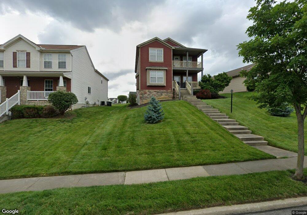
1938 Langdon Farm Rd Cincinnati, OH 45237
Bond Hill NeighborhoodEstimated Value: $383,067 - $444,000
4
Beds
3
Baths
2,760
Sq Ft
$152/Sq Ft
Est. Value
About This Home
This home is located at 1938 Langdon Farm Rd, Cincinnati, OH 45237 and is currently estimated at $418,517, approximately $151 per square foot. 1938 Langdon Farm Rd is a home located in Hamilton County with nearby schools including Bond Hill Academy Elementary School, Shroder High School, and Clark Montessori High School.
Ownership History
Date
Name
Owned For
Owner Type
Purchase Details
Closed on
Nov 21, 2007
Sold by
Potterhill Homes Llc
Bought by
Epperson Benita A
Current Estimated Value
Home Financials for this Owner
Home Financials are based on the most recent Mortgage that was taken out on this home.
Original Mortgage
$242,087
Outstanding Balance
$153,881
Interest Rate
6.47%
Mortgage Type
FHA
Estimated Equity
$264,636
Purchase Details
Closed on
Mar 3, 2006
Sold by
Allen Temple Tryed Stone Development Ltd
Bought by
Potterhill Homes Llc
Create a Home Valuation Report for This Property
The Home Valuation Report is an in-depth analysis detailing your home's value as well as a comparison with similar homes in the area
Home Values in the Area
Average Home Value in this Area
Purchase History
| Date | Buyer | Sale Price | Title Company |
|---|---|---|---|
| Epperson Benita A | $244,000 | Springdale Title Agency Llc | |
| Potterhill Homes Llc | -- | None Available |
Source: Public Records
Mortgage History
| Date | Status | Borrower | Loan Amount |
|---|---|---|---|
| Open | Epperson Benita A | $242,087 |
Source: Public Records
Tax History Compared to Growth
Tax History
| Year | Tax Paid | Tax Assessment Tax Assessment Total Assessment is a certain percentage of the fair market value that is determined by local assessors to be the total taxable value of land and additions on the property. | Land | Improvement |
|---|---|---|---|---|
| 2024 | $5,944 | $99,519 | $11,375 | $88,144 |
| 2023 | $6,078 | $99,519 | $11,375 | $88,144 |
| 2022 | $842 | $81,095 | $12,173 | $68,922 |
| 2021 | $807 | $81,095 | $12,173 | $68,922 |
| 2020 | $830 | $81,095 | $12,173 | $68,922 |
| 2019 | $848 | $75,789 | $11,375 | $64,414 |
| 2018 | $849 | $75,789 | $11,375 | $64,414 |
| 2017 | $807 | $75,789 | $11,375 | $64,414 |
| 2016 | $769 | $83,535 | $10,693 | $72,842 |
| 2015 | $694 | $83,535 | $10,693 | $72,842 |
| 2014 | $699 | $83,535 | $10,693 | $72,842 |
| 2013 | $756 | $88,865 | $11,375 | $77,490 |
Source: Public Records
Map
Nearby Homes
- 5447 Grafton Ave
- 5994 Wanderling Ln
- 1744 Northampton Dr
- 2014 Faith St
- 1712 Carrahen Ave
- 2054 Mistyoak Ln
- 1931 Seymour Ave
- 5120 Lillian Dr
- 1932 Truitt Ave
- 5728 Warren Ave
- 1917 Truitt Ave
- 5725 Carthage Ave
- 5621 Rolston Ave
- 1870 Dalewood Place
- 2232 Rosedale Ave
- 1730 Dale Rd
- 6110 Stover Ave
- 1855 Dalewood Place
- 6045 Elbrook Ave
- 7072 Eastlawn Dr
- 1942 Langdon Farm Rd
- 1934 Langdon Farm Rd
- 1900 Langdon Farm Rd
- 5921 Rhode Island Ave
- 5925 Rhode Island Ave
- 1950 Langdon Farm Rd
- 1896 Langdon Farm Rd
- 5923 Rhode Island Ave
- 5924 Morning Dew Ct
- 5929 Rhode Island Ave
- 1943 Langdon Farm Rd
- 1939 Langdon Farm Rd
- 5928 Morning Dew Ct
- 1892 Langdon Farm Rd
- 1954 Langdon Farm Rd
- 5920 Rhode Island Ave
- 5933 Rhode Island Ave
- 5932 Morning Dew Ct
- 1951 Langdon Farm Rd
- 5929 Morning Dew Ct