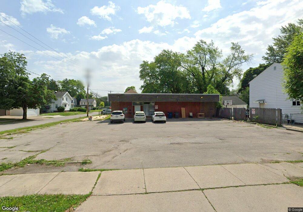
1938 Perth St Toledo, OH 43607
Ottawa NeighborhoodEstimated Value: $44,734
Studio
1
Bath
2,432
Sq Ft
$18/Sq Ft
Est. Value
About This Home
This home is located at 1938 Perth St, Toledo, OH 43607 and is currently estimated at $44,734, approximately $18 per square foot. 1938 Perth St is a home located in Lucas County with nearby schools including Old Orchard Elementary School, Start High School, and Central Academy Of Ohio.
Ownership History
Date
Name
Owned For
Owner Type
Purchase Details
Closed on
Jun 7, 2017
Sold by
The Qompany Llc
Bought by
1938 Perth Llc
Current Estimated Value
Purchase Details
Closed on
Jul 31, 2012
Sold by
Shafer John H and Shafer Sheril J
Bought by
The Qompany Lllc
Purchase Details
Closed on
Oct 25, 2004
Sold by
Warner Paul
Bought by
Shafer John H
Purchase Details
Closed on
Aug 30, 2004
Sold by
Settles Johnny and Settles Debra
Bought by
Warner Paul and Paul Warner Revocable Inter Vivos Trust
Purchase Details
Closed on
Apr 11, 1988
Sold by
Zyndorf Henry
Create a Home Valuation Report for This Property
The Home Valuation Report is an in-depth analysis detailing your home's value as well as a comparison with similar homes in the area
Home Values in the Area
Average Home Value in this Area
Purchase History
| Date | Buyer | Sale Price | Title Company |
|---|---|---|---|
| 1938 Perth Llc | -- | None Available | |
| The Qompany Lllc | $21,500 | None Available | |
| Shafer John H | $27,000 | -- | |
| Warner Paul | -- | -- | |
| -- | $47,000 | -- |
Source: Public Records
Tax History
| Year | Tax Paid | Tax Assessment Tax Assessment Total Assessment is a certain percentage of the fair market value that is determined by local assessors to be the total taxable value of land and additions on the property. | Land | Improvement |
|---|---|---|---|---|
| 2025 | -- | $14,280 | $5,285 | $8,995 |
| 2024 | $777 | $14,280 | $5,285 | $8,995 |
| 2023 | $1,649 | $14,280 | $5,285 | $8,995 |
| 2022 | $1,645 | $14,280 | $5,285 | $8,995 |
| 2021 | $1,663 | $14,280 | $5,285 | $8,995 |
| 2020 | $1,718 | $13,615 | $5,040 | $8,575 |
| 2019 | $1,662 | $13,615 | $5,040 | $8,575 |
| 2018 | $837 | $13,615 | $5,040 | $8,575 |
| 2017 | $1,602 | $12,950 | $4,760 | $8,190 |
| 2016 | $1,646 | $37,000 | $13,600 | $23,400 |
| 2015 | $1,641 | $37,000 | $13,600 | $23,400 |
| 2014 | $940 | $10,570 | $2,380 | $8,190 |
| 2013 | $940 | $10,570 | $2,380 | $8,190 |
Source: Public Records
Map
Nearby Homes
- 1917 Alvin St
- 1901 Alvin St
- 1814 Alvin St
- 2035 Alvin St
- 1702 Alvin St
- 2127 Perth St
- 2065 Wyndhurst Rd
- 2143 Alvin St
- 2547 Greenway St
- 1408 Roosevelt Ave
- 1723 Potomac Dr
- 1429 Potomac Dr
- 1427 Potomac Dr
- 2145 Dorr St
- 1424 Addington Rd
- 1819 Shenandoah Rd
- 1318 Addington Rd
- 2033 Crosswell Place
- 1011 Alldays Ave
- 1215 Woodstock Ave
- 1930 Perth St
- 1926 Perth St
- 1939 Evansdale Ave
- 1929 Evansdale Ave
- 2004 Perth St
- 1927 Evansdale Ave
- 1922 Perth St
- 1925 Evansdale Ave
- 2003 Evansdale Ave
- 1935 Perth St
- 1939 Perth St
- 1939 Perth St Unit 1
- 1931 Perth St
- 1914 Perth St
- 2010 Perth St
- 1923 Evansdale Ave
- 2007 Evansdale Ave
- 1927 Perth St
- 2001 Perth St
- 1923 Perth St
Your Personal Tour Guide
Ask me questions while you tour the home.