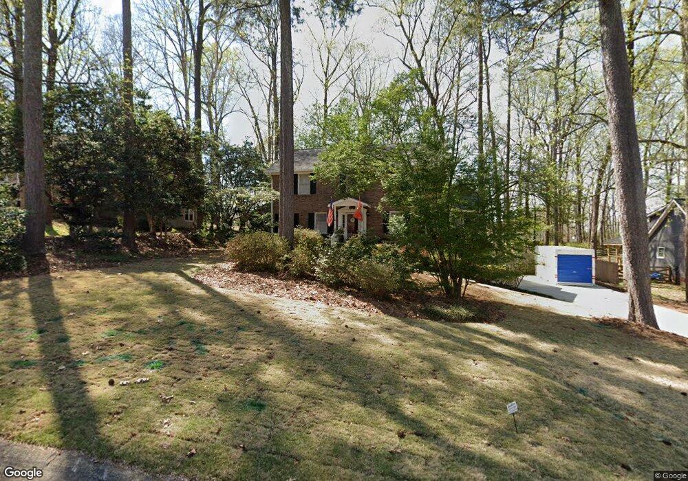
1938 Rollingwoods Way SW Unit 1 Marietta, GA 30064
West Cobb NeighborhoodEstimated Value: $404,000 - $464,000
4
Beds
2
Baths
2,123
Sq Ft
$207/Sq Ft
Est. Value
About This Home
This home is located at 1938 Rollingwoods Way SW Unit 1, Marietta, GA 30064 and is currently estimated at $438,894, approximately $206 per square foot. 1938 Rollingwoods Way SW Unit 1 is a home located in Cobb County with nearby schools including Dowell Elementary School, Lovinggood Middle School, and Hillgrove High School.
Ownership History
Date
Name
Owned For
Owner Type
Purchase Details
Closed on
May 24, 1995
Sold by
Paschal Donald N Paula
Bought by
Burns Jerry C Julia
Current Estimated Value
Create a Home Valuation Report for This Property
The Home Valuation Report is an in-depth analysis detailing your home's value as well as a comparison with similar homes in the area
Home Values in the Area
Average Home Value in this Area
Purchase History
| Date | Buyer | Sale Price | Title Company |
|---|---|---|---|
| Burns Jerry C Julia | $119,900 | -- |
Source: Public Records
Mortgage History
| Date | Status | Borrower | Loan Amount |
|---|---|---|---|
| Closed | Burns Jerry C Julia | $0 |
Source: Public Records
Tax History Compared to Growth
Tax History
| Year | Tax Paid | Tax Assessment Tax Assessment Total Assessment is a certain percentage of the fair market value that is determined by local assessors to be the total taxable value of land and additions on the property. | Land | Improvement |
|---|---|---|---|---|
| 2025 | $790 | $158,032 | $36,000 | $122,032 |
| 2024 | $738 | $139,716 | $12,800 | $126,916 |
| 2023 | $532 | $139,716 | $12,800 | $126,916 |
| 2022 | $707 | $129,284 | $12,800 | $116,484 |
| 2021 | $610 | $97,036 | $12,800 | $84,236 |
| 2020 | $610 | $97,036 | $12,800 | $84,236 |
| 2019 | $586 | $88,836 | $12,800 | $76,036 |
| 2018 | $570 | $83,704 | $12,800 | $70,904 |
| 2017 | $486 | $74,636 | $14,000 | $60,636 |
| 2016 | $489 | $74,276 | $14,000 | $60,276 |
| 2015 | $1,740 | $74,276 | $14,000 | $60,276 |
| 2014 | $1,059 | $44,472 | $0 | $0 |
Source: Public Records
Map
Nearby Homes
- 2040 Hardwood Cir SW Unit 3
- 1946 MacLand Rd SW
- 1830 MacLand Rd SW
- 1952 Freestone Way
- Monteluce Plan at Freestone Station
- Hillside Plan at Freestone Station
- Oakshire Plan at Freestone Station
- Hendricks Plan at Freestone Station
- Hedgerow Plan at Freestone Station
- Antioch Plan at Freestone Station
- 1985 Freestone Way
- 2093 Breconridge Dr SW
- 1646 Desford Ct SW
- 2002 MacLand Square Dr Unit 1
- 2009 Freestone Way
- 2409 Caneridge Point SW
- 2028 MacLand Square Dr Unit 4
- 1976 Grove Field Ln
- 1976 Grove Field Ln Unit BLDG 33
- 2117 Caneridge Dr SW
- 1940 Rollingwoods Way SW
- 1932 Rollingwoods Way SW Unit 1
- 1909 McEachern Manor Dr SW
- 1942 Rollingwoods Way SW
- 1930 Rollingwoods Way SW
- 1805 Walker Ridge Dr SW
- 1807 Walker Ridge Dr SW
- 1910 McEachern Manor Dr SW
- 1948 Rollingwoods Way SW Unit 1
- 1809 Walker Ridge Dr SW
- 1803 Walker Ridge Dr SW
- 2051 Hardwood Cir SW Unit 3
- 1913 McEachern Manor Dr SW Unit 44
- 1913 McEachern Manor Dr SW
- 1928 Rollingwoods Way SW
- 1928 Rollingwoods Way SW Unit 3
- 1801 Walker Ridge Dr SW
- 1811 Walker Ridge Dr SW
- 1941 Rollingwoods Way SW
- 2041 Hardwood Cir SW