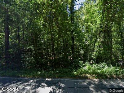
1939 Crawford Dairy Rd Unit 3 Chapel Hill, NC 27516
Baldwin NeighborhoodEstimated Value: $211,000 - $489,000
2
Beds
2
Baths
1,272
Sq Ft
$317/Sq Ft
Est. Value
About This Home
This home is located at 1939 Crawford Dairy Rd Unit 3, Chapel Hill, NC 27516 and is currently estimated at $403,356, approximately $317 per square foot. 1939 Crawford Dairy Rd Unit 3 is a home located in Chatham County with nearby schools including Perry W. Harrison Elementary School, Margaret B. Pollard Middle School, and Northwood High.
Ownership History
Date
Name
Owned For
Owner Type
Purchase Details
Closed on
Jul 1, 2016
Sold by
Williams Brenda Bea
Bought by
Bennett Timothy S and Erickson Sally C
Current Estimated Value
Purchase Details
Closed on
Dec 31, 1996
Bought by
Williams Brenda Bea
Create a Home Valuation Report for This Property
The Home Valuation Report is an in-depth analysis detailing your home's value as well as a comparison with similar homes in the area
Home Values in the Area
Average Home Value in this Area
Purchase History
| Date | Buyer | Sale Price | Title Company |
|---|---|---|---|
| Bennett Timothy S | $120,000 | Attorney | |
| Williams Brenda Bea | -- | -- |
Source: Public Records
Mortgage History
| Date | Status | Borrower | Loan Amount |
|---|---|---|---|
| Open | Erickson Sally C | $100,000 |
Source: Public Records
Tax History Compared to Growth
Tax History
| Year | Tax Paid | Tax Assessment Tax Assessment Total Assessment is a certain percentage of the fair market value that is determined by local assessors to be the total taxable value of land and additions on the property. | Land | Improvement |
|---|---|---|---|---|
| 2024 | $2,456 | $271,871 | $124,476 | $147,395 |
| 2023 | $2,456 | $271,871 | $124,476 | $147,395 |
| 2022 | $2,129 | $271,871 | $124,476 | $147,395 |
| 2021 | $1,447 | $271,871 | $124,476 | $147,395 |
| 2020 | $1,447 | $197,852 | $107,730 | $90,122 |
| 2019 | $1,664 | $197,852 | $107,730 | $90,122 |
| 2018 | $0 | $197,852 | $107,730 | $90,122 |
| 2017 | $1,572 | $197,852 | $107,730 | $90,122 |
| 2016 | $1,751 | $220,688 | $107,730 | $112,958 |
| 2015 | $1,725 | $220,688 | $107,730 | $112,958 |
| 2014 | $1,692 | $220,688 | $107,730 | $112,958 |
| 2013 | -- | $220,688 | $107,730 | $112,958 |
Source: Public Records
Map
Nearby Homes
- 0 Crawford Dairy Rd Unit 10090315
- 2811 Chicken Bridge Rd
- 46 Chetango Mountain Rd
- 889 Old Stonehouse Rd
- 183 Birnamwood Dr
- 195 Nicks Bend W
- 2354 Jones Ferry Rd
- 97 Fox Oak Trail
- 59 Mill Rd
- 9349 Perry Rd
- 639 Cedar Grove Rd
- 273 Blufftonwood Dr
- 36 Blufftonwood Dr
- 119 Cardinal Crest Ct
- 1487 Collins Mountain Rd
- 164 Blufftonwood Dr Unit 35
- 92 Bluffside Ct
- 1018 Terrell Woods Ln
- 175 Clear Springs Ct
- 31 Meandering Way Ct
- 1939 Crawford Dairy Rd
- 1939 Crawford Dairy Rd Unit 3
- 1995 Crawford Dairy Rd
- 1995 Crawford Dairy Rd
- 85 Holly Hill Rd
- 215 Holly Hill Rd
- 1 Ridge Top Dr
- 1 Ridge Top Dr Unit 1
- 165 Holly Hill Rd
- 130 Holly Hill Rd
- 1 Ridge Top Dr
- 0 Ridge Top Dr Unit 1819143
- 0 Ridge Top Dr Unit 517782
- 0 Ridge Top Dr Unit 519538
- 0 Ridge Top Dr Unit 519132
- 0 Ridge Top Dr Unit 1 TR1819143
- 300 Holly Hill Rd
- 161 Ridge Top Dr
- 2038 Crawford Dairy Rd Unit B
- 2038 Crawford Dairy Rd Unit D
