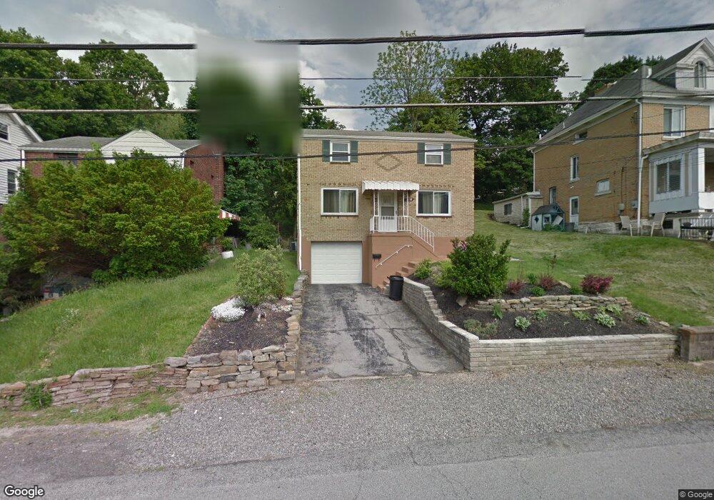
1939 Dartmore St Pittsburgh, PA 15210
Carrick NeighborhoodEstimated Value: $140,000 - $169,373
3
Beds
2
Baths
1,232
Sq Ft
$122/Sq Ft
Est. Value
About This Home
This home is located at 1939 Dartmore St, Pittsburgh, PA 15210 and is currently estimated at $150,343, approximately $122 per square foot. 1939 Dartmore St is a home located in Allegheny County with nearby schools including Pittsburgh Roosevelt K. - 5, Pittsburgh South Brook, and Pittsburgh Carrick High School.
Ownership History
Date
Name
Owned For
Owner Type
Purchase Details
Closed on
Jul 26, 2022
Sold by
Sanchez Mercedes
Bought by
Heren Andrew
Current Estimated Value
Purchase Details
Closed on
Oct 13, 2008
Sold by
Miller Paul
Bought by
Sanchez Mercedes
Home Financials for this Owner
Home Financials are based on the most recent Mortgage that was taken out on this home.
Original Mortgage
$76,892
Interest Rate
5.94%
Mortgage Type
FHA
Purchase Details
Closed on
Feb 5, 2008
Sold by
U S Bank
Bought by
Miller Paul and Schaffer,Fredrick A
Purchase Details
Closed on
Dec 3, 2007
Sold by
Smith James E
Bought by
U S Bank
Create a Home Valuation Report for This Property
The Home Valuation Report is an in-depth analysis detailing your home's value as well as a comparison with similar homes in the area
Home Values in the Area
Average Home Value in this Area
Purchase History
| Date | Buyer | Sale Price | Title Company |
|---|---|---|---|
| Heren Andrew | $125,000 | -- | |
| Sanchez Mercedes | $77,500 | -- | |
| Miller Paul | $32,000 | -- | |
| U S Bank | $1,506 | -- |
Source: Public Records
Mortgage History
| Date | Status | Borrower | Loan Amount |
|---|---|---|---|
| Previous Owner | Sanchez Mercedes | $76,892 |
Source: Public Records
Tax History Compared to Growth
Tax History
| Year | Tax Paid | Tax Assessment Tax Assessment Total Assessment is a certain percentage of the fair market value that is determined by local assessors to be the total taxable value of land and additions on the property. | Land | Improvement |
|---|---|---|---|---|
| 2025 | $1,028 | $44,600 | $14,400 | $30,200 |
| 2024 | $1,028 | $44,600 | $14,400 | $30,200 |
| 2023 | $1,028 | $44,600 | $14,400 | $30,200 |
| 2022 | $1,014 | $44,600 | $14,400 | $30,200 |
| 2021 | $1,014 | $44,600 | $14,400 | $30,200 |
| 2020 | $1,009 | $44,600 | $14,400 | $30,200 |
| 2019 | $1,009 | $44,600 | $14,400 | $30,200 |
| 2018 | $717 | $44,600 | $14,400 | $30,200 |
| 2017 | $1,009 | $44,600 | $14,400 | $30,200 |
| 2016 | $211 | $44,600 | $14,400 | $30,200 |
| 2015 | $211 | $44,600 | $14,400 | $30,200 |
| 2014 | $987 | $44,600 | $14,400 | $30,200 |
Source: Public Records
Map
Nearby Homes
- 1928 Dartmore St
- 373 Copperfield Ave
- 331 Redwood St
- 2082 Walton Ave
- 2032 Jacob St
- 309 Parkfield St
- 1725 Hallowell St
- 42 Queenston St
- 0 Ballinger St Unit 1705904
- 1641 Mount Joseph St
- 1572 Brookline Blvd
- 2220 Jacob St
- 1611 Westmont Ave
- 2000 Brownsville Rd
- 2020 Brownsville Rd
- 2201 Whited St
- 1800 Concordia St
- 1444 Milan Ave
- 12 E Meyers St
- 404 Ariston Ave
- 1935 Dartmore St
- 1943 Dartmore St
- 1933 Dartmore St
- 1940 Fairland St
- 1929 Dartmore St
- 1934 Fairland St
- 1949 Dartmore St
- 1927 Dartmore St
- 1942 Dartmore St
- 1932 Dartmore St
- 1932 Dartmore St
- 1932 Dartmore St
- 1946 Fairland St
- 1944 Dartmore St
- 1925 Dartmore St
- 1928 Fairland St
- 1957 Dartmore St
- 1948 Dartmore St
- 1950 Fairland St
- 1926 Dartmore St