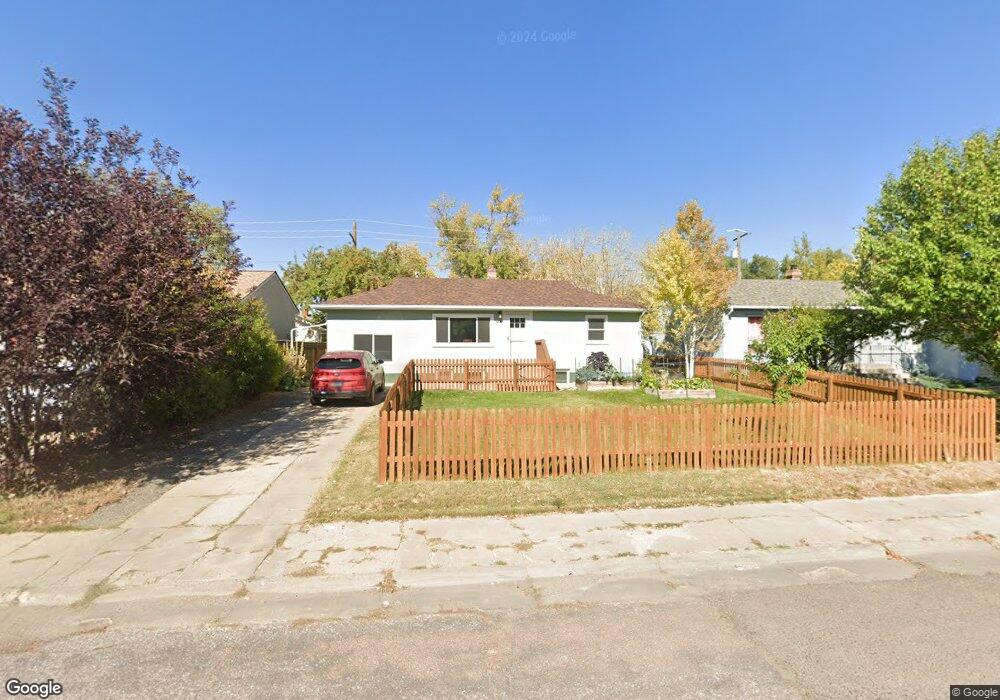
1939 E Garfield St Laramie, WY 82070
Estimated Value: $304,000 - $404,000
3
Beds
2
Baths
1,056
Sq Ft
$344/Sq Ft
Est. Value
About This Home
This home is located at 1939 E Garfield St, Laramie, WY 82070 and is currently estimated at $363,276, approximately $344 per square foot. 1939 E Garfield St is a home located in Albany County with nearby schools including Beitel Elementary School, Laramie Middle School, and Laramie High School.
Ownership History
Date
Name
Owned For
Owner Type
Purchase Details
Closed on
Mar 14, 2019
Sold by
Kearley Timothy G and Kearley Jamie P
Bought by
Rye Randy L and Laubhan Mary Ellen
Current Estimated Value
Purchase Details
Closed on
Apr 24, 2009
Sold by
Schenck John E B and Schenck Gail A
Bought by
Kearley Timothy G and Kearley Jamie P
Home Financials for this Owner
Home Financials are based on the most recent Mortgage that was taken out on this home.
Original Mortgage
$120,000
Interest Rate
5.03%
Mortgage Type
New Conventional
Create a Home Valuation Report for This Property
The Home Valuation Report is an in-depth analysis detailing your home's value as well as a comparison with similar homes in the area
Home Values in the Area
Average Home Value in this Area
Purchase History
| Date | Buyer | Sale Price | Title Company |
|---|---|---|---|
| Rye Randy L | -- | None Available | |
| Kearley Timothy G | -- | -- |
Source: Public Records
Mortgage History
| Date | Status | Borrower | Loan Amount |
|---|---|---|---|
| Previous Owner | Kearley Timothy G | $120,000 |
Source: Public Records
Tax History Compared to Growth
Tax History
| Year | Tax Paid | Tax Assessment Tax Assessment Total Assessment is a certain percentage of the fair market value that is determined by local assessors to be the total taxable value of land and additions on the property. | Land | Improvement |
|---|---|---|---|---|
| 2025 | $1,805 | $19,291 | $3,775 | $15,516 |
| 2024 | $1,805 | $24,732 | $4,840 | $19,892 |
| 2023 | $1,795 | $24,592 | $4,840 | $19,752 |
| 2022 | $1,638 | $22,442 | $5,547 | $16,895 |
| 2021 | $1,502 | $20,574 | $4,186 | $16,388 |
| 2020 | $1,397 | $19,141 | $4,186 | $14,955 |
| 2019 | $1,316 | $18,029 | $4,186 | $13,843 |
| 2018 | $1,310 | $17,951 | $3,663 | $14,288 |
| 2017 | $1,263 | $17,307 | $3,663 | $13,644 |
| 2016 | $1,248 | $17,096 | $3,663 | $13,433 |
| 2015 | $1,225 | $16,784 | $3,171 | $13,613 |
| 2014 | $1,205 | $16,500 | $0 | $0 |
Source: Public Records
Map
Nearby Homes
- 1930 E Custer St
- 1936 E Custer St
- 1707 E Custer St
- 1802 E Sheridan St
- 2022 E Sheridan St
- 1618 E Custer St
- 417 Stetson Ct
- 1516 E Grand Ave Unit 107
- 1521 E Kearney St
- 2215 E Sheridan St
- 812 S 22nd St
- 1821 Spring Creek Dr
- 1509 E Park Ave
- 803 S 15th St
- 1531 Spring Creek Dr
- 906 S 15th St
- 1727 E Palmer Dr
- 1412 S 17th St Unit A
- 1100 E Garfield St
- 1425 Fetterman Dr
- 1935 E Garfield St
- 1943 E Garfield St
- 1931 E Garfield St
- 1947 E Garfield St
- 1940 E Grand Ave
- 1936 E Grand Ave
- 1927 E Garfield St
- 1932 E Grand Ave
- 1940 E Garfield St
- 1936 E Garfield St
- 1944 E Garfield St
- 1932 E Garfield St
- 1928 E Grand Ave
- 1948 E Garfield St
- 1923 E Garfield St
- 1928 E Garfield St
- 1924 E Grand Ave
- 1919 E Garfield St
- 1924 E Garfield St
- 1939 E Custer St