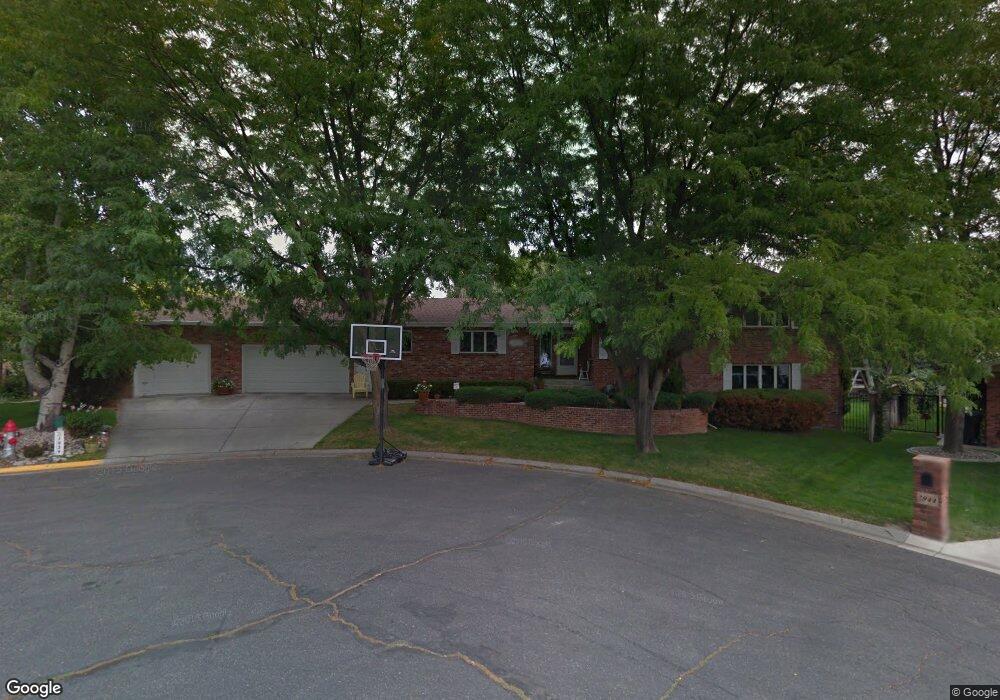
1939 Iris Ln Billings, MT 59102
North Central Billings NeighborhoodEstimated Value: $506,000 - $595,000
4
Beds
5
Baths
3,960
Sq Ft
$136/Sq Ft
Est. Value
About This Home
This home is located at 1939 Iris Ln, Billings, MT 59102 and is currently estimated at $537,515, approximately $135 per square foot. 1939 Iris Ln is a home located in Yellowstone County with nearby schools including Rose Park School, Lewis & Clark Junior High School, and Billings Senior High School.
Ownership History
Date
Name
Owned For
Owner Type
Purchase Details
Closed on
Apr 3, 2020
Sold by
Day Michael T and Day Lisa M
Bought by
Rude Karl J and Rude Margaret M
Current Estimated Value
Home Financials for this Owner
Home Financials are based on the most recent Mortgage that was taken out on this home.
Original Mortgage
$389,600
Interest Rate
3.4%
Mortgage Type
Commercial
Create a Home Valuation Report for This Property
The Home Valuation Report is an in-depth analysis detailing your home's value as well as a comparison with similar homes in the area
Home Values in the Area
Average Home Value in this Area
Purchase History
We collect this data history from publicly available records. To have your information removed, we recommend requesting removal directly through your county’s website.
| Date | Buyer | Sale Price | Title Company |
|---|---|---|---|
| Rude Karl J | -- | First Montana Title Co |
Source: Public Records
Mortgage History
We collect this data history from publicly available records. To have your information removed, we recommend requesting removal directly through your county’s website.
| Date | Status | Borrower | Loan Amount |
|---|---|---|---|
| Closed | Rude Karl J | $389,600 |
Source: Public Records
Tax History
| Year | Tax Paid | Tax Assessment Tax Assessment Total Assessment is a certain percentage of the fair market value that is determined by local assessors to be the total taxable value of land and additions on the property. | Land | Improvement |
|---|---|---|---|---|
| 2025 | $4,061 | $523,400 | $59,801 | $463,599 |
| 2024 | $4,061 | $423,600 | $56,739 | $366,861 |
| 2023 | $4,060 | $423,600 | $56,739 | $366,861 |
| 2022 | $3,732 | $342,100 | $0 | $0 |
| 2021 | $3,547 | $342,100 | $0 | $0 |
| 2020 | $3,948 | $367,900 | $0 | $0 |
| 2019 | $3,765 | $367,900 | $0 | $0 |
| 2018 | $3,873 | $372,500 | $0 | $0 |
| 2017 | $3,762 | $372,500 | $0 | $0 |
| 2016 | $3,600 | $360,700 | $0 | $0 |
| 2015 | $3,520 | $360,700 | $0 | $0 |
| 2014 | $3,221 | $175,271 | $0 | $0 |
Source: Public Records
Map
Nearby Homes
- 1905 Poly Dr
- 1833 Iris Ln
- 2115 Mariposa Ln
- 2807 Terrace Dr
- 13 Stanford Ct
- 2036 Green Terrace Dr
- 2618 Sunnyview Ln
- 2406 Woody Dr
- 2095 17th St W
- 3026 Morledge St
- 2214 Meadowood St
- 2117 Fairway Dr
- 1729 Avenue E
- 2306 Fairway Dr
- 2042 Avenue C
- 3226 Country Club Cir
- 2311 Fairway Dr
- 2713 Downer Ln
- 1837 Avenue B
- 1600 Avenue E
Your Personal Tour Guide
Ask me questions while you tour the home.