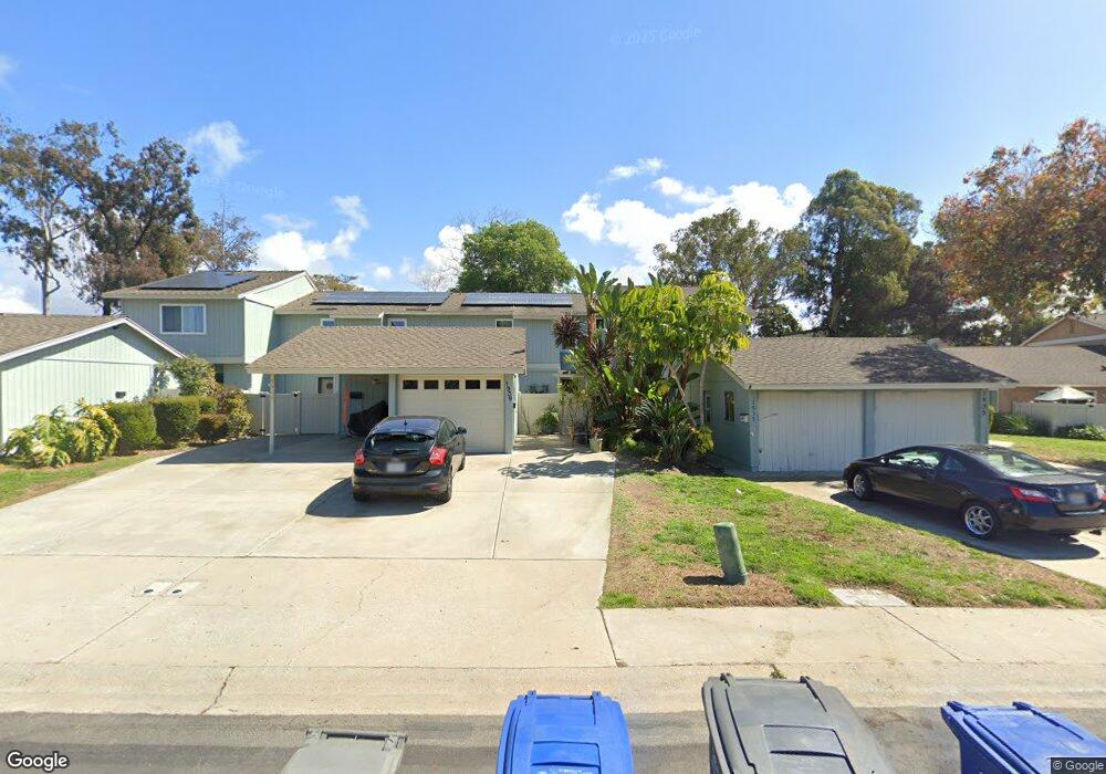
1939 Misty Cir Encinitas, CA 92024
Central Encinitas NeighborhoodEstimated Value: $1,043,000 - $1,194,000
3
Beds
2
Baths
1,394
Sq Ft
$804/Sq Ft
Est. Value
About This Home
This home is located at 1939 Misty Cir, Encinitas, CA 92024 and is currently estimated at $1,120,194, approximately $803 per square foot. 1939 Misty Cir is a home located in San Diego County with nearby schools including Park Dale Lane Elementary, Diegueno Middle School, and La Costa Canyon High School.
Ownership History
Date
Name
Owned For
Owner Type
Purchase Details
Closed on
Apr 13, 2017
Sold by
Mancarti Elaine
Bought by
Mancarti Brian Stanley
Current Estimated Value
Home Financials for this Owner
Home Financials are based on the most recent Mortgage that was taken out on this home.
Original Mortgage
$431,200
Outstanding Balance
$358,134
Interest Rate
4.14%
Mortgage Type
New Conventional
Estimated Equity
$762,060
Purchase Details
Closed on
Apr 10, 2017
Sold by
Mancarti Brian Stanley
Bought by
Williams Craig Jonathan
Home Financials for this Owner
Home Financials are based on the most recent Mortgage that was taken out on this home.
Original Mortgage
$431,200
Outstanding Balance
$358,134
Interest Rate
4.14%
Mortgage Type
New Conventional
Estimated Equity
$762,060
Purchase Details
Closed on
Mar 3, 2003
Sold by
Mancarti Guy D
Bought by
Mancarti Brian Stanley
Purchase Details
Closed on
Oct 12, 1987
Create a Home Valuation Report for This Property
The Home Valuation Report is an in-depth analysis detailing your home's value as well as a comparison with similar homes in the area
Home Values in the Area
Average Home Value in this Area
Purchase History
| Date | Buyer | Sale Price | Title Company |
|---|---|---|---|
| Mancarti Brian Stanley | -- | Chicago Title Company Sd | |
| Williams Craig Jonathan | $543,000 | Chicago Title Company Sd | |
| Mancarti Brian Stanley | -- | -- | |
| -- | $93,000 | -- |
Source: Public Records
Mortgage History
| Date | Status | Borrower | Loan Amount |
|---|---|---|---|
| Open | Williams Craig Jonathan | $431,200 |
Source: Public Records
Tax History Compared to Growth
Tax History
| Year | Tax Paid | Tax Assessment Tax Assessment Total Assessment is a certain percentage of the fair market value that is determined by local assessors to be the total taxable value of land and additions on the property. | Land | Improvement |
|---|---|---|---|---|
| 2025 | $7,160 | $630,192 | $539,669 | $90,523 |
| 2024 | $7,160 | $617,837 | $529,088 | $88,749 |
| 2023 | $6,950 | $605,723 | $518,714 | $87,009 |
| 2022 | $6,780 | $593,847 | $508,544 | $85,303 |
| 2021 | $6,662 | $582,204 | $498,573 | $83,631 |
| 2020 | $6,549 | $576,235 | $493,461 | $82,774 |
| 2019 | $6,422 | $564,937 | $483,786 | $81,151 |
| 2018 | $6,301 | $553,860 | $474,300 | $79,560 |
| 2017 | $191 | $153,353 | $45,060 | $108,293 |
| 2016 | $1,937 | $150,347 | $44,177 | $106,170 |
| 2015 | $1,883 | $148,090 | $43,514 | $104,576 |
| 2014 | $1,825 | $145,190 | $42,662 | $102,528 |
Source: Public Records
Map
Nearby Homes
- 2005 Countrywood Ct
- 155 Countrywood Ln
- 1838 Stonebrook Ln
- 1824 Eastwood Ln
- 2128 Mountain Vista Dr
- 1785 Caliban Dr
- 1931 Hummock Ln
- 3736 38 Via Rancho Michelle
- 658 660 Santa fe Dr
- 772 Conestoga Ct
- 2154 Ranch View Terrace
- 1741 Charleston Ln
- 1709 Edgefield Ln
- 1824 Forestdale Dr
- 1617 Blossom Field Way
- 1641 Tucker Ln
- 1655 Splitrail Dr
- 721 Summersong Ln
- 1926 Springdale Ln
- 277 Via Del Cerrito
- 1937 Misty Cir
- 1935 Misty Cir
- 1941 Misty Cir
- 1943 Misty Cir
- 1945 Misty Cir Unit 212
- 1933 Misty Cir
- 2006 Shadytree Ln
- 1931 Misty Cir
- 2004 Shadytree Ln
- 2012 Shadytree Ln
- 1929 Misty Cir
- 1947 Misty Cir
- 2008 Shadytree Ln
- 2002 Shadytree Ln
- 1927 Misty Cir
- 1949 Misty Cir
- 1953 Misty Cir Unit 216
- 1951 Misty Cir Unit 215
- 1910 Misty Cir
- 1923 Misty Cir