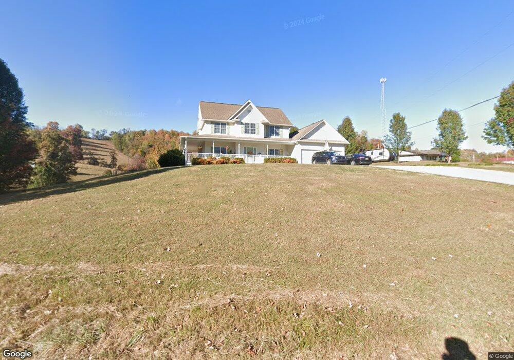
1939 Pleasant Ridge Rd Unit 1 La Follette, TN 37766
Estimated Value: $371,000 - $477,000
3
Beds
4
Baths
2,310
Sq Ft
$183/Sq Ft
Est. Value
About This Home
This home is located at 1939 Pleasant Ridge Rd Unit 1, La Follette, TN 37766 and is currently estimated at $422,679, approximately $182 per square foot. 1939 Pleasant Ridge Rd Unit 1 is a home located in Campbell County.
Ownership History
Date
Name
Owned For
Owner Type
Purchase Details
Closed on
Nov 8, 2021
Sold by
Jeffries John S and Jeffries Kim
Bought by
Kinsey Michael J and Kinsey Christine A
Current Estimated Value
Home Financials for this Owner
Home Financials are based on the most recent Mortgage that was taken out on this home.
Original Mortgage
$224,000
Outstanding Balance
$189,986
Interest Rate
2.99%
Mortgage Type
New Conventional
Estimated Equity
$232,693
Purchase Details
Closed on
Jul 22, 2005
Sold by
Tackett Billy R
Bought by
Jeffries John S and Jeffries Kim
Create a Home Valuation Report for This Property
The Home Valuation Report is an in-depth analysis detailing your home's value as well as a comparison with similar homes in the area
Home Values in the Area
Average Home Value in this Area
Purchase History
| Date | Buyer | Sale Price | Title Company |
|---|---|---|---|
| Kinsey Michael J | $280,000 | Concord Title | |
| Jeffries John S | -- | -- |
Source: Public Records
Mortgage History
| Date | Status | Borrower | Loan Amount |
|---|---|---|---|
| Open | Kinsey Michael J | $224,000 |
Source: Public Records
Tax History Compared to Growth
Tax History
| Year | Tax Paid | Tax Assessment Tax Assessment Total Assessment is a certain percentage of the fair market value that is determined by local assessors to be the total taxable value of land and additions on the property. | Land | Improvement |
|---|---|---|---|---|
| 2025 | $1,072 | $88,175 | $0 | $0 |
| 2024 | $1,072 | $88,175 | $7,975 | $80,200 |
| 2023 | $1,139 | $55,125 | $2,800 | $52,325 |
| 2022 | $1,139 | $55,125 | $2,800 | $52,325 |
| 2021 | $1,139 | $55,125 | $2,800 | $52,325 |
| 2020 | $1,116 | $55,125 | $2,800 | $52,325 |
| 2019 | $1,139 | $55,125 | $2,800 | $52,325 |
| 2018 | $998 | $44,350 | $2,650 | $41,700 |
| 2017 | $998 | $44,350 | $2,650 | $41,700 |
| 2016 | $998 | $44,350 | $2,650 | $41,700 |
| 2015 | $883 | $44,350 | $2,650 | $41,700 |
| 2014 | $883 | $44,350 | $2,650 | $41,700 |
| 2013 | -- | $44,350 | $2,650 | $41,700 |
Source: Public Records
Map
Nearby Homes
- 2473 Long Hollow Rd
- 286 Lewis White Ln
- 647 Coolidge Rd
- 689 Ivey Hollow Rd
- 1123 Pleasant Ridge Rd
- 174 Old Ivey Hollow Rd
- 0 Dr
- 1971 Demory Rd
- 258 Marina Ln
- 309 Marina Ln
- 640 Camp Ridge Rd
- 0 Low Gap Rd Unit 18767562
- 0 Low Gap Rd Unit 11277254
- 1184 Davis Chapel Rd
- 0 Cedar Creek Rd
- 0 Mariner Point Rd
- 0 Gamble Ln
- 129 Bridgeview Ln
- 679 Waterfront Tr
- 143 Northbridge Ln
- 1939 Pleasant Ridge Rd
- 1965 Pleasant Ridge Rd
- 1910 Pleasant Ridge Rd
- 1936 Pleasant Ridge Rd
- 1902 Pleasant Ridge Rd
- 1978 Pleasant Ridge Rd
- 1778 Pleasant Ridge Rd
- 2000 Pleasant Ridge Rd
- 2452 Long Hollow Rd
- 2010 Pleasant Ridge Rd
- 2038 Pleasant Ridge Rd
- 1836 Pleasant Ridge Rd
- 2513 Long Hollow Rd
- 2445 Long Hollow Rd
- 2483 Long Hollow Rd
- 1455 Sugar Hollow Rd
- 721 Easter Ln
- 1449 Sugar Hollow Rd
- 1914 Pleasant Ridge Rd
- 282 Easter Ln