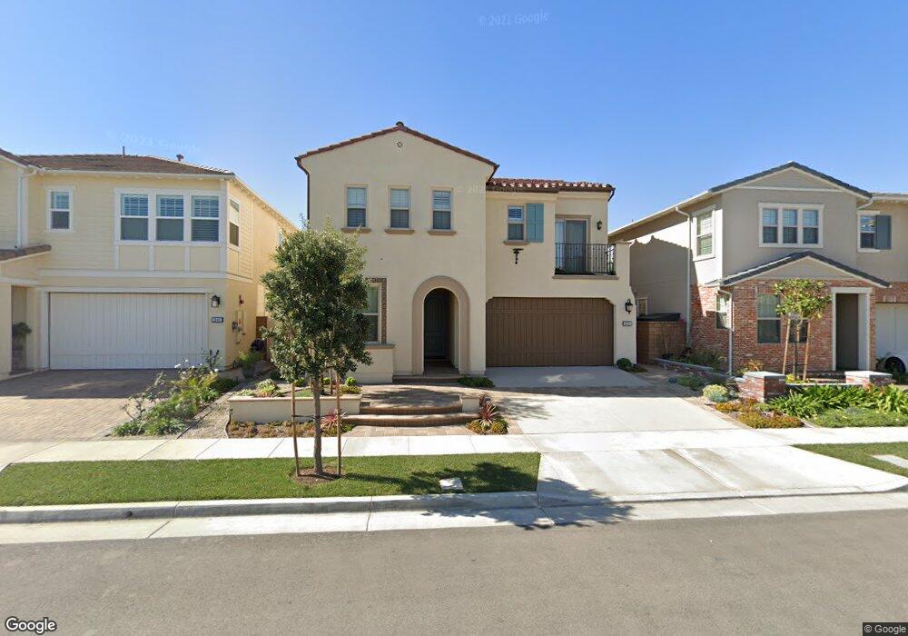
19391 Snowdon Ln Huntington Beach, CA 92646
Estimated Value: $1,748,276 - $1,865,000
4
Beds
3
Baths
2,478
Sq Ft
$739/Sq Ft
Est. Value
About This Home
This home is located at 19391 Snowdon Ln, Huntington Beach, CA 92646 and is currently estimated at $1,832,069, approximately $739 per square foot. 19391 Snowdon Ln is a home with nearby schools including Isojiro Oka Elementary, Talbert Middle School, and Edison High School.
Ownership History
Date
Name
Owned For
Owner Type
Purchase Details
Closed on
Sep 12, 2020
Sold by
Madler Andrew J and Madler Stephanie Sie
Bought by
Madler Andrew J and Madler Stephanie Sie
Current Estimated Value
Home Financials for this Owner
Home Financials are based on the most recent Mortgage that was taken out on this home.
Original Mortgage
$512,400
Interest Rate
2.9%
Mortgage Type
New Conventional
Purchase Details
Closed on
Mar 27, 2019
Sold by
Madler Michael S and Madler Audrey H
Bought by
Madler Andrew J and Madler Stephanie Sie
Create a Home Valuation Report for This Property
The Home Valuation Report is an in-depth analysis detailing your home's value as well as a comparison with similar homes in the area
Home Values in the Area
Average Home Value in this Area
Purchase History
| Date | Buyer | Sale Price | Title Company |
|---|---|---|---|
| Madler Andrew J | -- | Solidifi Title And Closing | |
| Madler Andrew J | -- | None Available |
Source: Public Records
Mortgage History
| Date | Status | Borrower | Loan Amount |
|---|---|---|---|
| Closed | Madler Andrew J | $512,400 |
Source: Public Records
Tax History Compared to Growth
Tax History
| Year | Tax Paid | Tax Assessment Tax Assessment Total Assessment is a certain percentage of the fair market value that is determined by local assessors to be the total taxable value of land and additions on the property. | Land | Improvement |
|---|---|---|---|---|
| 2025 | $11,881 | $1,079,593 | $537,535 | $542,058 |
| 2024 | $11,881 | $1,058,425 | $526,995 | $531,430 |
| 2023 | $11,605 | $1,037,672 | $516,662 | $521,010 |
| 2022 | $11,439 | $1,017,326 | $506,531 | $510,795 |
| 2021 | $11,292 | $997,379 | $496,599 | $500,780 |
| 2020 | $11,228 | $987,153 | $491,507 | $495,646 |
| 2019 | $10,994 | $967,798 | $481,870 | $485,928 |
| 2018 | $10,782 | $948,822 | $472,422 | $476,400 |
| 2017 | $10,611 | $930,218 | $463,159 | $467,059 |
| 2016 | $10,150 | $911,979 | $454,078 | $457,901 |
Source: Public Records
Map
Nearby Homes
- 10151 Kukui Dr
- 19361 Brookhurst St Unit 159
- 19361 Brookhurst St Unit 87
- 19361 Brookhurst St Unit 50
- 19361 Brookhurst St Unit 143
- 19361 Brookhurst St Unit 21
- 19361 Brookhurst St Unit 22
- 19361 Brookhurst St Unit 184
- 19361 Brookhurst St Unit 33
- 19350 Ward St Unit 14
- 19350 Ward St Unit 38
- 19350 Ward St Unit 57
- 19251 Brookhurst St Unit 13
- 19251 Brookhurst St Unit 48
- 19251 Brookhurst St Unit 11
- 19251 Brookhurst St Unit 22
- 19251 Brookhurst St Unit 38
- 19251 Brookhurst St Unit 137
- 19251 Brookhurst St Unit 69
- 9850 Garfield Ave Unit 129
- 19381 Snowdon Ln
- 19401 Snowdon Ln
- 19392 Lamb Ln
- 19382 Lamb Ln
- 19402 Lamb Ln
- 19371 Snowdon Ln
- 19411 Snowdon Ln
- 19372 Lamb Ln
- 19412 Lamb Ln
- 19392 Snowdon Ln
- 19382 Snowdon Ln
- 19421 Snowdon Ln
- 19402 Snowdon Ln
- 19422 Lamb Ln
- 19372 Snowdon Ln
- 19412 Snowdon Ln
- 19431 Snowdon Ln
- 19422 Snowdon Ln
- 19432 Lamb Ln
- 10201 Patch Dr