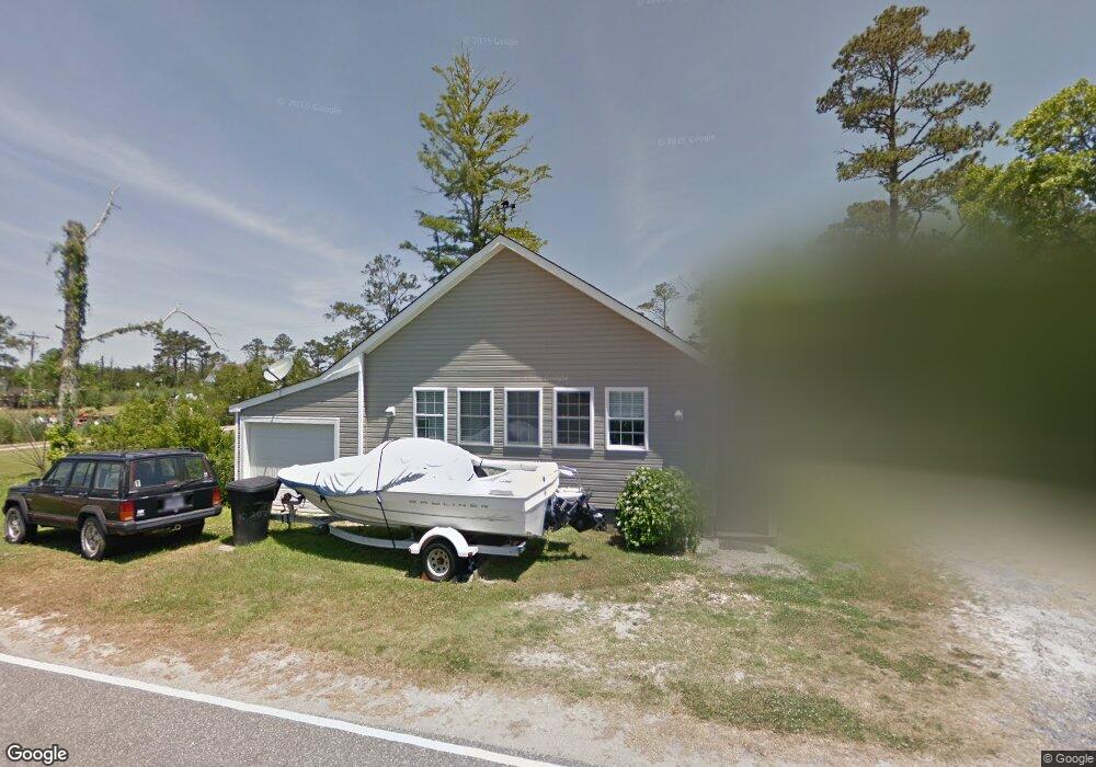
194 Bayview Dr Unit 1 Stumpy Point, NC 27978
Estimated Value: $197,407 - $309,000
3
Beds
1
Bath
1,360
Sq Ft
$183/Sq Ft
Est. Value
About This Home
This home is located at 194 Bayview Dr Unit 1, Stumpy Point, NC 27978 and is currently estimated at $248,602, approximately $182 per square foot. 194 Bayview Dr Unit 1 is a home located in Dare County with nearby schools including Manteo Elementary School, Manteo Middle School, and Manteo High School.
Ownership History
Date
Name
Owned For
Owner Type
Purchase Details
Closed on
Jul 1, 2016
Sold by
Cooper Joann Logan and King Goslin M
Bought by
Grant Clayton J and Grant Angela N
Current Estimated Value
Home Financials for this Owner
Home Financials are based on the most recent Mortgage that was taken out on this home.
Original Mortgage
$78,300
Outstanding Balance
$62,257
Interest Rate
3.54%
Mortgage Type
New Conventional
Estimated Equity
$186,345
Create a Home Valuation Report for This Property
The Home Valuation Report is an in-depth analysis detailing your home's value as well as a comparison with similar homes in the area
Purchase History
| Date | Buyer | Sale Price | Title Company |
|---|---|---|---|
| Grant Clayton J | $87,000 | None Available |
Source: Public Records
Mortgage History
| Date | Status | Borrower | Loan Amount |
|---|---|---|---|
| Open | Grant Clayton J | $78,300 |
Source: Public Records
Tax History Compared to Growth
Tax History
| Year | Tax Paid | Tax Assessment Tax Assessment Total Assessment is a certain percentage of the fair market value that is determined by local assessors to be the total taxable value of land and additions on the property. | Land | Improvement |
|---|---|---|---|---|
| 2025 | $766 | $182,200 | $35,700 | $146,500 |
| 2024 | $625 | $101,600 | $28,600 | $73,000 |
| 2023 | $625 | $101,600 | $28,600 | $73,000 |
| 2022 | $640 | $105,724 | $28,600 | $77,124 |
| 2021 | $629 | $105,724 | $28,600 | $77,124 |
| 2020 | $628 | $105,852 | $28,600 | $77,252 |
| 2019 | $551 | $74,300 | $16,800 | $57,500 |
| 2018 | $552 | $74,300 | $16,800 | $57,500 |
| 2017 | $520 | $74,300 | $16,800 | $57,500 |
| 2016 | $490 | $74,300 | $16,800 | $57,500 |
| 2014 | $490 | $74,300 | $16,800 | $57,500 |
Source: Public Records
Map
Nearby Homes
- 232A Bayview Dr
- 172 Bayview Dr
- 170 Bayview Dr
- 149 Bayview Dr
- 137 Bayview Dr Unit Lot N/A
- 288 Bayview Dr Unit N/A
- 0 Bayview Dr Unit 131251
- 92 Mosley Ln
- 72 Hickman Ln
- 168 Burrus Rd
- 4013 Mill Landing Rd
- 7636 Shipyard Rd
- 807 Back Bay Rd Unit Lot30
- 0 Docks Unit slip R14 130572
- 0 Docks Unit Lot 15 125645
- 0 N Highway 64 264 Unit Lot 1R 129719
- 0 N Highway 64 264 Unit Lot 3R 129718
- 601 Viccars Ln
- 715 Arvilla Ln Unit Lot 4
- 717 Fernando St Unit Lot 3
- 194 Bayview Dr Unit parcel
- 194 Bayview Dr
- 225 Bayview Dr
- 226 Bayview Dr
- 155 Bayview Dr
- 234 Bayview Dr
- 195 Bayview Dr
- 196 Bayview Dr
- 196 Bayview Dr Unit /Lot NA
- 190 Bayview Dr
- 197 Bayview Dr
- 193 Bayview Dr
- 199 Bayview Dr
- 188 Bayview Dr
- 191 Bayview Dr
- 201 Bayview Dr
- 208 Bayview Dr
- 207 Bayview Dr
- 184 Bayview Dr
- 187 Bayview Dr Unit 1
