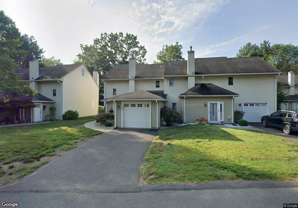
194 Dusky Ln Suffield, CT 06078
Estimated Value: $317,260 - $358,000
2
Beds
2
Baths
1,641
Sq Ft
$206/Sq Ft
Est. Value
About This Home
This home is located at 194 Dusky Ln, Suffield, CT 06078 and is currently estimated at $338,815, approximately $206 per square foot. 194 Dusky Ln is a home located in Hartford County with nearby schools including A. Ward Spaulding School, Mcalister Intermediate School, and Suffield Middle School.
Ownership History
Date
Name
Owned For
Owner Type
Purchase Details
Closed on
Mar 1, 2025
Sold by
Moore Kathleen A
Bought by
Moynahan T T and Moynahan M
Current Estimated Value
Purchase Details
Closed on
Jul 31, 2017
Sold by
Hartmann Richard M
Bought by
Moore Kathleen A
Home Financials for this Owner
Home Financials are based on the most recent Mortgage that was taken out on this home.
Original Mortgage
$100,000
Interest Rate
3.91%
Mortgage Type
Purchase Money Mortgage
Purchase Details
Closed on
Sep 22, 1998
Sold by
Goodrow Laura
Bought by
Hartmann Richard
Home Financials for this Owner
Home Financials are based on the most recent Mortgage that was taken out on this home.
Original Mortgage
$84,000
Interest Rate
6.9%
Create a Home Valuation Report for This Property
The Home Valuation Report is an in-depth analysis detailing your home's value as well as a comparison with similar homes in the area
Home Values in the Area
Average Home Value in this Area
Purchase History
| Date | Buyer | Sale Price | Title Company |
|---|---|---|---|
| Moynahan T T | $333,000 | None Available | |
| Moynahan T T | $333,000 | None Available | |
| Moore Kathleen A | $165,000 | -- | |
| Moore Kathleen A | $165,000 | -- | |
| Hartmann Richard | $105,000 | -- | |
| Hartmann Richard | $105,000 | -- |
Source: Public Records
Mortgage History
| Date | Status | Borrower | Loan Amount |
|---|---|---|---|
| Previous Owner | Moore Kathleen A | $100,000 | |
| Previous Owner | Hartmann Richard | $83,300 | |
| Previous Owner | Hartmann Richard | $84,000 |
Source: Public Records
Tax History
| Year | Tax Paid | Tax Assessment Tax Assessment Total Assessment is a certain percentage of the fair market value that is determined by local assessors to be the total taxable value of land and additions on the property. | Land | Improvement |
|---|---|---|---|---|
| 2025 | $3,717 | $158,760 | $0 | $158,760 |
| 2024 | $3,593 | $158,760 | $0 | $158,760 |
| 2023 | $3,272 | $114,380 | $0 | $114,380 |
| 2022 | $3,272 | $114,380 | $0 | $114,380 |
| 2021 | $3,276 | $114,380 | $0 | $114,380 |
| 2020 | $3,276 | $114,380 | $0 | $114,380 |
| 2019 | $3,285 | $114,380 | $0 | $114,380 |
| 2018 | $3,481 | $118,720 | $0 | $118,720 |
| 2017 | $3,430 | $118,720 | $0 | $118,720 |
| 2016 | $3,348 | $118,720 | $0 | $118,720 |
| 2015 | $3,298 | $118,720 | $0 | $118,720 |
| 2014 | $3,220 | $118,720 | $0 | $118,720 |
Source: Public Records
Map
Nearby Homes
- 147 W Grayling Ln
- 24 Pebblestone Cir Unit 24
- 3 Pebblestone Cir Unit 3
- 4 Pebblestone Cir
- 80 S River St
- 45 Douglas St
- 69 Prospect St
- 98 1st St
- 57 Asnuntuck St
- 47 Maple Ave
- 41 Walnut St
- 40 Church St
- 242 Pearl St
- 30-32 Church St
- 26-28 Church St
- 97 Pleasant St
- 148 Pleasant St
- 270 Pearl St
- 5 Claremont Ave
- 11 Orchard Hill Dr
- 200 Dusky Ln
- 198 Dusky Ln
- 196 Dusky Ln
- 192 Dusky Ln
- 190 Dusky Ln
- 194 Dusky Ln Unit 194
- 192 Dusky Ln Unit 192
- 168 Dusky Ln
- 166 Dusky Ln
- 166 Dusky Ln Unit 166
- 164 Dusky Ln
- 164 Dusky Ln Unit 164
- 170 Dusky Ln
- 172 Dusky Ln
- 172 Dusky Ln Unit 172
- 158 Dusky Ln
- 174 Dusky Ln
- 176 Dusky Ln
- 176 Dusky Ln
- 178 Dusky Ln
Your Personal Tour Guide
Ask me questions while you tour the home.