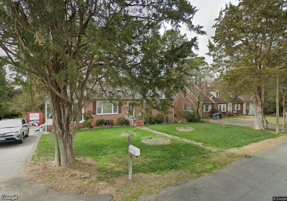
1940 Lansing Ave Richmond, VA 23225
Westlake Hills NeighborhoodEstimated Value: $330,524 - $360,000
Studio
2
Baths
1,180
Sq Ft
$294/Sq Ft
Est. Value
About This Home
This home is located at 1940 Lansing Ave, Richmond, VA 23225 and is currently estimated at $346,881, approximately $293 per square foot. 1940 Lansing Ave is a home located in Richmond City with nearby schools including Southampton Elementary School, Lucille M. Brown Middle, and Huguenot High School.
Ownership History
Date
Name
Owned For
Owner Type
Purchase Details
Closed on
Jul 17, 2002
Sold by
Wormald Keri L
Bought by
Hawkes Susan S
Current Estimated Value
Home Financials for this Owner
Home Financials are based on the most recent Mortgage that was taken out on this home.
Original Mortgage
$82,000
Outstanding Balance
$34,811
Interest Rate
6.73%
Mortgage Type
New Conventional
Estimated Equity
$312,070
Purchase Details
Closed on
Sep 22, 1998
Sold by
Bullard William R and Bullard Divisee
Bought by
Single Wormald and Single Keri L
Home Financials for this Owner
Home Financials are based on the most recent Mortgage that was taken out on this home.
Original Mortgage
$70,000
Interest Rate
6.9%
Mortgage Type
New Conventional
Create a Home Valuation Report for This Property
The Home Valuation Report is an in-depth analysis detailing your home's value as well as a comparison with similar homes in the area
Home Values in the Area
Average Home Value in this Area
Purchase History
| Date | Buyer | Sale Price | Title Company |
|---|---|---|---|
| Hawkes Susan S | -- | -- | |
| Single Wormald | $95,000 | -- |
Source: Public Records
Mortgage History
| Date | Status | Borrower | Loan Amount |
|---|---|---|---|
| Open | Hawkes Susan S | $82,000 | |
| Previous Owner | Single Wormald | $70,000 |
Source: Public Records
Tax History
| Year | Tax Paid | Tax Assessment Tax Assessment Total Assessment is a certain percentage of the fair market value that is determined by local assessors to be the total taxable value of land and additions on the property. | Land | Improvement |
|---|---|---|---|---|
| 2025 | $3,336 | $308,000 | $58,000 | $250,000 |
| 2024 | $3,336 | $278,000 | $39,000 | $239,000 |
| 2023 | $3,264 | $272,000 | $39,000 | $233,000 |
| 2022 | $2,724 | $227,000 | $39,000 | $188,000 |
| 2020 | $2,280 | $190,000 | $30,000 | $160,000 |
| 2019 | $1,992 | $166,000 | $30,000 | $136,000 |
| 2018 | $1,836 | $153,000 | $30,000 | $123,000 |
| 2017 | $1,788 | $149,000 | $30,000 | $119,000 |
| 2016 | $1,788 | $149,000 | $30,000 | $119,000 |
| 2015 | $1,716 | $148,000 | $30,000 | $118,000 |
| 2014 | $1,716 | $143,000 | $30,000 | $113,000 |
Source: Public Records
Map
Nearby Homes
- 1669 Bilder Ct
- 1648 Bilder Ct
- 5636 Forest Hill Ave
- 5606 Southern Pine Dr
- 6119 Primrose Place
- 6117 Primrose Place
- 5607 Jahnke Rd
- 2956 Hathaway Rd Unit U104
- 2956 Hathaway Rd Unit 903
- 2956 Hathaway Rd Unit U301
- 2956 Hathaway Rd Unit U709
- 2956 Hathaway Rd Unit U807
- 2956 Hathaway Rd Unit U1212
- 2956 Hathaway Rd Unit U102
- 1408 Boroughbridge Rd
- 5411 Dorchester Rd
- 1164 Grand Brook Dr
- 1234 Boulder Creek Rd
- 3369 Warner Rd
- 5618 Larrymore Rd
- 1946 Lansing Ave
- 1932 Lansing Ave
- 6259 Nicolet Rd
- 6253 Nicolet Rd
- 1926 Lansing Ave
- 1952 Lansing Ave
- 6265 Nicolet Rd
- 1943 Lansing Ave
- 6245 Nicolet Rd
- 1929 Lansing Ave
- 1951 Lansing Ave
- 1920 Lansing Ave
- 6273 Nicolet Rd
- 1921 Lansing Ave
- 6237 Nicolet Rd
- 1957 Lansing Ave
- 1962 Lansing Ave
- 1913 Lansing Ave
- 1914 Lansing Ave
- 2000 Briarcliff Rd
Your Personal Tour Guide
Ask me questions while you tour the home.