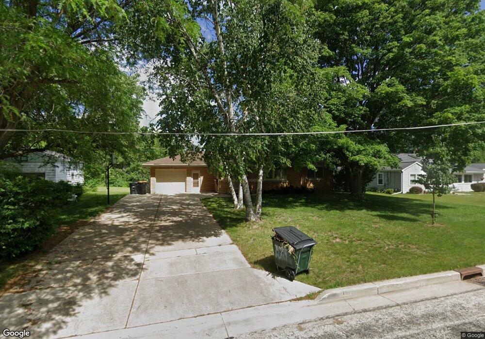
1940 N 121st St Milwaukee, WI 53226
Estimated Value: $378,000 - $412,747
3
Beds
3
Baths
1,316
Sq Ft
$299/Sq Ft
Est. Value
About This Home
This home is located at 1940 N 121st St, Milwaukee, WI 53226 and is currently estimated at $393,187, approximately $298 per square foot. 1940 N 121st St is a home located in Milwaukee County with nearby schools including Eisenhower Elementary School, Whitman Middle School, and West High School.
Ownership History
Date
Name
Owned For
Owner Type
Purchase Details
Closed on
Oct 20, 2004
Sold by
Gore Janice M
Bought by
Greener Brian W and Greener Anne
Current Estimated Value
Home Financials for this Owner
Home Financials are based on the most recent Mortgage that was taken out on this home.
Original Mortgage
$100,000
Outstanding Balance
$49,989
Interest Rate
5.91%
Estimated Equity
$343,198
Purchase Details
Closed on
Dec 19, 1997
Sold by
Gore Janice M and Matheus John J
Bought by
Gore Janice M
Home Financials for this Owner
Home Financials are based on the most recent Mortgage that was taken out on this home.
Original Mortgage
$72,200
Interest Rate
7.24%
Create a Home Valuation Report for This Property
The Home Valuation Report is an in-depth analysis detailing your home's value as well as a comparison with similar homes in the area
Home Values in the Area
Average Home Value in this Area
Purchase History
| Date | Buyer | Sale Price | Title Company |
|---|---|---|---|
| Greener Brian W | $225,000 | -- | |
| Gore Janice M | -- | -- |
Source: Public Records
Mortgage History
| Date | Status | Borrower | Loan Amount |
|---|---|---|---|
| Open | Greener Brian W | $100,000 | |
| Previous Owner | Gore Janice M | $72,200 |
Source: Public Records
Tax History Compared to Growth
Tax History
| Year | Tax Paid | Tax Assessment Tax Assessment Total Assessment is a certain percentage of the fair market value that is determined by local assessors to be the total taxable value of land and additions on the property. | Land | Improvement |
|---|---|---|---|---|
| 2024 | $5,523 | $255,900 | $111,300 | $144,600 |
| 2023 | $5,194 | $255,900 | $111,300 | $144,600 |
| 2022 | $5,325 | $255,900 | $111,300 | $144,600 |
| 2021 | $5,064 | $255,900 | $111,300 | $144,600 |
| 2020 | $5,427 | $255,900 | $111,300 | $144,600 |
| 2019 | $5,484 | $255,900 | $111,300 | $144,600 |
| 2018 | $5,400 | $213,100 | $93,400 | $119,700 |
| 2017 | $4,882 | $213,100 | $93,400 | $119,700 |
| 2016 | $4,882 | $213,100 | $93,400 | $119,700 |
| 2015 | $4,830 | $213,100 | $93,400 | $119,700 |
| 2014 | $4,838 | $213,100 | $93,400 | $119,700 |
| 2013 | $4,896 | $213,100 | $93,400 | $119,700 |
Source: Public Records
Map
Nearby Homes
- 1920 Fairhaven Blvd
- 12675 W North Ave
- 1409 N 116th St
- 1239 N 122nd St
- 12455 W Center St
- 11722 W Diane Dr
- 12855 Stephen Place
- 2808 N Park Dr
- 13130 Watertown Plank Rd Unit 312
- 2925 N 120th St
- 744 N 115th St
- 11510 W Wisconsin Ave
- 13145 Kittridge Ct
- 12000 W Bluemound Rd Unit 111
- 14220 Hillside Rd
- 13050 W Bluemound Rd Unit 303
- 12207 W Bluemound Rd
- 12990 W Bluemound Rd Unit 205
- 10915 W Wisconsin Ave
- 12980 W Bluemound Rd Unit 308
- 1930 N 121st St
- 1950 N 121st St
- 1918 N 121st St
- 1937 N 121st St
- 1949 N 121st St
- 1906 N 121st St
- 1919 N 121st St
- 1937 N 119th St
- 1945 N 119th St
- 1927 N 119th St
- 12110 W Woodland Ave
- 2001 N 119th St
- 1919 N 119th St
- 1913 N 119th St
- 2015 N 119th St
- 11910 W Woodland Ave
- 2025 N 119th St
- 12128 W Woodland Ave
- 12109 Woodside Ct
- 1936 N 122nd St