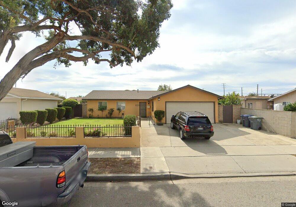
1940 Oneill Place Oxnard, CA 93033
Lemonwood Eastmont NeighborhoodEstimated Value: $598,000 - $725,000
3
Beds
2
Baths
1,026
Sq Ft
$641/Sq Ft
Est. Value
About This Home
This home is located at 1940 Oneill Place, Oxnard, CA 93033 and is currently estimated at $658,071, approximately $641 per square foot. 1940 Oneill Place is a home located in Ventura County with nearby schools including Lemonwood Elementary School, R.J. Frank Academy of Marine Science & Engineering, and Santa Clara High School.
Ownership History
Date
Name
Owned For
Owner Type
Purchase Details
Closed on
Oct 23, 2024
Sold by
Herrera Arturo Orozco and Camacho Maria Raquel
Bought by
Herrera-Camacho Family Living Trust and Herrera
Current Estimated Value
Purchase Details
Closed on
Aug 22, 1994
Sold by
Herrera Arturo O
Bought by
Herrera Arturo Orozco and Herrera Maria R
Create a Home Valuation Report for This Property
The Home Valuation Report is an in-depth analysis detailing your home's value as well as a comparison with similar homes in the area
Home Values in the Area
Average Home Value in this Area
Purchase History
| Date | Buyer | Sale Price | Title Company |
|---|---|---|---|
| Herrera-Camacho Family Living Trust | -- | None Listed On Document | |
| Herrera Arturo Orozco | -- | -- |
Source: Public Records
Tax History
| Year | Tax Paid | Tax Assessment Tax Assessment Total Assessment is a certain percentage of the fair market value that is determined by local assessors to be the total taxable value of land and additions on the property. | Land | Improvement |
|---|---|---|---|---|
| 2025 | $2,848 | $239,144 | $83,698 | $155,446 |
| 2024 | $2,848 | $234,455 | $82,056 | $152,399 |
| 2023 | $2,744 | $229,858 | $80,447 | $149,411 |
| 2022 | $2,660 | $225,351 | $78,869 | $146,482 |
| 2021 | $2,638 | $220,933 | $77,323 | $143,610 |
| 2020 | $2,685 | $218,670 | $76,531 | $142,139 |
| 2019 | $2,609 | $214,383 | $75,031 | $139,352 |
| 2018 | $2,571 | $210,180 | $73,560 | $136,620 |
| 2017 | $2,440 | $206,060 | $72,118 | $133,942 |
| 2016 | $2,354 | $202,020 | $70,704 | $131,316 |
| 2015 | $2,377 | $198,988 | $69,643 | $129,345 |
| 2014 | $2,350 | $195,092 | $68,280 | $126,812 |
Source: Public Records
Map
Nearby Homes
- 1928 San Benito St
- 1036 Cheyenne Way
- 3700 Olds Rd Unit 86
- 1407 Peach Ave Unit 14
- 2117 Cardinal Ave Unit 2117h
- 2178 Thrush Ave Unit J
- 2177 Robin Ave Unit 2177A
- 1645 Lime Ave Unit 91
- 3130 Paula St
- 4200 Browning Dr
- 3151 Fournier St
- 2400 E Pleasant Valley Rd Unit 108
- 2151 E Wooley Rd
- 4340 Highland Ave
- 4108 Ranchita Ln
- 4731 Hamilton Ave
- 3631 La Costa Place
- 360 Ibsen Place Unit 129
- 4160 Petit Dr Unit 39
- 320 Columbia Place Unit 46
- 1944 Oneill Place
- 2610 Beaufort Dr
- 2620 Beaufort Dr
- 1941 Pericles Place
- 1945 Pericles Place
- 1950 Oneill Place
- 2630 Beaufort Dr
- 1951 Pericles Place
- 1941 Oneill Place
- 1935 Oneill Place
- 1945 Oneill Place
- 1954 Oneill Place
- 1951 Oneill Place
- 1931 Oneill Place
- 1955 Pericles Place
- 1955 Oneill Place
- 2621 Beaufort Dr
- 1960 Oneill Place
- 2611 Beaufort Dr
- 2631 Beaufort Dr
Your Personal Tour Guide
Ask me questions while you tour the home.