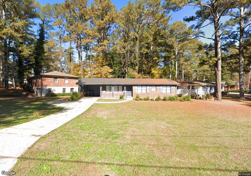
1940 Shepherd Cir SW Atlanta, GA 30311
Estimated Value: $244,319 - $324,000
3
Beds
2
Baths
1,582
Sq Ft
$178/Sq Ft
Est. Value
About This Home
This home is located at 1940 Shepherd Cir SW, Atlanta, GA 30311 and is currently estimated at $281,080, approximately $177 per square foot. 1940 Shepherd Cir SW is a home located in Fulton County with nearby schools including Tuskegee Airman Global Academy, Herman J. Russell West End Academy, and Booker T. Washington High School.
Ownership History
Date
Name
Owned For
Owner Type
Purchase Details
Closed on
Feb 7, 1994
Sold by
Secretary Of Va
Bought by
Wright Sinclair A Carolyn
Current Estimated Value
Home Financials for this Owner
Home Financials are based on the most recent Mortgage that was taken out on this home.
Original Mortgage
$66,690
Interest Rate
6.75%
Mortgage Type
VA
Create a Home Valuation Report for This Property
The Home Valuation Report is an in-depth analysis detailing your home's value as well as a comparison with similar homes in the area
Home Values in the Area
Average Home Value in this Area
Purchase History
| Date | Buyer | Sale Price | Title Company |
|---|---|---|---|
| Wright Sinclair A Carolyn | $40,200 | -- |
Source: Public Records
Mortgage History
| Date | Status | Borrower | Loan Amount |
|---|---|---|---|
| Closed | Wright Sinclair A Carolyn | $66,690 |
Source: Public Records
Tax History Compared to Growth
Tax History
| Year | Tax Paid | Tax Assessment Tax Assessment Total Assessment is a certain percentage of the fair market value that is determined by local assessors to be the total taxable value of land and additions on the property. | Land | Improvement |
|---|---|---|---|---|
| 2025 | $2,403 | $82,920 | $23,240 | $59,680 |
| 2023 | $2,403 | $75,320 | $22,880 | $52,440 |
| 2022 | $1,934 | $75,320 | $22,880 | $52,440 |
| 2021 | $1,936 | $47,800 | $10,880 | $36,920 |
| 2020 | $1,935 | $47,240 | $10,760 | $36,480 |
| 2019 | $506 | $19,440 | $4,520 | $14,920 |
| 2018 | $787 | $19,000 | $4,440 | $14,560 |
| 2017 | $468 | $10,840 | $3,120 | $7,720 |
| 2016 | $469 | $10,840 | $3,120 | $7,720 |
| 2015 | $1,023 | $10,840 | $3,120 | $7,720 |
| 2014 | $492 | $10,840 | $3,120 | $7,720 |
Source: Public Records
Map
Nearby Homes
- 1905 Fort Valley Dr SW
- 1806 Fort Valley Dr SW
- 3002 Bayrose Cir
- 2357 Bayrose Cir Unit 57B
- 2028 Dewberry Ln
- 3111 Bayrose Cir
- 3111 Bayrose Cir Unit 109B
- 2106 Penrose Dr
- 2115 Pinehurst Dr
- 1826 Bayrose Cir
- 2126 Pinehurst Dr
- 1829 Bayrose Cir
- 1735 Carter Cir
- 6034 Bayrose Cir
- 2146 Pinehurst Dr
- 2069 Woodberry Ave
- 2162 Westover Dr
- 1723 Fort Valley Dr SW
- 1958 Shepherd Cir SW
- 1928 Shepherd Cir SW
- 1914 Shepherd Cir SW
- 1964 Shepherd Cir SW
- 1945 Shepherd Cir SW
- 1931 Shepherd Cir SW
- 1951 Shepherd Cir SW
- 1906 Shepherd Cir SW
- 1939 Shepherd Cir SW
- 1959 Shepherd Cir SW
- 1899 Fort Valley Dr SW
- 1898 Shepherd Cir SW
- 1923 Shepherd Cir SW Unit 1923
- 1923 Shepherd Cir SW
- 1923 Shepherd Cir SW Unit 1
- 0 Fort Valley Dr SW Unit 8645817
- 0 Fort Valley Dr SW Unit 8580055
- 0 Fort Valley Dr SW Unit 8456907
- 0 Fort Valley Dr SW Unit 8373752
- 0 Fort Valley Dr SW Unit 8237340